Source: AGU Advances
A translation of this article was made possible by a partnership with Planeteando. Una traducción de este artículo fue posible gracias a una asociación con Planeteando.
Not all extreme weather hazards are sufficiently documented in global databases. For instance, life-threatening high-heat events that fall within climatological norms are often not included in hazard studies, and local or regional flash flooding events frequently go undetected by satellite instruments.
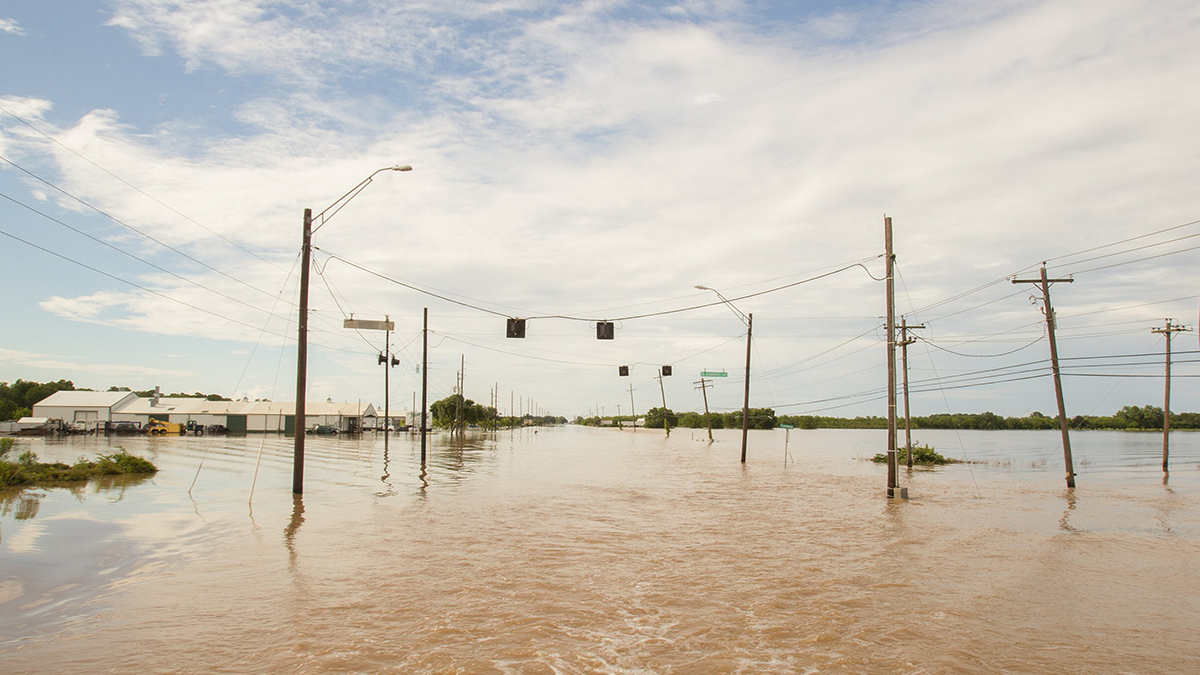
Texas has experienced more than its fair share of extreme weather over the past 20 years, including increasingly frequent flooding and heat events. Using widely accessible daily precipitation and temperature satellite data, Preisser and Passalacqua created a more complete picture of the flooding and heat hazards that have affected the state in recent years.
In consulting rainfall data from 2001 to 2020, the researchers designated a hazardous flood event as one that had an average recurrence interval of 2 or more years—meaning that an event of that magnitude occurred in a given area no more often than every 2 years. They compared their findings to the flooding events documented in the NOAA Storm Events Database and Dartmouth Flood Observatory (DFO) database. Their analysis captured 3 times as many flooding events as the DFO database did and identified an additional $320 million in damages.
The team also broadened the analysis of extreme heat. Many previous multihazard studies considered only heat waves, in which temperature exceeds a percentile, such as the 90th or 95th, for three consecutive days or longer. This study also considered heat events, or periods in which the wet-bulb globe temperature exceeds a 30°C health threshold rather than a given percentile. Using this definition, the researchers determined that between 2003 and 2020, Texas experienced 2,517 days with a heat hazard event—nearly 40% of all days. Heat hazard events affected a total of 253.2 million square kilometers.
The study defined combinations of floods and extreme heat as multihazard experiences. Using the average recurrence interval method, combined with the broader definition of hazards, the researchers found that parts of the state with large minority populations faced higher risk from multihazard events. This suggests that older methods may underestimate both the extent of multihazard risks and their disproportionate impact on marginalized communities, the researchers say. (AGU Advances, https://doi.org/10.1029/2025AV001667, 2025)
—Rebecca Owen (@beccapox.bsky.social), Science Writer
