
The Landslide Blog is written by Dave Petley, who is widely recognized as a world leader in the study and management of landslides. On 17 November 2023 at 4:14 pm local time, an Mw=6.8 earthquake struck the the area of Sarangani in Davao Occidental in the Philippines. The epicentre was located offshore at a depth […]
landslides
Posted inThe Landslide Blog
The Woda landslide on the Jinsha River
The Landslide Blog is written by Dave Petley, who is widely recognized as a world leader in the study and management of landslides. An article in the journal Natural Hazards (Yao et al. 2023) examines the Woda landslide on the Jinsha River. The study tries to determine the potential impact of the failure of a […]

Posted inThe Landslide Blog
Rongjiang: the 4 June 2022 landslide-induced, high speed railway accident in Guizhou, China
The Landslide Blog is written by Dave Petley, who is widely recognized as a world leader in the study and management of landslides. On 4 June 2022, a high speed train traveling at about 250 km per hour (155 miles per hour) struck a 200 cubic metre landslide that had inundated the track close to […]
Posted inThe Landslide Blog
Brienz/Brinzauls: Controls on rockfalls in high mountain environments
The Landslide Blog is written by Dave Petley, who is widely recognized as a world leader in the study and management of landslides. The availability of high temporal and spatial resolution monitoring technologies, most notably terretrial laser scanning (Lidar) and doppler radar, has transformed our ability to understand rockfalls. These systems can be deployed to […]
Posted inThe Landslide Blog
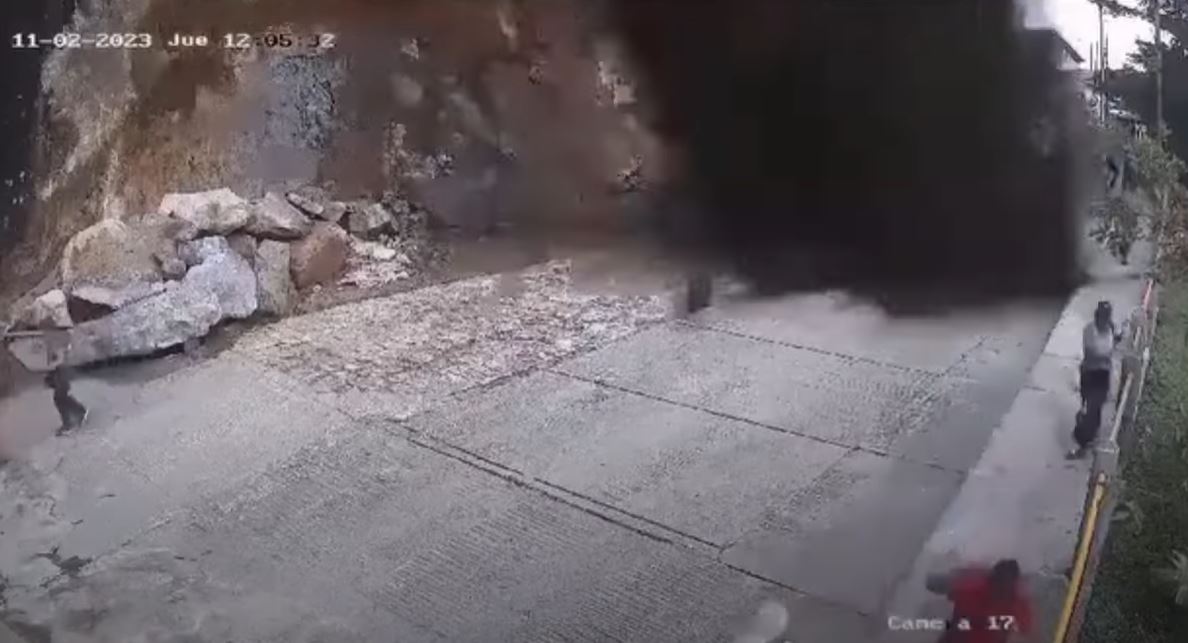
El Peñón de Guatapé: a dangerous collapse at a tourist site in Colombia
On 2 November 2023 a dramatic fall of soil and organic debris injured 17 people.

Posted inThe Landslide Blog
Ardfern: a landslide that is causing a serious problem to a remote Scottish community
The Landslide Blog is written by Dave Petley, who is widely recognized as a world leader in the study and management of landslides. The Guardian has run a story about the remote Scottish village of Ardfern, located on the Craignish peninsula in Argyll, and its travails as a result of a landslide triggered by heavy […]

Posted inThe Landslide Blog
The causes of the 18 April 2023 Torkham Rockslide in Pakistan
The Landslide Blog is written by Dave Petley, who is widely recognized as a world leader in the study and management of landslides. On 18 April 2023, a destructive rockslide hit the border town of Torkham in Khyber Pakhtunkhwa province in NW Pakistan. I blogged about the Torkham Rockslide at the time, speculating that undercutting […]

Posted inThe Landslide Blog
LaVerkin Bench: damaging landslides in Utah
The Landslide Blog is written by Dave Petley, who is widely recognized as a world leader in the study and management of landslides. In the city of LaVerkin in Utah, USA, a series of damaging landslides are destroying houses. The slope failures are occurring on a steep bluff on the edge of the city on […]
Posted inThe Landslide Blog
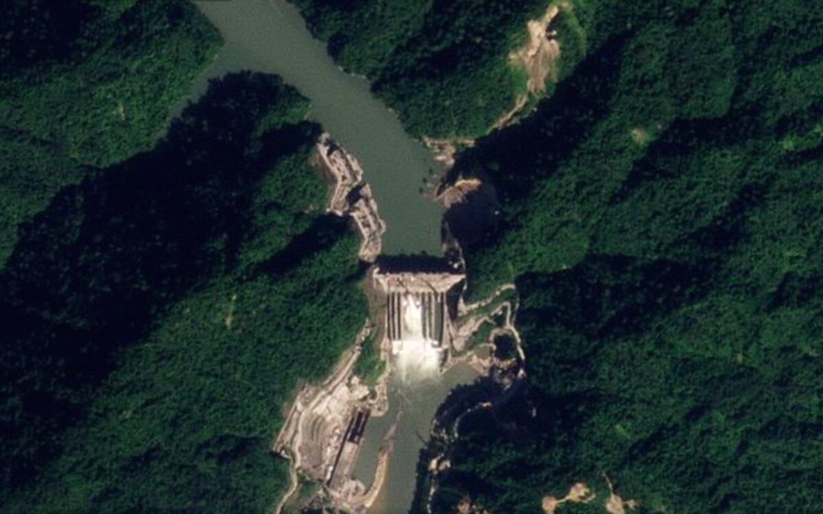
Subansiri: a significant landslide at a hydroelectric dam in India
The Landslide Blog is written by Dave Petley, who is widely recognized as a world leader in the study and management of landslides. On Friday 27 October 2023 a major landslide occurred at the site of the Subansiri Lower Hydroelectric Power facility in Assam, northern India. The landslide is significant because it has blocked the […]

Posted inThe Landslide Blog
A landslide triggered the 1650 tsunamigenic eruption of Kolumbo in the Aegean Sea
The Landslide Blog is written by Dave Petley, who is widely recognized as a world leader in the study and management of landslides. In 1650, a destructive tsunami occurred in the Aegean Sea, which is an embayment of the Mediterranean sea, located between the modern Greece to the west and Turkey to the east. There […]