
The Landslide Blog is written by Dave Petley, who is widely recognized as a world leader in the study and management of landslides. On Friday, the first set of satellite images became available of the 13 February 2024 landslide at Çöpler Mine in Turkey. This was a very good radar image released by Capella Space […]
landslides
Posted inThe Landslide Blog
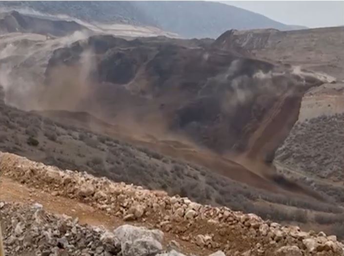
Further videos of the 13 February 2024 landslide at Çöpler Mine in Turkey
The Landslide Blog is written by Dave Petley, who is widely recognized as a world leader in the study and management of landslides. In the last 24 hours, two new videos have emerged showing the 13 February 2024 landslide at Çöpler Mine in Turkey. Once again, these have been widely posted to social media. The […]
Posted inThe Landslide Blog
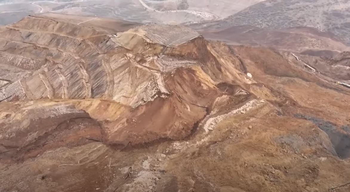
The 13 February 2024 landslide at the Çöpler Mine in Erzincan province, Turkey
The Landslide Blog is written by Dave Petley, who is widely recognized as a world leader in the study and management of landslides. At about 2 pm local time on 13 February 2024, a large landslide struck the Çöpler Mine in Erzincan Province, eastern Turkey. The landslide was caught on a remarkable video that has […]
Posted inThe Landslide Blog
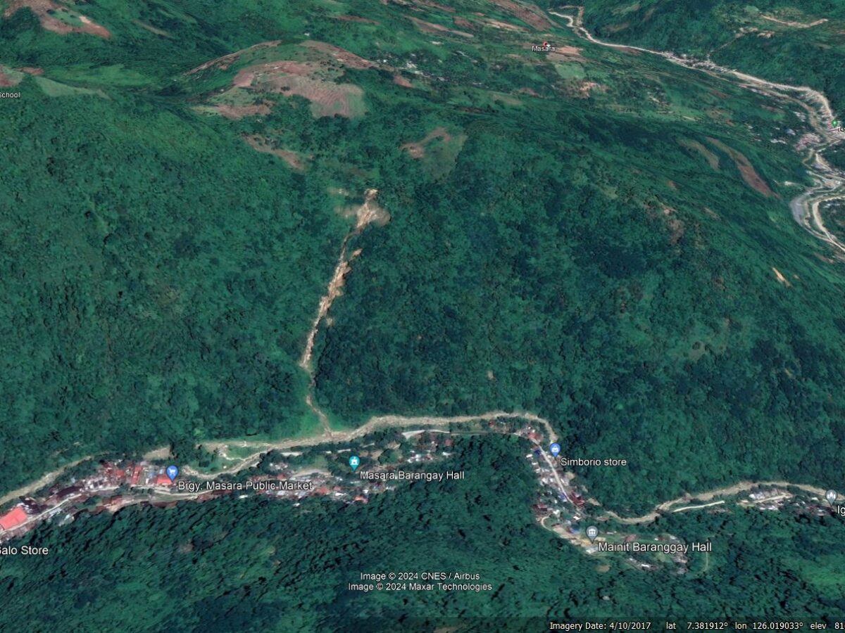
The 6 February 2024 landslide at Masara in the Philippines
The Landslide Blog is written by Dave Petley, who is widely recognized as a world leader in the study and management of landslides. On 6 February 2024, a large landslide struck the mining village of Masara in in Maco town, Davao de Oro in the Philippines. As of the time of writing, it had been […]
Posted inThe Landslide Blog
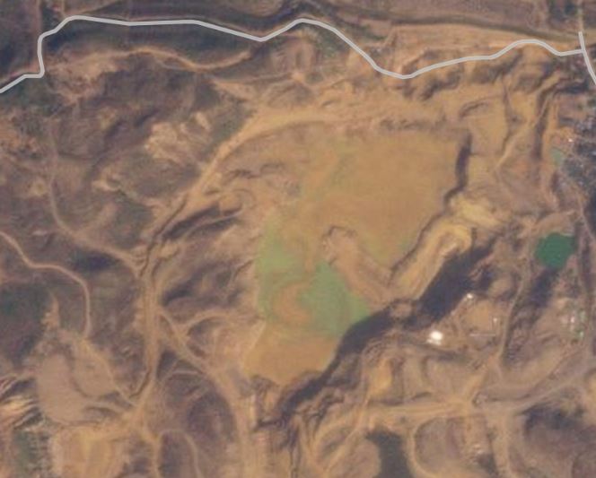
The 25 January 2024 mine waste failure in the Hpakant mining area of Myanmar
The Landslide Blog is written by Dave Petley, who is widely recognized as a world leader in the study and management of landslides. Earlier this week a video appeared on social media showing a mine waste failure. The video is remarkable – probably the best example of a progressive failure of a mine waste dam […]

Posted inThe Landslide Blog
The Moon Township landslide in Pennsylvania, USA
The Landslide Blog is written by Dave Petley, who is widely recognized as a world leader in the study and management of landslides. In Moon Township in Pennsylvania, a landslide has forced two families to vacate their homes. The landslide has occurred above Beaver Grade Road, on the slope that links a comparatively new housing […]
Posted inThe Landslide Blog
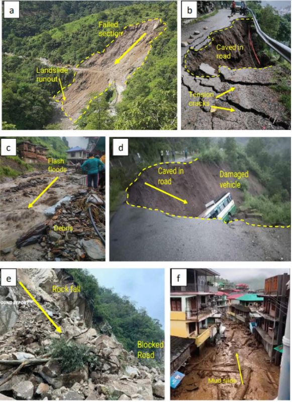
Landslides triggered by heavy rainfall on 7 to 14 July 2023 in Himachal Pradesh, India
The Landslide Blog is written by Dave Petley, who is widely recognized as a world leader in the study and management of landslides. In July 2023, northern India was affected by intense and prolonged rainfall that triggered multiple landslides. Himachal Pradesh, in the NW Himalayas, was particularly badly impacted. A new paper published in the […]
Posted inThe Landslide Blog
Professor Denys Brunsden
The Landslide Blog is written by Dave Petley, who is widely recognized as a world leader in the study and management of landslides. Professor Denys Brunsden, one of the most influential and impactful people in geomorphology, sadly died last week, at the age of 87. He will be missed greatly by us all. Denys described […]
Posted inThe Landslide Blog
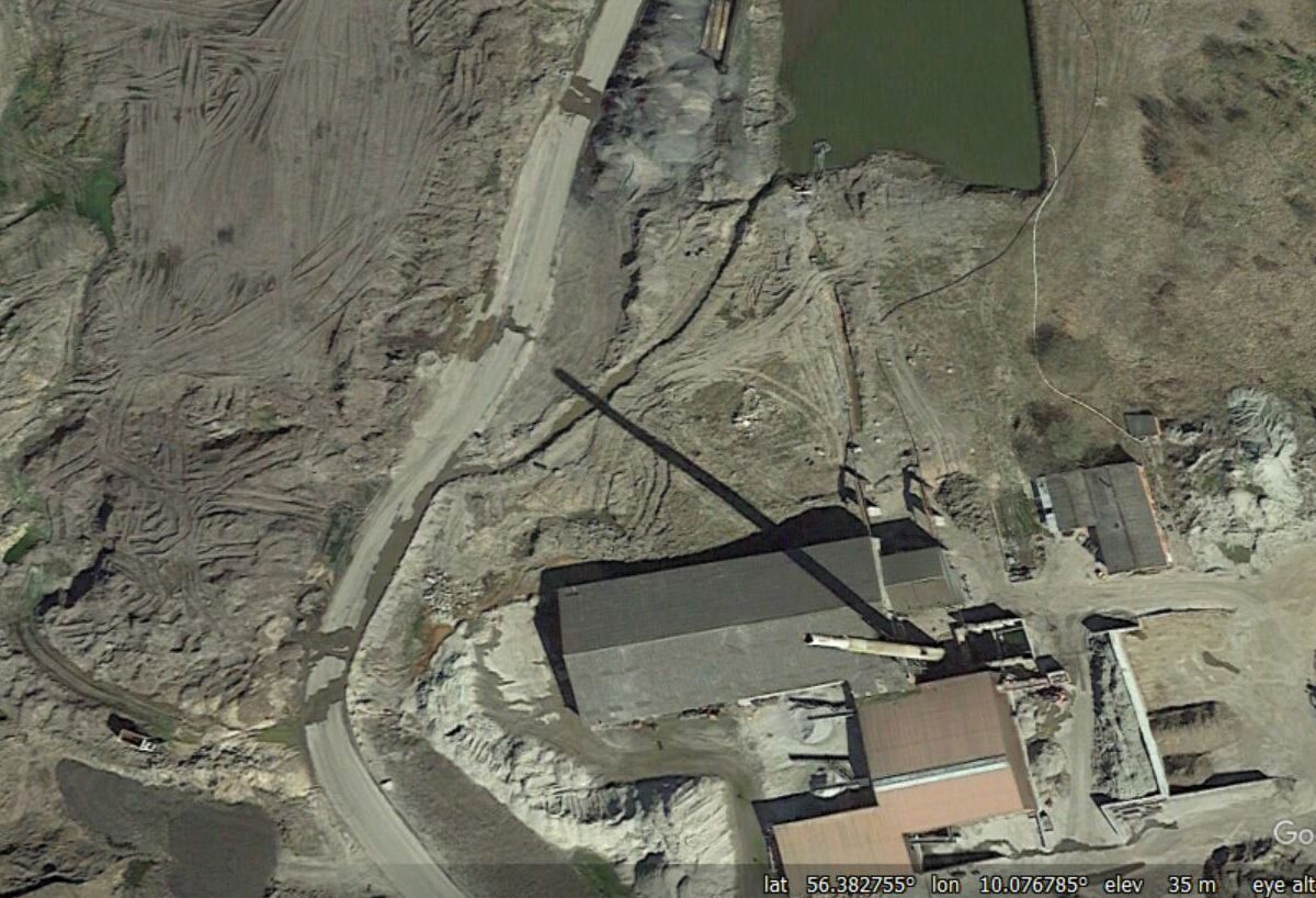
The Nordic Waste landslide scandal in Denmark
The Landslide Blog is written by Dave Petley, who is widely recognized as a world leader in the study and management of landslides. In Denmark , there is a substantial scandal rumbling on around a substantial landslide at a site owned by Nordic Waste, a company specialising in dealing with contaminated soil. The site in […]

Posted inThe Landslide Blog
The 22 January 2023 landslide at Zhenxiong in Yunnan Province, China
The Landslide Blog is written by Dave Petley, who is widely recognized as a world leader in the study and management of landslides. At 5:51 am local time on 22 January 2023, a significant landslide occurred in Liangshui Village in Zhenxiong County, Yunnan Province of China. It is reported that 47 people from 18 households […]