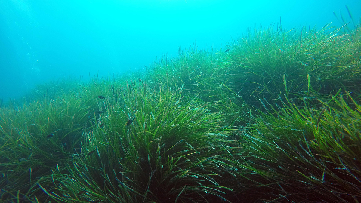
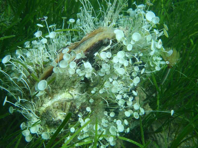
• About
  • Sections
  • Topics
    • Climate
    • Earth Science
    • Oceans
    • Space & Planets
    • Health & Ecosystems
    • Culture & Policy
    • Education & Careers
    • Opinions
  • Projects
    • ENGAGE
    • Editors’ Highlights
    • Editors’ Vox
    • Eos en Español
    • Eos 简体中文版
    • Print Archive
  • Blogs
    • Research & Developments
    • The Landslide Blog
  • Newsletter
  • Submit to Eos
  • AGU.org
  • Career Center
  • Join AGU
  • Give to AGU
  • About
  • Sections
  • Topics
    • Climate
    • Earth Science
    • Oceans
    • Space & Planets
    • Health & Ecosystems
    • Culture & Policy
    • Education & Careers
    • Opinions
  • Projects
    • ENGAGE
    • Editors’ Highlights
    • Editors’ Vox
    • Eos en Español
    • Eos 简体中文版
    • Print Archive
  • Blogs
    • Research & Developments
    • The Landslide Blog
  • Newsletter
  • Submit to Eos
Skip to content
  • AGU.org
  • Career Center
  • Join AGU
  • Give to AGU
Eos

Eos

Science News by AGU

Support Eos
Sign Up for Newsletter
  • About
  • Sections
  • Topics
    • Climate
    • Earth Science
    • Oceans
    • Space & Planets
    • Health & Ecosystems
    • Culture & Policy
    • Education & Careers
    • Opinions
  • Projects
    • ENGAGE
    • Editors’ Highlights
    • Editors’ Vox
    • Eos en Español
    • Eos 简体中文版
    • Print Archive
  • Blogs
    • Research & Developments
    • The Landslide Blog
  • Newsletter
  • Submit to Eos

Mediterranean Sea

Map of the eastern Mediterranean showing modeled wave height from a magnitude 7.7 normal fault earthquake sourced offshore of southern Crete.
Posted inEditors' Highlights

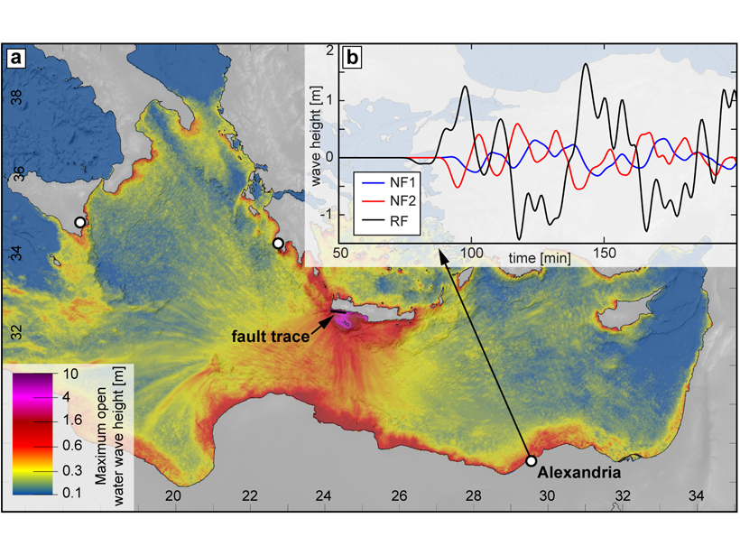
Was the AD 365 Mediterranean Earthquake Normal?

by T. Parsons 10 May 202114 September 2022

The great AD 365 earthquake at Crete has implied a locked Hellenic subduction zone that can produce more earthquakes to threaten Mediterranean coastlines. But what if wasn’t a subduction zone event?

Posted inEditors' Vox

Coastal Ecosystems Under Pressure Worldwide

by T. Malone, A. Malej and J. Faganeli 19 March 202127 October 2022

A new book explores how two river-dominated coastal estuaries are responding to the pressures of human expansion and climate change.

Satellite view of Santorini, Greece
Posted inNews

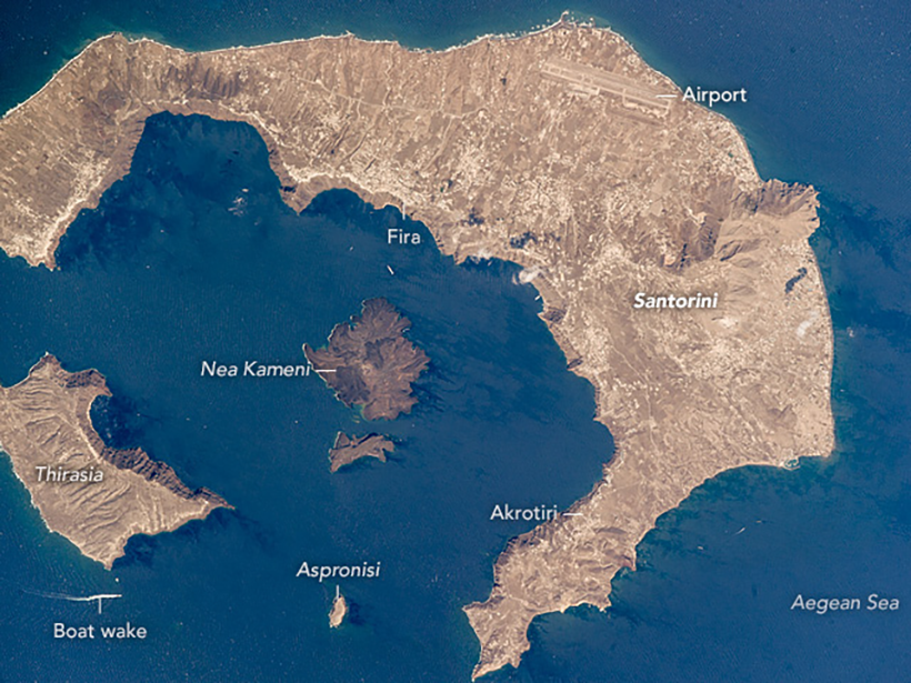
Podcast: Escape from Thera

Liza Lester, staff writer by L. Lester 21 July 20206 September 2023

A colossal volcanic eruption at Santorini, Greece, 3,600 years ago sent the island’s Bronze Age population fleeing for their lives. Where did the people go?

Satellite image of the Strait of Gibraltar
Posted inNews

Sediments May Support the Mediterranean Megaflood Hypothesis

Javier Barbuzano, Science Writer by Javier Barbuzano 26 February 202016 August 2022

Millions of years ago, the Mediterranean Sea may have evaporated. A newly identified body of sediments could have been deposited by the giant flood that refilled the basin.

Black-and-white photo of a rubble-filled city street and a queue of people filing out
Posted inNews

Finding Faults in Our Past: Uncovering the Messina Earthquake

Sarah Derouin, Science Writer by Sarah Derouin 19 December 20198 December 2022

The source of the deadly 1908 Italian earthquake may finally be identified, thanks to a fresh look at the geomorphology of the Strait of Messina.

Diagram showing the subduction of the Ionian tectonic plate beneath the Tyrrhenian plate off the coast of Italy
Posted inResearch Spotlights

New Volcanic Complex Found Below the Southern Tyrrhenian Sea

by Terri Cook 11 September 201920 December 2021

Researchers have identified a previously unknown volcanic-intrusive complex that originated through the melting of mantle material at the northern edge of the Ionian slab.

Phytoplankton under a scanning electron microscope
Posted inNews

Artificial Intelligence Can Spot Plankton from Space

Jenessa Duncombe, Staff Writer by Jenessa Duncombe 6 September 20191 February 2023

Training an algorithm with satellite images of ocean color reveals the blooms and busts of phytoplankton communities.

The crew of the R/V L'Atalante is up and working at sunrise during an annual MOOSE-GE (Grande Echelle) oceanographic cruise.
Posted inScience Updates

Monitoring the Environment in the Northwestern Mediterranean Sea

by L. Coppola, P. Raimbault, L. Mortier and P. Testor 25 July 201922 October 2021

The Mediterranean Ocean Observing System for the Environment (MOOSE) network integrates a range of platforms to detect and identify long-term environmental anomalies.

A large piece of technology is deployed into the ocean from a ship.
Posted inNews

An Underwater Telescope to Study Sky and Sea

Kimberly M. S. Cartier, News Writing and Production Intern for Eos.org by Kimberly M. S. Cartier 25 June 201917 January 2023

To peer into the farthest reaches of the universe, you must first build a giant underwater telescope.

eastern-mediterranean-map
Posted inNews

Ancient River Discovery Confirms Mediterranean Nearly Dried Up in the Miocene

Mara Johnson-Groh, Science Writer by Mara Johnson-Groh 25 March 201931 May 2023

Sedimentary deposits reveal a Nile-sized river system flowing from what are today Turkey and Syria.

Posts pagination

Newer posts 1 2 3 4 Older posts
A view of a Washington, D.C., skyline from the Potomac River at night. The Lincoln Memorial (at left) and the Washington Monument (at right) are lit against a purple sky. Over the water of the Potomac appear the text “#AGU24 coverage from Eos.”

Features from AGU Publications

Research Spotlights

What’s Changed—and What Hasn’t—Since the EPA’s Endangerment Finding

24 June 202524 June 2025
Editors' Highlights

Coupled Isotopes Reveal Sedimentary Sources of Rare Metal Granites

17 June 202516 June 2025
Editors' Vox

Inside Volcanic Clouds: Where Tephra Goes and Why It Matters

16 June 202512 June 2025
Eos logo at left; AGU logo at right

About Eos
ENGAGE
Awards
Contact

Advertise
Submit
Career Center
Sitemap

© 2025 American Geophysical Union. All rights reserved Powered by Newspack