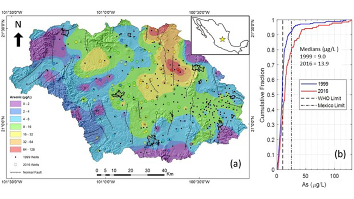
• About
  • Sections
  • Topics
    • Climate
    • Earth Science
    • Oceans
    • Space & Planets
    • Health & Ecosystems
    • Culture & Policy
    • Education & Careers
    • Opinions
  • Projects
    • ENGAGE
    • Editors’ Highlights
    • Editors’ Vox
    • Eos en Español
    • Eos 简体中文版
    • Print Archive
  • Science Policy Tracker
  • Blogs
    • Research & Developments
    • The Landslide Blog
  • Newsletter
  • Submit to Eos
  • AGU.org
  • Career Center
  • Join AGU
  • Give to AGU
  • About
  • Sections
  • Topics
    • Climate
    • Earth Science
    • Oceans
    • Space & Planets
    • Health & Ecosystems
    • Culture & Policy
    • Education & Careers
    • Opinions
  • Projects
    • ENGAGE
    • Editors’ Highlights
    • Editors’ Vox
    • Eos en Español
    • Eos 简体中文版
    • Print Archive
  • Science Policy Tracker
  • Blogs
    • Research & Developments
    • The Landslide Blog
  • Newsletter
  • Submit to Eos
Skip to content
  • AGU.org
  • Career Center
  • Join AGU
  • Give to AGU
Eos

Eos

Science News by AGU

Support Eos
Sign Up for Newsletter
  • About
  • Sections
  • Topics
    • Climate
    • Earth Science
    • Oceans
    • Space & Planets
    • Health & Ecosystems
    • Culture & Policy
    • Education & Careers
    • Opinions
  • Projects
    • ENGAGE
    • Editors’ Highlights
    • Editors’ Vox
    • Eos en Español
    • Eos 简体中文版
    • Print Archive
  • Science Policy Tracker
  • Blogs
    • Research & Developments
    • The Landslide Blog
  • Newsletter
  • Submit to Eos

Mexico

Camino dañado por un terremoto en Calexico, California, 2010. El camino muestra grietas en el pavimento. Al fondo se observa un edificio de una planta cercado y el cielo azul.
Posted inNews

Buscando terremotos en la ionosfera

by Nathaniel Scharping 28 March 202228 March 2022

Los terremotos pueden liberar ráfagas de energía eléctrica que se pueden sentir en la ionosfera, a kilómetros por encima de la Tierra. Sin embargo, la teoría sigue siendo controvertida.

La pirámide del Sol en Teotihuacan al frente con un cerro y el cielo despejado detrás.
Posted inNews

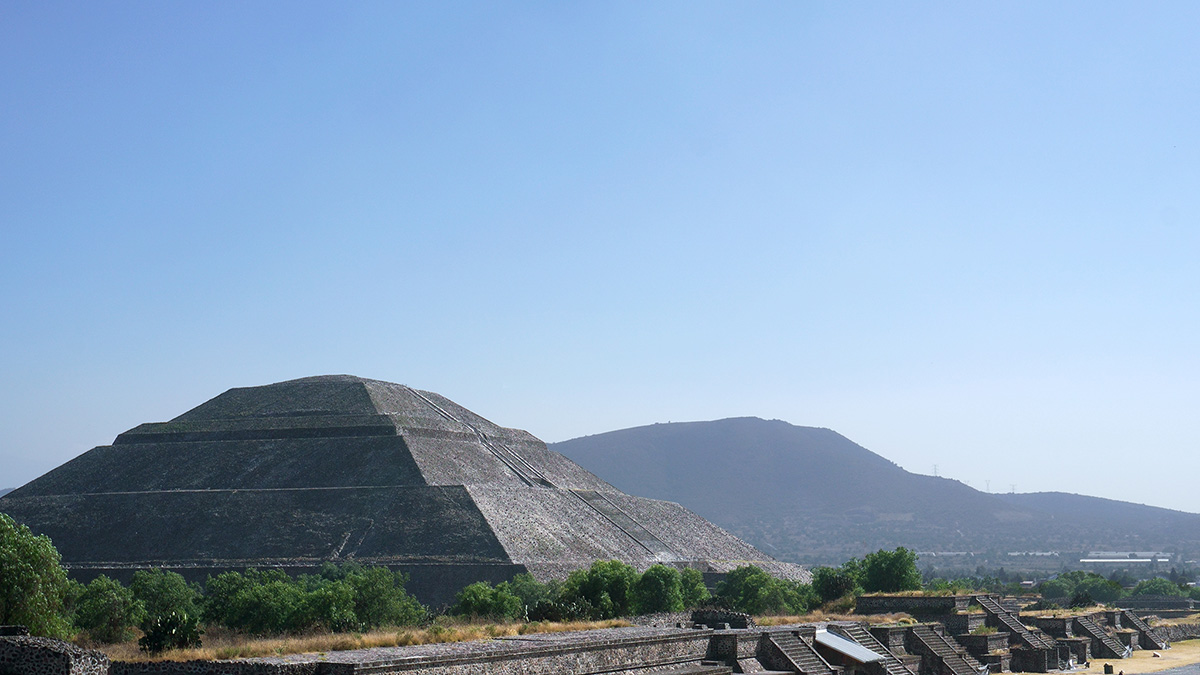
Mapeando el pasado, presente y futuro de Teotihuacan

by Humberto Basilio 14 March 202227 March 2023

Un nuevo proyecto con tecnología lidar revela cómo la minería y la expansión urbana han puesto en riesgo a uno de los sitios del patrimonio cultural más icónicos de México.

An earthquake damaged a paved road in Calexico, Calif., in 2010.
Posted inNews

Searching for Earthquakes in the Ionosphere

by Nathaniel Scharping 25 February 202212 April 2022

Earthquakes may release bursts of electrical energy that can be felt in the ionosphere, kilometers above Earth. The theory remains controversial, though.

The Pyramid of the Sun at Teotihuacan
Posted inNews

Mapping Teotihuacan’s Past, Present, and Future

by Humberto Basilio 6 January 20229 May 2023

A new lidar project reveals how mining and urban expansion have put one of Mexico’s most iconic cultural heritage sites at risk.

Posted inNews

Sobreviviendo en la periferia de una ciudad de terremotos

by Humberto Basilio 17 November 202128 March 2023

La Ciudad de México es una de las áreas urbanas más propensas a desastres del mundo. Después de un terremoto, las comunidades marginadas que viven en la periferia de la ciudad están expuestas a más peligros que el simple derrumbe de edificios.

A person clipping mangrove leaves
Posted inNews

Inland Mangroves Are Relics of the Past’s Higher Sea Levels

Katherine Kornei, Science Writer by Katherine Kornei 10 November 202124 January 2024

Mangroves found in southern Mexico’s rain forest, 170 kilometers from the nearest ocean, date to a time when sea levels were several meters higher.

Debris covers a densely populated hillside community in Cerro del Chiquihuite, Mexico.
Posted inNews

Surviving on the Periphery of a City of Earthquakes

by Humberto Basilio 19 October 20219 May 2023

Mexico City is one of the most disaster-prone urban areas in the world. Following an earthquake, marginalized communities living on the city’s periphery are exposed to more dangers than just collapsing buildings.

Ilustración que ejemplifica la Cuenca del Valle de México, los diferentes componentes del subsuelo, líneas que indican el nivel de subsidencia y las direcciones de los flujos de recarga del acuífero al 2020
Posted inResearch Spotlights

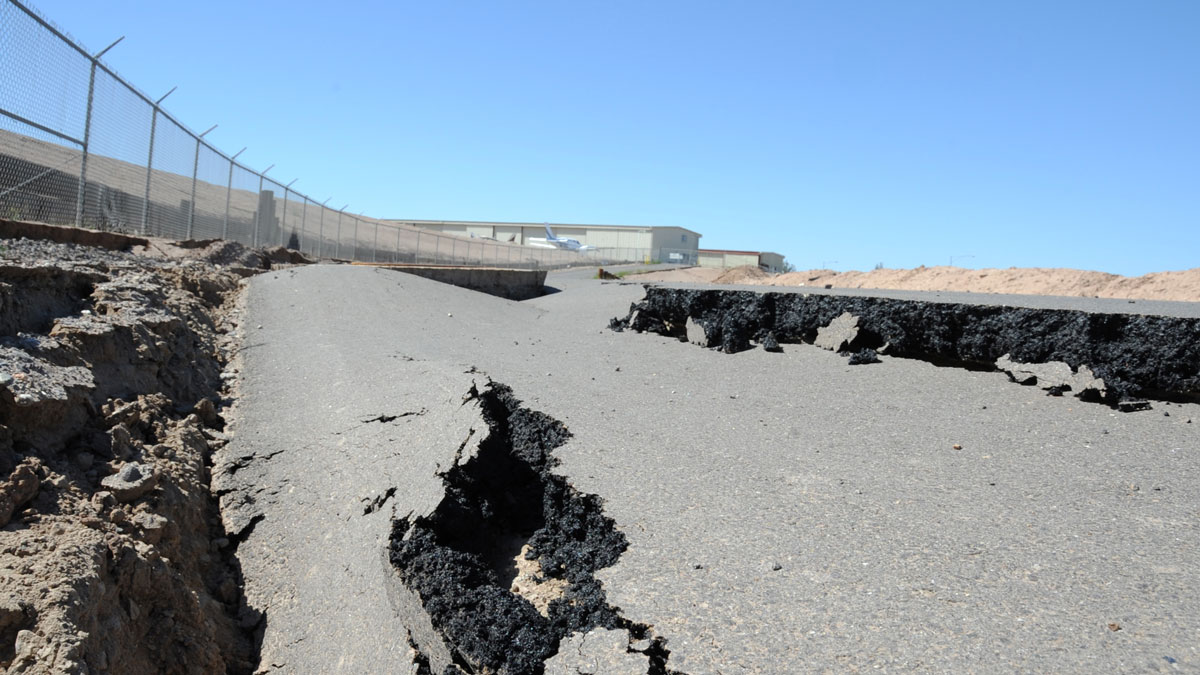
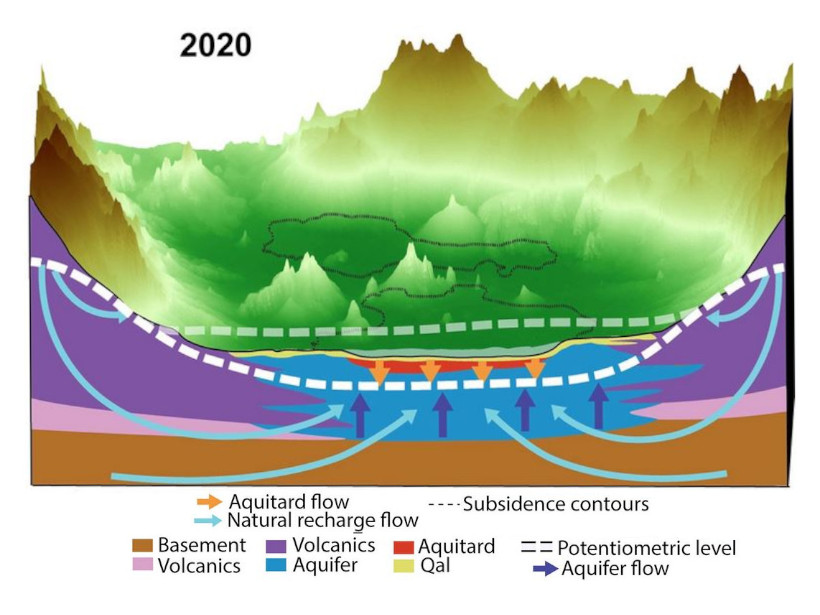
La inminente crisis del hundimiento del suelo en la Ciudad de México

by L. O’Hanlon 12 May 20219 May 2023

Una nueva investigación revela la causa del rápido hundimiento y fracturación del suelo de la Ciudad de México.

Schematic showing how ground and groundwater are moving in the Valley of Mexico.
Posted inResearch Spotlights

The Looming Crisis of Sinking Ground in Mexico City

by L. O’Hanlon 22 April 20219 May 2023

New research reveals the cause of Mexico City’s rapidly sinking and fracturing ground.

Aerial photo of Cayos Cochinos, a series of small coral cays off the Caribbean coast of Honduras
Posted inNews

Scientists Support Local Activities to Rescue the Mesoamerican Reef

by J. Rodriguez 15 September 20203 November 2022

The reef’s report card analyzed 286 sites in Mexico, Belize, Guatemala, and Honduras. Communities, scientists, and governments are working to improve coral and ecosystem resilience.

Posts pagination

Newer posts 1 2 3 4 5 6 Older posts
A view of a Washington, D.C., skyline from the Potomac River at night. The Lincoln Memorial (at left) and the Washington Monument (at right) are lit against a purple sky. Over the water of the Potomac appear the text “#AGU24 coverage from Eos.”

Features from AGU Publications

Research Spotlights

Machine Learning Simulates 1,000 Years of Climate

27 August 202527 August 2025
Editors' Highlights

As Simple as Possible: The Importance of Idealized Climate Models

28 August 202526 August 2025
Editors' Vox

Experienced Researcher Book Publishing: Sharing Deep Expertise

3 September 202526 August 2025
Eos logo at left; AGU logo at right

About Eos
ENGAGE
Awards
Contact

Advertise
Submit
Career Center
Sitemap

© 2025 American Geophysical Union. All rights reserved Powered by Newspack