• About
  • Special Reports
  • Topics
    • Climate
    • Earth Science
    • Oceans
    • Space & Planets
    • Health & Ecosystems
    • Culture & Policy
    • Education & Careers
    • Opinions
  • Projects
    • ENGAGE
    • Third Pod from the Sun
    • Eos en Español
    • Eos 简体中文版
    • Print Archive
  • Newsletter
  • Submit to Eos
  • AGU.org
  • AGU Publications
    • AGU Journals
    • Editors’ Highlights
    • Editors’ Vox
  • Career Center
  • AGU Blogs
  • Join AGU
  • Give to AGU
  • About
  • Special Reports
  • Topics
    • Climate
    • Earth Science
    • Oceans
    • Space & Planets
    • Health & Ecosystems
    • Culture & Policy
    • Education & Careers
    • Opinions
  • Projects
    • ENGAGE
    • Third Pod from the Sun
    • Eos en Español
    • Eos 简体中文版
    • Print Archive
  • Newsletter
  • Submit to Eos
Skip to content
  • AGU.org
  • AGU Publications
    • AGU Journals
    • Editors’ Highlights
    • Editors’ Vox
  • Career Center
  • AGU Blogs
  • Join AGU
  • Give to AGU
Eos

Eos

Science News by AGU

Sign Up for Newsletter
  • About
  • Special Reports
  • Topics
    • Climate
    • Earth Science
    • Oceans
    • Space & Planets
    • Health & Ecosystems
    • Culture & Policy
    • Education & Careers
    • Opinions
  • Projects
    • ENGAGE
    • Third Pod from the Sun
    • Eos en Español
    • Eos 简体中文版
    • Print Archive
  • Newsletter
  • Submit to Eos

Missouri River

Flooding during June 2011 on the Missouri River floodplain near Arrow Rock, Mo.
Posted inResearch Spotlights

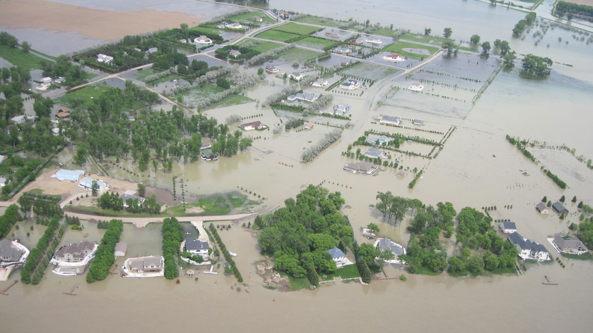
Missouri River Floodplain Expansion, Services, and Resiliency

Aaron Sidder, freelance science writer by Aaron Sidder 28 July 202221 September 2022

Benefits might accrue for both wildlife and climate resiliency if more floodplains along the lower Missouri River were allowed to flood.

Mississippi River levee at Gretna, La.
Posted inResearch Spotlights

Algorithm Detects Thousands of Missing Levees from U.S. Database

Rachel Fritts, Science Writer by Rachel Fritts 17 June 202221 February 2023

An existing levee database accounts for just one fifth of the country’s actual total levee count, limiting the study of how these embankments affect riparian ecosystem health in the United States.

Two maps of the Missouri river basin showing estimates of river discharge in a hydrological model (top) and when the model incorporates satellite data (bottom).
Posted inEditors' Highlights

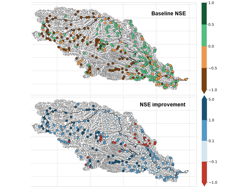
Gauging Ungauged River Basins with Smart Remote Sensing

by Marc F. P. Bierkens 10 March 202115 March 2023

A clever combination of hydrologic modelling and discharge estimates from the Landsat satellite provides good discharge estimates throughout the Missouri river basin.

Three-part image showing maps of the Missouri River near Council Bluffs, Iowa, and Omaha, Neb., in 1893 (left) and 2013 (middle) as well as a satellite image of the same area from 2019
Posted inOpinions

It’s Time to Revise Estimates of River Flood Hazards

by G. Sofia, E. I. Nikolopoulos and L. Slater 16 March 202021 February 2023

Accurately assessing flood hazards requires a better understanding of the feedbacks between natural and human influences on the characteristics of rivers.

Features from AGU Journals

RESEARCH SPOTLIGHTS
Geophysical Research Letters
“Neural Networks Map the Ebb and Flow of Tiny Ponds”
By Sarah Derouin

EDITORS' HIGHLIGHTS
Community Science
“Collaboration Helps Overcome Challenges in Air Quality Monitoring”
By Muki Haklay

EDITORS' VOX
Reviews of Geophysics
“What We Know and Don’t Know About Climate Tipping Elements”
By Seaver Wang

Eos logo at left; AGU logo at right

About Eos
ENGAGE
Awards
Contact

Advertise
Submit
Career Center
Sitemap

© 2023 American Geophysical Union. All rights reserved. Proudly powered by Newspack by Automattic