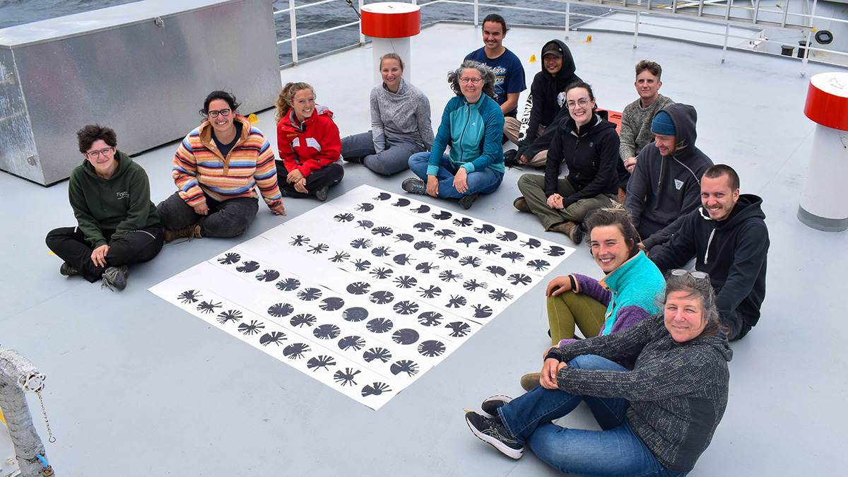
The bread and butter of oceanography, sea voyages rarely include minoritized communities and nonscientists. The Inclusion Mission wants to change that.
Oceans

Posted inEditors' Highlights
Can Anelastic Attenuation of Oceanic Mantle be Reliably Measured?
A new study demonstrates that robust anelastic attenuation measurements can be made across ocean bottom seismic arrays at different locations using surface wave array analysis.
Posted inNews
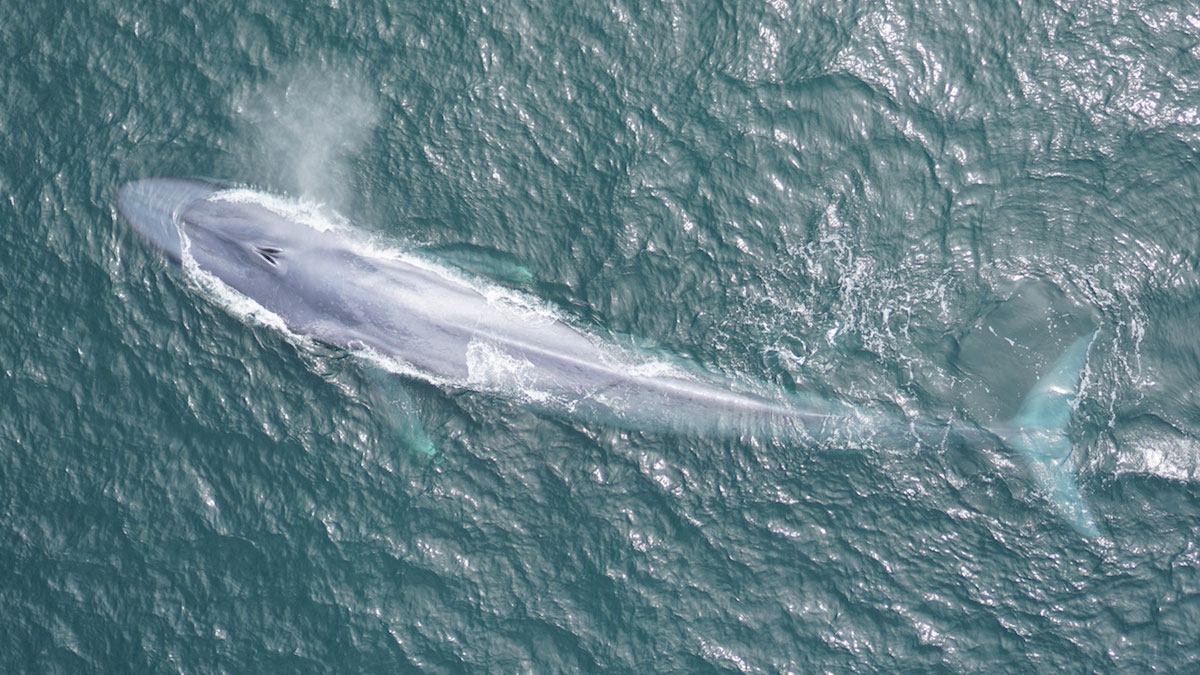
Scientists Tune In to Blue Whale Feeding Rhythms
New acoustic sensing technology is allowing scientists to track blue whale movements in real time, a breakthrough that could help save whales’ lives.
Posted inEditors' Highlights
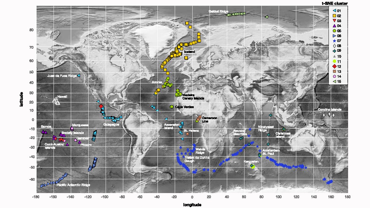
Machine Learning Looks Anew at Isotope Ratios in Oceanic Basalts
While past attempts to define isotopic endmembers and assign them a geodynamic significance ended in controversy, a machine-learning clustering algorithm offers a solution to this classical problem.

Posted inResearch Spotlights
Tracing Anthropogenically Emitted Carbon Dioxide into the Ocean
Researchers labeled anthropogenically emitted carbon and tracked it with an ocean circulation model to determine whether it winds up in the sky or sea.
Posted inEditors' Highlights
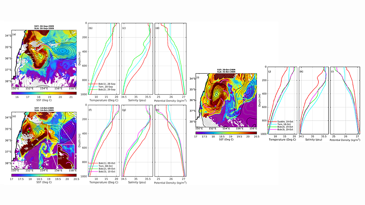
How do Bob and Tom Eddies Meet, Pair-Spin, and Twist?
Autonomous float data reveal that mergers of two eddies, known to have spiraling subducting water surrounding each other, happens more frequently than previously thought.
Posted inNews
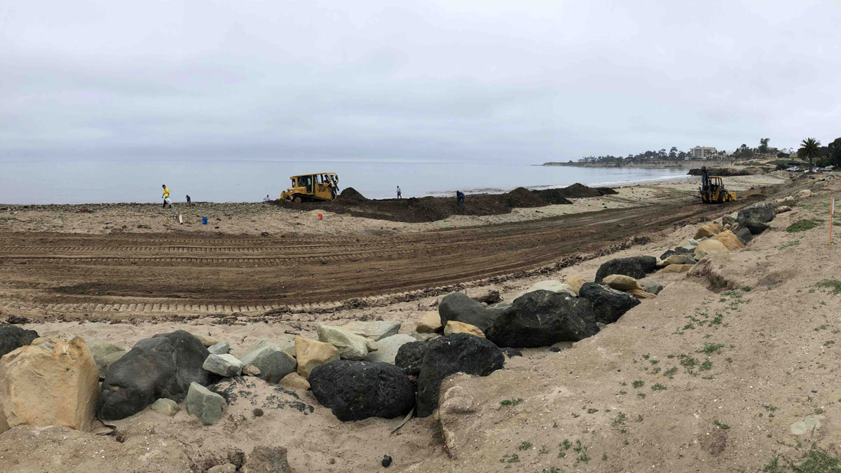
Managing Mudslide Debris After Fires
California officials faced a conundrum in dealing with mudslides after the Thomas Fire.

Posted inEditors' Highlights
Two Kinds of Warm Core Rings Emanate From the Gulf Stream
A new study reveals that long-lived warm core rings found in the “Ring Corridor”, a narrow path north of the Gulf Stream, have two different formation mechanisms.

Posted inEditors' Highlights
Ocean Waves Cause Drag Coefficient Asymmetry Within Typhoons
Observations show that, due to ocean waves, the drag coefficients for surface wind stresses have spatial asymmetry within typhoons, which should be considered in weather and climate simulations.
Posted inResearch Spotlights
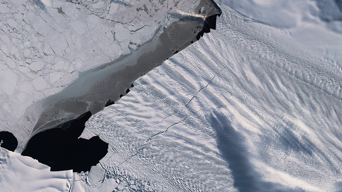
Melting Below the Pine Island Ice Shelf Minds the Gap
New research shows that increased calving from West Antarctica’s Pine Island Ice Shelf will likely drive increased circulation of warm water—and melting—below the ice.