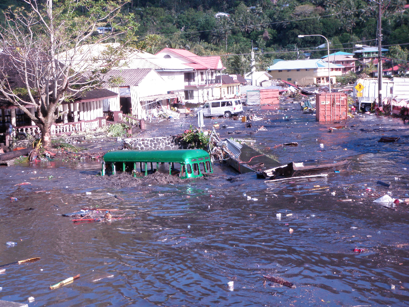
A next-generation network of seismic and wave sensors in the southwestern Pacific will warn coastal residents of an approaching tsunami before they see the wave.
Pacific Ocean
Posted inNews
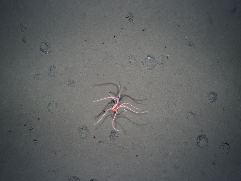
The Long-Lasting Legacy of Deep-Sea Mining
New research reveals a deep-sea mining experiment that took place 26 years ago still has significant and persistent impacts on benthic life.
Posted inNews
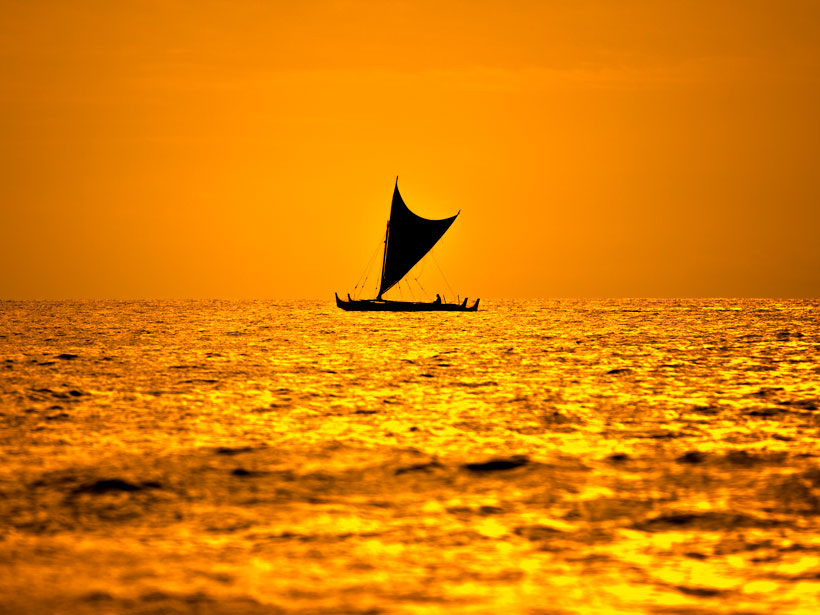
Humans Colonized Polynesia Much Earlier Than Previously Thought
Evidence from mud, charcoal, and feces suggests humans arrived in East Polynesia during the driest period in 2 millennia.
Posted inScience Updates
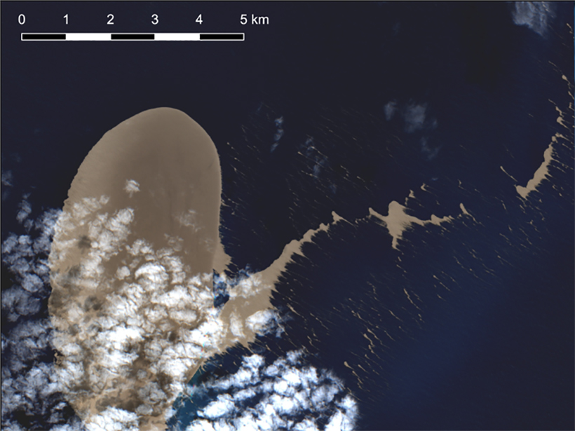
Satellite Sleuthing Detects Underwater Eruptions
Satellite data helped scientists locate the volcanic source of a pumice raft floating in the South Pacific Ocean, illustrating their promise in locating and monitoring undersea eruptions.

Posted inNews
The Ecological Costs of Removing California’s Offshore Oil Rigs
Offshore oil- and gas-drilling platforms are rich habitats for fish, and removing them completely would result in a loss of over 95% of fish biomass, new research has revealed.
Posted inNews
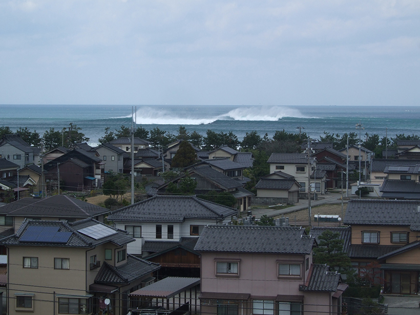
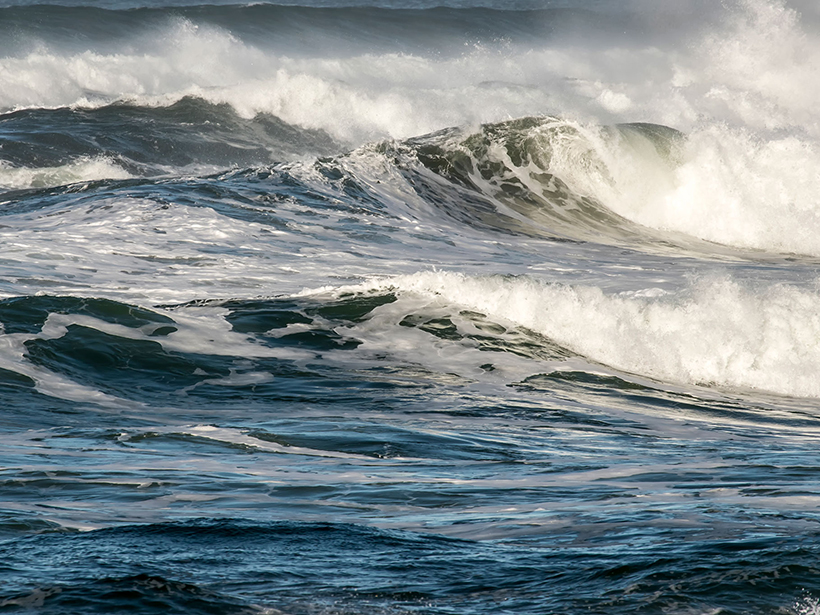
Submarine Canyons Breed Megawaves in Japan
The canyons act like a prism, focusing waves into mammoths of destruction.
Posted inResearch Spotlights
Oceans Vented Carbon Dioxide During the Last Deglaciation
A new boron isotope record from South Pacific marine sediments offers a more complete picture of ocean-atmosphere carbon dioxide exchange during the late Pleistocene.
Posted inNews
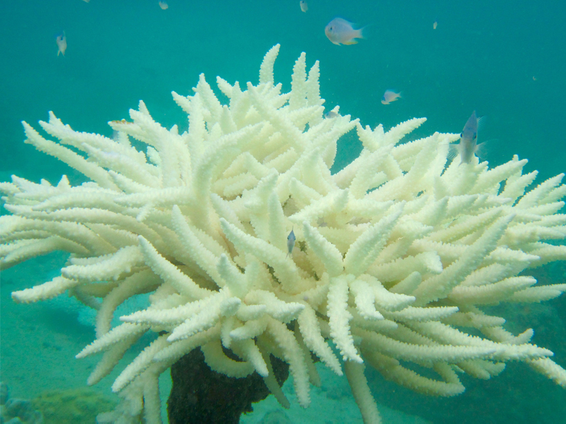
A Key to Coral Bleaching Events? Location, Location, Location
New research indicates that longitude, as well as warming waters, may be a key predictor of coral bleaching events.
Posted inNews
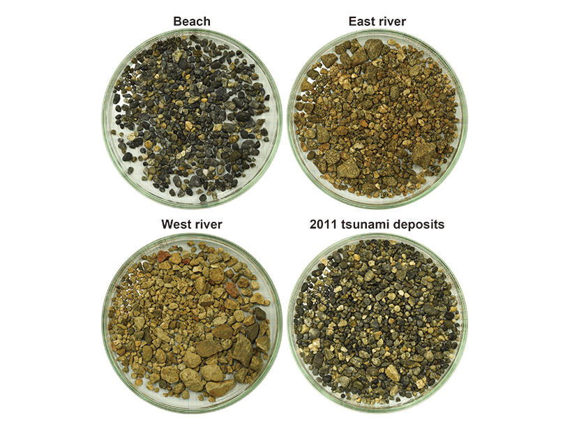
Gravel Gives Clues to the Strength of Paleotsunamis
The roundness of sediment deposits may shed light on how big tsunamis were in the past and how to evaluate hazards in the future.

Posted inNews
Volcanic Eruption Creates Temporary Islands of Pumice
Rafts of pumice, spewed from an undersea volcano, recently appeared in the South Pacific. These transient, movable islands are important toeholds for marine life like barnacles, coral, and macroalgae.