
Long-distance swimmer Ben Lecomte seeks to raise awareness about plastic pollution in the ocean.
Pacific Ocean
Posted inResearch Spotlights
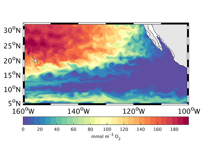
How the Ocean’s “Shadow Zone” Breathes
A new study uses Argo floats and an ocean circulation model to track the sources supplying pulses of oxygen to the deep North Pacific.

Posted inEditors' Vox
The Kuroshio Current: Artery of Life
The waters of the Kuroshio Current in the northwestern Pacific Ocean transport heat, salt, and organic and inorganic matter from south to north, shaping the ocean ecosystem.

Posted inNews
Far-Flung Dust Storms Deliver Nutrient Boosts to North Pacific
Barren marine deserts bloom seasonally with iron infusions from Asian dust storms.

Posted inNews
Marshall Islands Nuclear Contamination Still Dangerously High
Today’s radiation levels at some locations were higher than in areas affected by the Chernobyl and Fukushima nuclear disasters.
Posted inEditors' Highlights
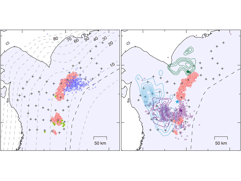
Shallow Low Frequency Tremors in Japan Trench
A new seafloor seismic network detected low-frequency tremor on the subduction zone interface offshore northern Japan, indicating regions of slow slip in close proximity to shallow megathrust events.
Posted inEditors' Highlights
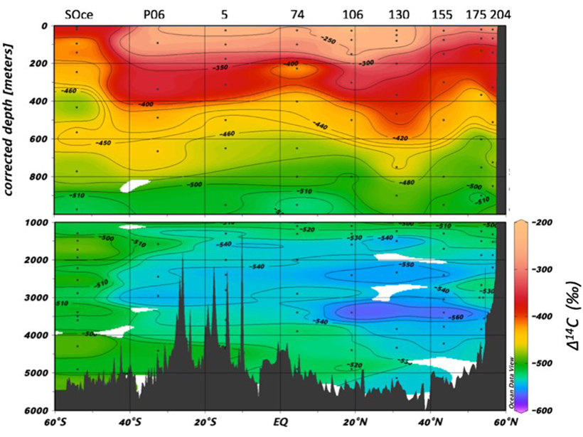
Pacific Carbon Ages During Long Journey Along Ocean Floor
The radiocarbon signal of DOC with depth across the Pacific Ocean basin effectively supports a number of important theories that have been suggested over the years.

Posted inResearch Spotlights
Déjà Vu: Understanding Subduction Zones’ Cycle of Seismicity
A unique geodetic data set from Japan’s Nankai subduction zone offers an unparalleled opportunity to study surface deformation spanning almost an entire seismic cycle.
Posted inResearch Spotlights
Pacific Carbon Uptake Accelerating Faster Than Expected
A new study suggests that shifting ocean currents drive faster carbon dioxide uptake.

Posted inScience Updates
Australia–New Zealand Plan for Future Scientific Ocean Drilling
Australian–New Zealand IODP Consortium Ocean Planet Workshop; Canberra, Australia, 14–16 April 2019