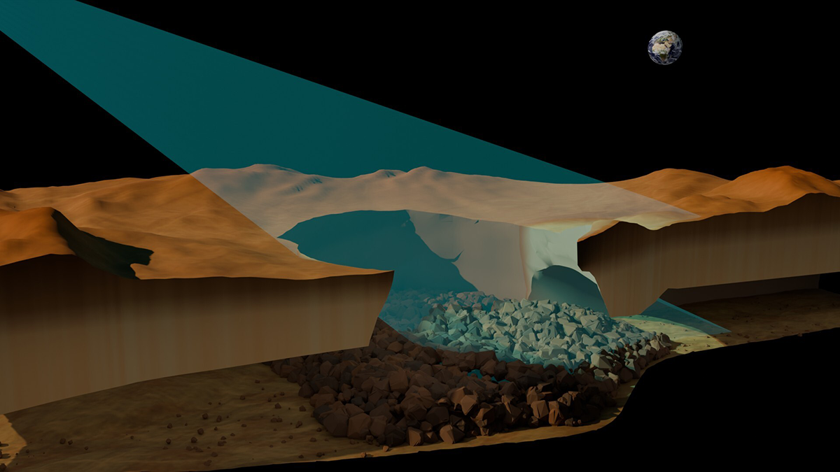
Researchers bring new life to 30-year-old Magellan data to unearth the first direct evidence of the long-hypothesized structures.
radar & radio
Posted inFeatures
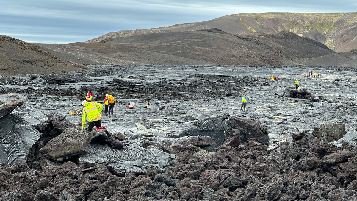
Discovering Venus on Iceland
Scientists trekked across Icelandic lava flows that served as stand-ins for Venus’s volcanic landscapes, testing tools and methods the upcoming VERITAS mission will use when it reaches the planet.
Posted inFeatures
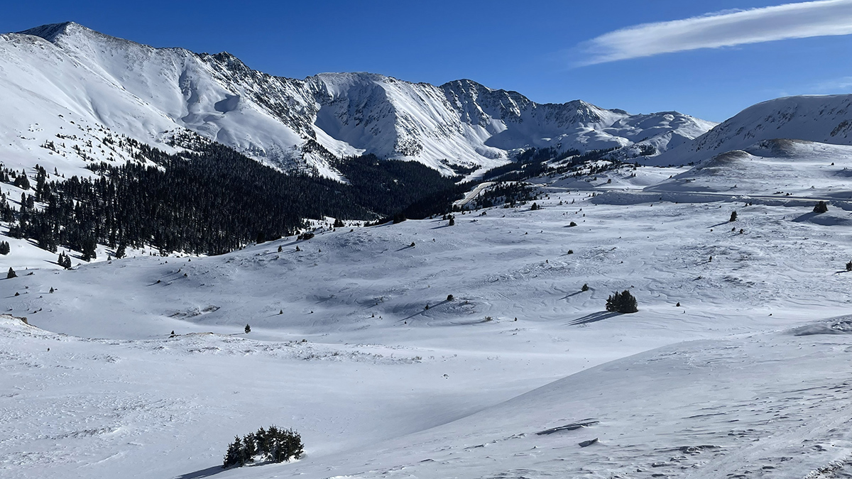
Satellite Radar Advances Could Transform Global Snow Monitoring
The recent SnowEx campaign and the new NISAR satellite mission are lighting the way to high-resolution snowpack monitoring and improved decisionmaking in critical river basins around the world.

Posted inResearch Spotlights
Maybe That’s Not Liquid Water on Mars After All
A “very large roll” of a radar instrument offers new insight into a highly reflective area near the Martian south pole.
Posted inEditors' Highlights
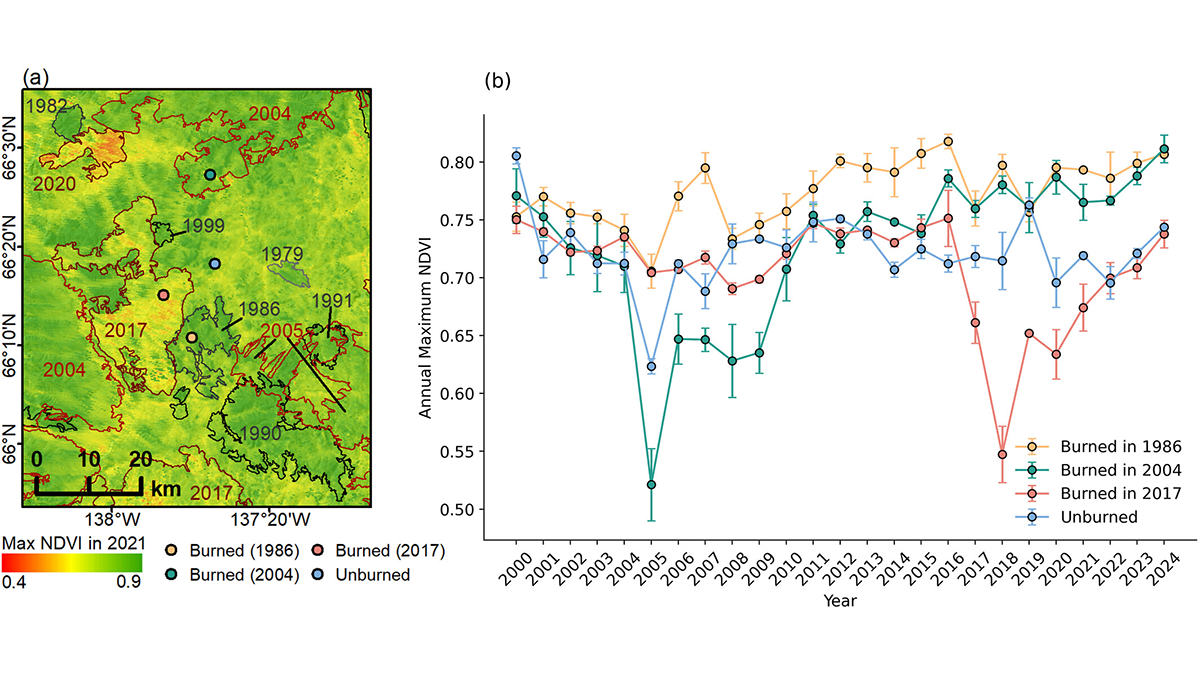
Radar Surveys Reveal Permafrost Recovery After Wildfires
Boreal-permafrost systems are still resilient against wildfires, but continuous and long-term monitoring is needed to control the impact of climate change.
Posted inEditors' Highlights
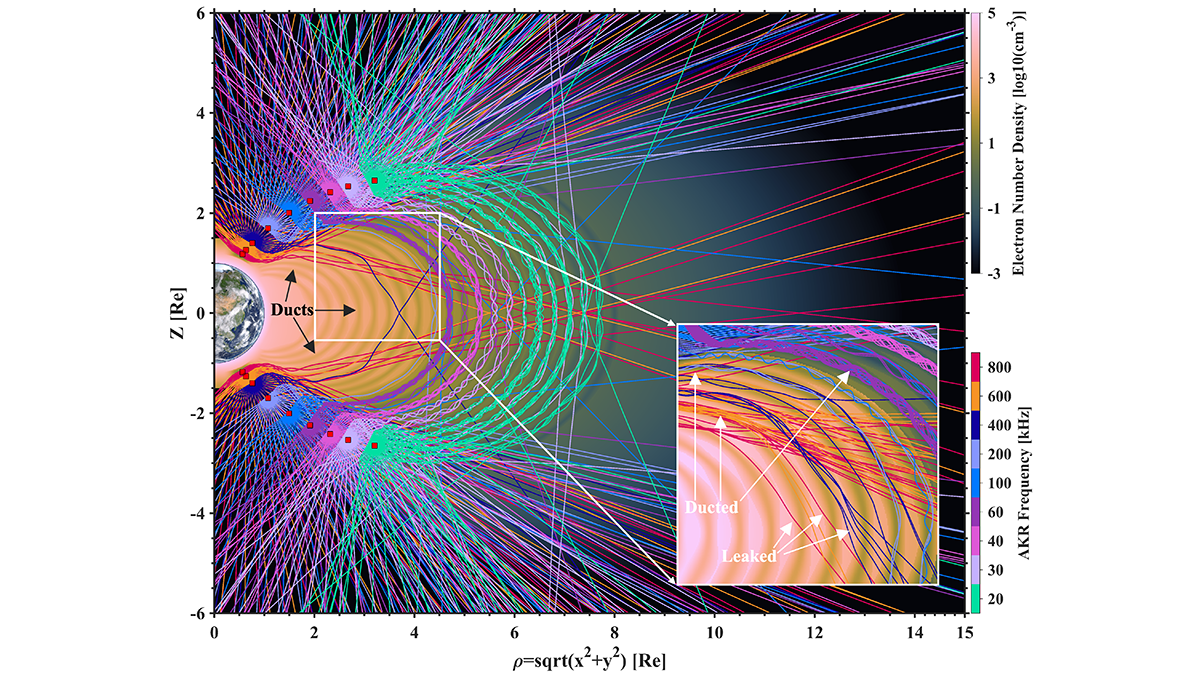
Spacecraft Surveys Shed New Light on Auroral Kilometric Radiation
Observations show low-density space channels guide Auroral Kilometric Radiation, like wind through mountain tunnels, offering new insights into its occurrence and directionality.

Posted inFeatures
How Researchers Have Studied the Where, When, and Eye of Hurricanes Since Katrina
Twenty years after one of the country’s deadliest storms, scientists reflect on improvements in the ability to understand and predict disasters.
Posted inOpinions
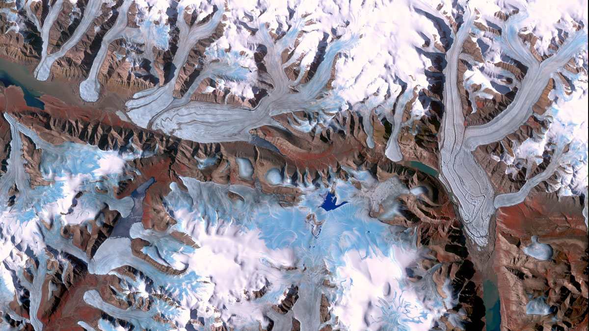
Glacier Monitoring from Space Is Crucial, and at Risk
A new community effort shows that Earth has lost 5% of its global glacier mass since 2000. The work highlights the necessity of spaceborne glacier observations and upcoming gaps in long-term monitoring.
Posted inEditors' Highlights
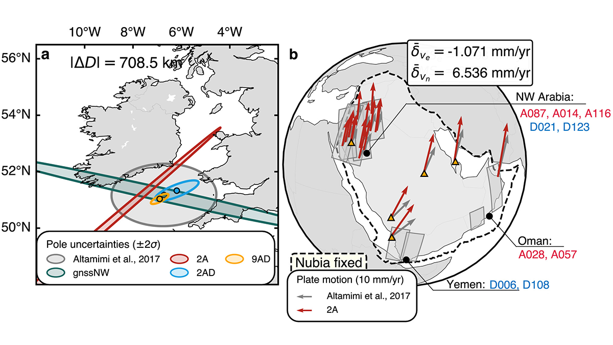
Mapping the Whereabouts of Continents
A new method integrates Interferometric Synthetic Aperture Radar (InSAR) with conventional ground geodetic networks, taking us closer to high-resolution mapping of plate motions.
Posted inResearch Spotlights
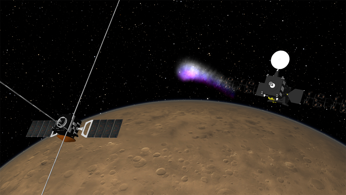
Orbiter Pair Expands View of Martian Ionosphere
Radio signals sent between two Mars orbiters—rather than between an orbiter and an Earth-based receiver—capture new insights into atmospheric dynamics.