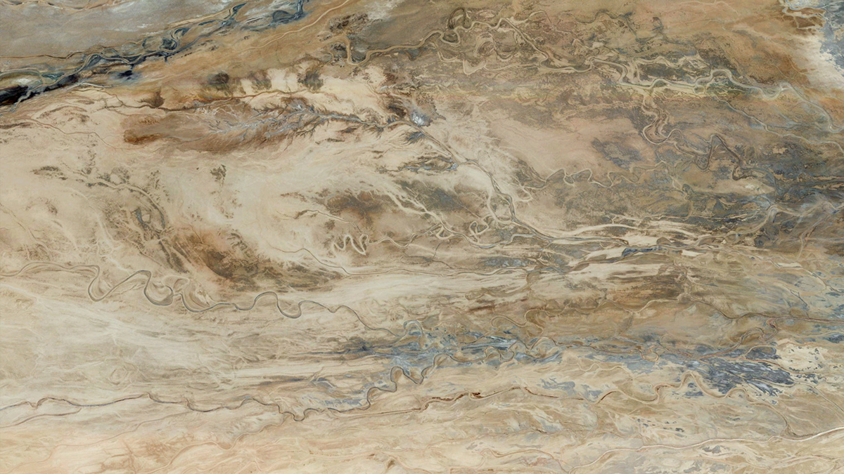
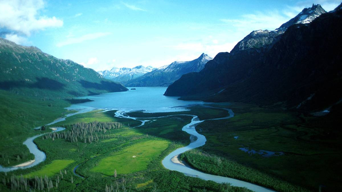
New evidence from 1.2-billion-year-old rocks suggests that single, sinuous channels could have formed in muddy floodplain sediments without the stabilizing help of vegetation.
rivers
Posted inEditors' Highlights
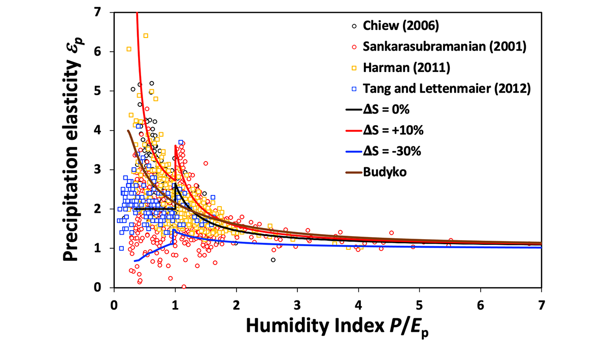
How Much Terrestrial Precipitation is Used by Vegetation?
Precipitation is partly used by vegetation and partly transformed into river flow. Quantifying the amount of water that is directly used by vegetation is essential to decipher climate change’s impact.

Posted inFeatures
Cee Nell: Making Data Visual
Nell turns vast columns of data into beautiful and understandable graphics.
Posted inEditors' Vox
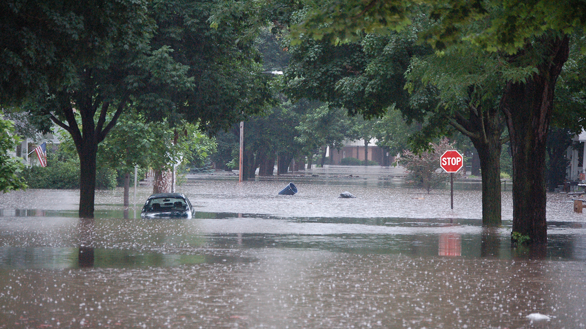
Unlocking the Secrets of Floods: Breakthroughs in Riverine and Coastal Modeling
To enhance flood modeling, it is imperative to gain a comprehensive understanding of the causative mechanisms and cutting-edge models and tools, while also acknowledging their uncertainties.
Posted inFeatures
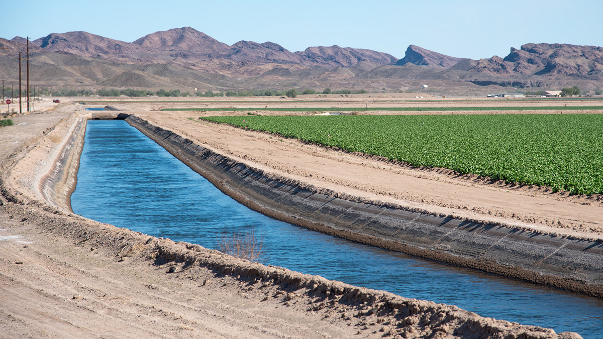
Agriculture 3.0: Preparing for a Drier Future in the Colorado River Basin
Years of drought and climate change are causing water resources to dwindle in the Colorado River Basin. But farmers and scientists are collaborating to learn how to grow crops with less water.

Posted inFeatures
Fixing the Flawed Colorado River Compact
The 1922 Colorado River Compact ignored available science and overallocated the river’s water, a decision whose effects reverberate today. Now there’s an opportunity to get things right.

Posted inNews
Forecasting Earthquake-Induced Floods
Surface-rupturing earthquakes can abruptly reroute rivers when fault scarps function like dams. Researchers have now successfully modeled such an event that occurred in New Zealand.
Posted inResearch Spotlights
The Greenhouse Gas Burden of Inland Waters
A global collaboration inventoried greenhouse gas emissions from rivers, lakes, and streams.

Posted inEditors' Highlights
Inductive Approach Reveals Controls on Dissolved Organic Carbon
Machine learning leverages large data sets to reveal hidden patterns explaining when, where, and why dissolved organic carbon moves from hillslopes to streams.

Posted inNews
Hypoxia Affects One in Eight Rivers Worldwide
A global study found dangerously low levels of dissolved oxygen in rivers around the world. The true prevalence of hypoxia is probably even higher.