An annual report highlights 10 waterways that have arrived at forks: where public support could determine whether they receive protection.
rivers

Posted inENGAGE, News
As the Arctic Warms, These Rivers Are Slowing Down
The Arctic is warming up, but instead of large rivers migrating faster, they’re actually slowing down because of shrubification.
Posted inNews
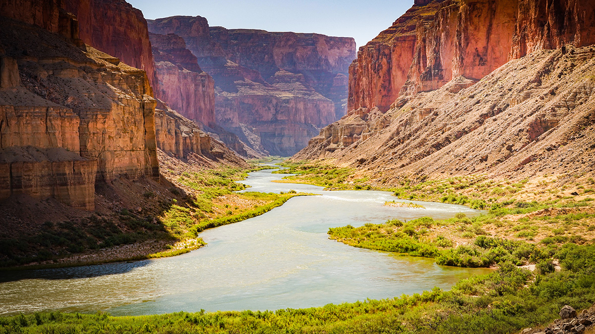
Biden Administration Considers Unprecedented Solution to Colorado River Crisis
As Colorado River Basin states prove unable to reach a consensus in reducing their water consumption, the U.S. Department of the Interior is investigating an option that defies the Law of the River.

Posted inENGAGE, News
Spring and Sewage Are in the Air Near San Diego
Sea spray can transport sewage-contaminated waters inland, potentially exposing those living kilometers from the beach.
Posted inEditors' Highlights
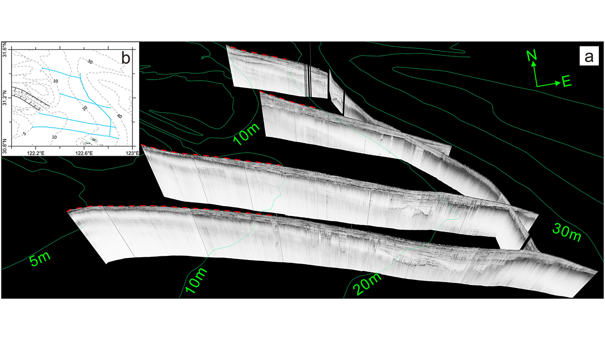
Delta Degradation Leads to Exacerbated Greenhouse Gas Emissions
Seismic ship surveys and seabed elevation maps of the Yangtze subaqueous delta reveal how the reduction of sediment supply to the coastal ocean can trigger increased greenhouse gas emissions.

Posted inENGAGE, News
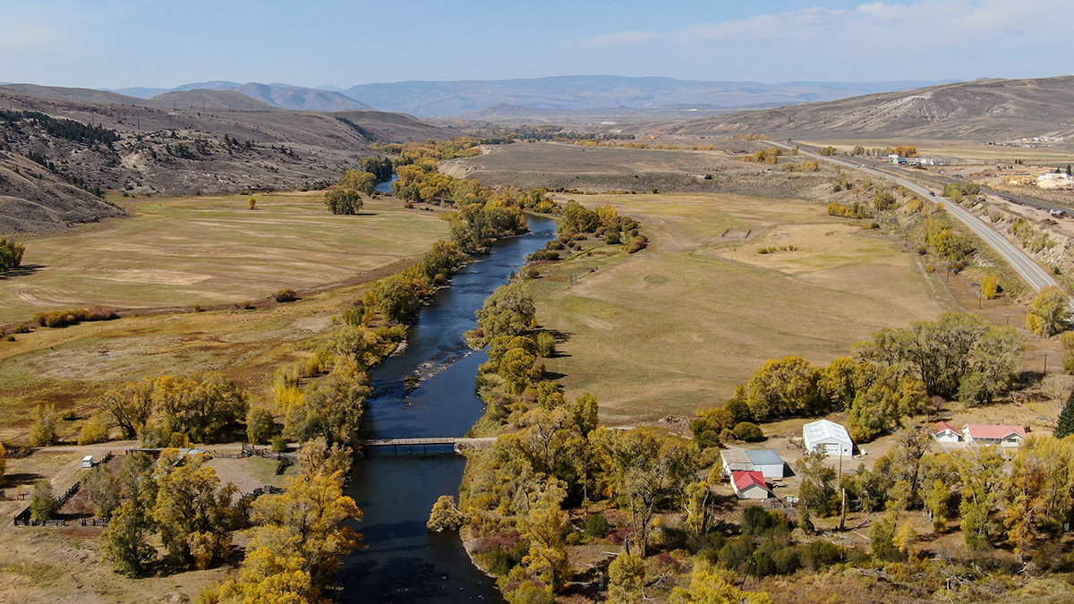
Urban Water Conservation Success in the Colorado River Basin
In the past few decades, cities in Arizona, Colorado, and Nevada have vastly increased their water use efficiency. They’ve also learned lessons that can inform other cities’ efforts.

Posted inNews
In New Zealand, Fish Are Helping Scientists Find Gold
Enormous amounts of gold lie buried beneath the rubble of New Zealand’s mountains, and scientists are using freshwater fish genetics to find it.
Posted inNews
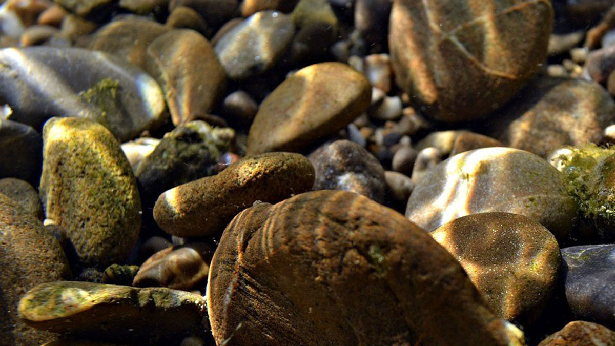
Decoding the Secrets of Shifting Sediments
In the small-scale details of grain shape, researchers have found a new way to understand how sediment flows in a river, a process shaping Earth’s landscapes.

Posted inEditors' Highlights
What Electrons Can Tell Us About the Speed of Sand
A new sediment tracer uses the interactions between radiation, charge, and the Sun to uncover the hidden transport histories of sand grains.
Posted inEditors' Highlights
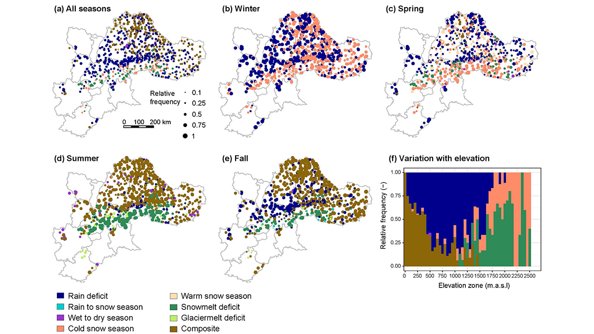
Streamflow Drought Intensification in the European Alps
A five-decade analysis of drought generation processes in the Alps shows their changing seasonality in high-elevation basins with increasingly frequent droughts caused by a lack of snowmelt water.