Efficiently tracking nature’s engineers—beavers—at the scale of entire watersheds over time is now possible, thanks to a new artificial intelligence–trained model called EEAGER.
rivers
Posted inEditors' Highlights
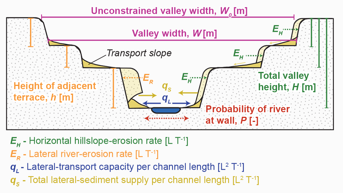
Why Do Fluvial Valleys Behave So Differently?
Source: AGU Advances Editors’ Highlights are summaries of recent papers by AGU’s journal editors. The shape of fluvial valleys results from the complex interaction between climate and the local environment. Our current knowledge suggests that river discharge and valley-wall lithology are the main controls on valley width. Yet, current models based on these observations fail […]
Posted inEditors' Highlights
Disentangling River Water Turbidity and its Flow
A new study shows why fine sediments in rivers are not simply proportional to the water flow across the United States.
Posted inNews
U.S. Streams Are Drying Up
A new study reports that streamflow drought is getting more intense in some parts of the United States, a phenomenon that is stressing the nation’s water policy and infrastructure.
Posted inResearch Spotlights
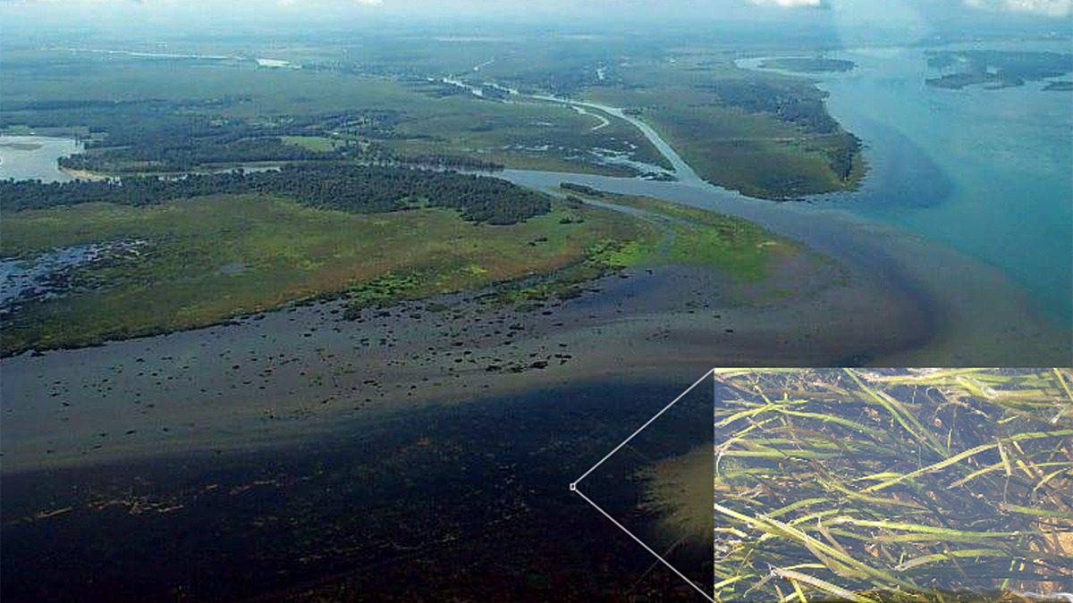
High-Frequency Monitoring Reveals Riverine Nitrogen Removal
Years of daily readings provide an unprecedented view into how a submerged aquatic meadow kept nitrogen from reaching the St. Lawrence Estuary as well as insights on how climate change may alter it.
Posted inENGAGE, News
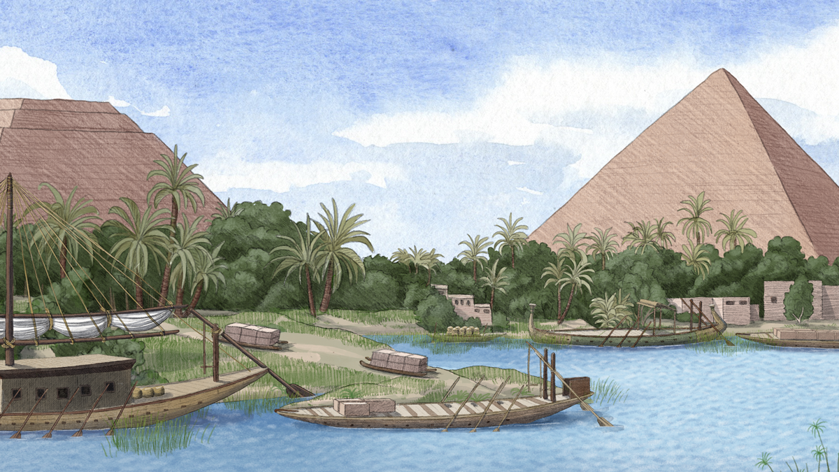
Ancient Nile Tributary May Have Aided Pyramid Construction
Pollen from sediment cores shows that a now dry channel cutting through Giza was once a flowing waterway that Egyptian pyramid builders could have used to transport supplies.

Posted inEditors' Highlights
The Burning Tundra
As wildfires blaze through the Arctic, scientists examine the role of landscape characteristics on wildfire ecosystem responses in northern aquatic ecosystems.
Posted inEditors' Vox
Bank Retreat Controls River and Estuary Morphodynamics
Understanding and predicting the geomorphological response of fluvial and tidal channels to bank retreat underpins the robust management of water courses and the protection of wetlands.

Posted inNews
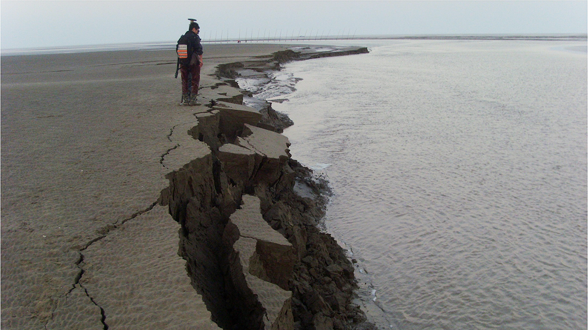
Estimating Land Loss in River Deltas
Some deltas are susceptible to land loss during sea level rise, whereas others gain land because of changes in the courses of rivers.
Posted inENGAGE, News
River Floods Can Trigger Powerful Underwater Landslides
A record-length turbidity current triggered by river flooding has revealed a new link between the surface and the deep sea.