Weathering of the earliest continents could have set in motion the formation of cratons, the immutable roots of continents.
sediments
Posted inEditors' Highlights
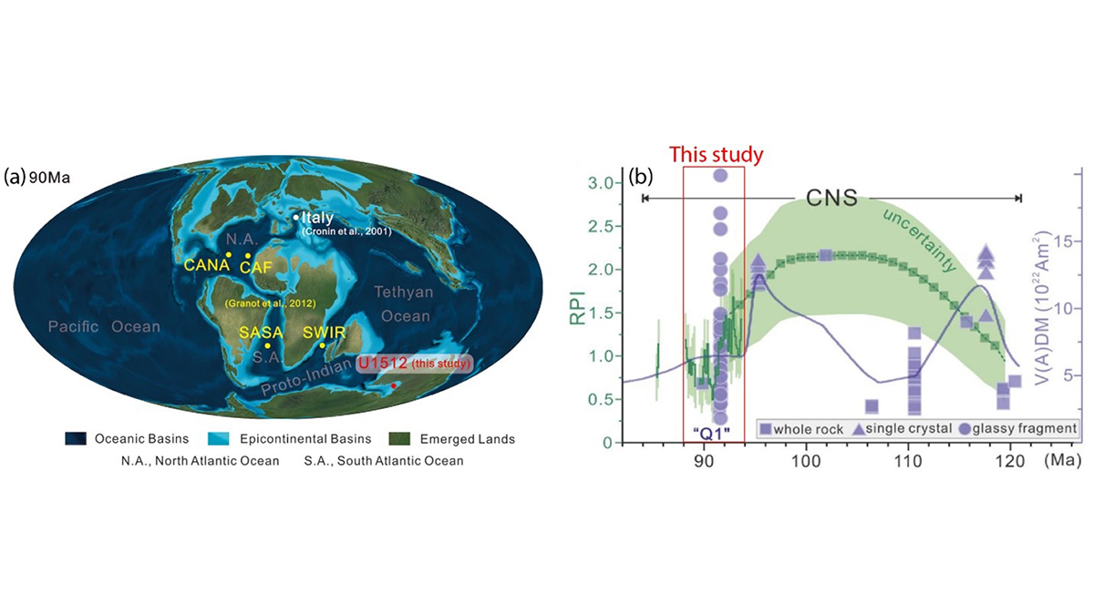
The Not-So-Quiet Cretaceous Quiet Zone
A new study finds that Earth’s magnetic field intensity varied significantly during the Cretaceous Normal Superchron, providing insights into the operation of the geodynamo during superchrons.

Posted inNews
Sand’s Role in Rerouting Meandering Rivers Is Bigger Than We Thought
Researchers delve into the dirt causing rivers to migrate.

Posted inResearch Spotlights
Tsunami Sands Help Scientists Assess Cascadia Earthquake Models
With evidence from new sediment cores, researchers tested the performance of various models of the 1700 CE megathrust earthquake.
Posted inResearch Spotlights
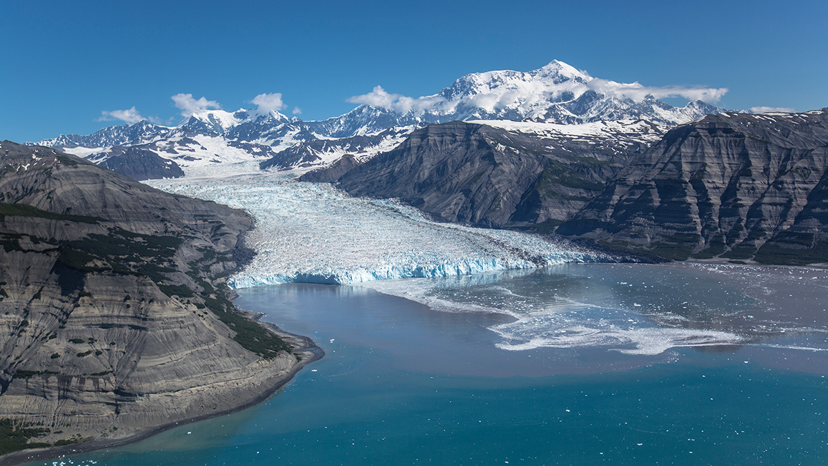
A Million Years Without a Megaslide
A new study goes deep into the Gulf of Alaska to examine the sixth-largest underwater landslide and investigate why a similar event hasn’t happened since.

Posted inENGAGE, News
The Crocodile Dundee Site Helping Rewrite the History of Australian Bushfires
A lake made famous by Hollywood has yielded powerful new evidence that humans have conducted controlled burns on the Red Continent for tens of thousands of years.

Posted inFeatures
The End of the Eclipse
Scientists are studying how the Earth–Moon distance has changed over time, and what effect that change might have had on our planet. Future changes will extinguish total solar eclipses entirely.

Posted inNews
Mars as a Driver of Deep-Sea Erosion
An analysis of breaks in deep-sea sediment links the geological record to a 2.4-million-year cycle that heats Earth and ventilates our oceans.
Posted inScience Updates
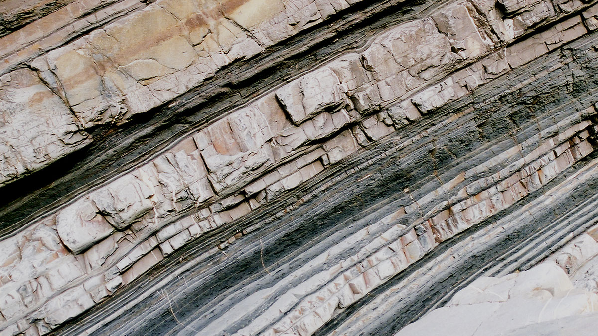
Submarine Avalanche Deposits Hold Clues to Past Earthquakes
Scientists are making progress on illuminating how undersea sedimentary deposits called turbidites form and on reconstructing the complex histories they record. But it’s not an easy task.

Posted inNews
Scientists Quantify Blue Carbon in Bahamas Seagrass
The island nation’s underwater fields store huge reserves of carbon, though not as much as scientists thought.