
Scientists found flurries of seismic activity within weak fault zones in Costa Rica after two giant ruptures elsewhere.
seismology

Posted inNews
Thunderquakes Map the Subsurface
Researchers have figured out how rumbling thunder turns to seismic waves and how this shaking could be used to reveal subsurface geology.

Posted inResearch Spotlights
Subducted Seamounts May Lead to Larger Earthquakes
New findings show that underwater mountains may increase friction along subduction zones, building up stress and making larger ruptures more likely.

Posted inNews
Mars’s Interior May Have an Extra Layer of Molten Rock
New findings suggest that unlike in Earth, the bottom of Mars’s mantle is a sea of molten silicate rock.
Posted inEditors' Highlights
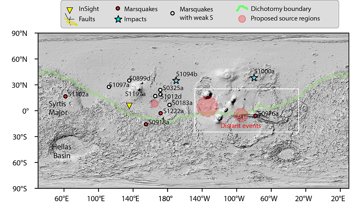
Where the Wild Marsquakes Are
A new analysis of the seismic data gathered by the InSight lander reveals that marsquakes occur across a much larger area of the planet than previously believed.

Posted inEditors' Highlights
Rift-to-Ridge: Mid-Atlantic Ridge Segments Imprinted During Rifting
A new seismic study shows that magmatism along the eastern North American rift margin was segmented, and that rift discontinuities influence formation of fracture zones along the Mid-Atlantic Ridge.

Posted inEditors' Highlights
Illuminating the Complex Structural Fabric Beneath the European Alps
A new study investigates the dynamics of the complex continental collision that formed the European Alps and reveals how structural alignments change with depth.

Posted inEditors' Highlights
Earthquakes Have Preparatory Stage Years Before Rupture
Tidally induced seismicity increased locally before the 2019 Ridgecrest earthquake, suggesting that fault sensitivity to stress increases in the years immediately before large earthquakes.

Posted inResearch Spotlights
Exploring the Mantle Through Microseisms
A new method for examining the tiny vibrations of Earth caused by ocean swells could help reveal details of deep-Earth structure.
Posted inEditors' Highlights
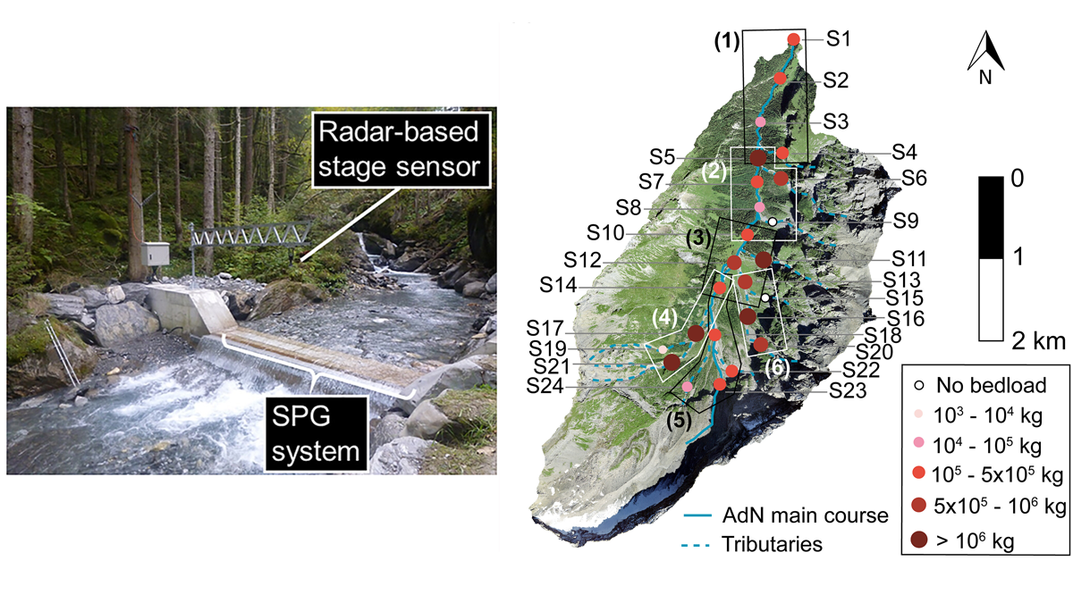
Seismometers Listening at Rivers to Measure Sediment Transport
Bedload sediment, transported throughout an alpine catchment by a flood, was remotely tracked in detail by analyzing the ground vibrations recorded by a network of 24 seismic sensors.