
Distributed acoustic sensing offers a cost-effective alternative to traditional seismic arrays, and building such a network on the Moon might be possible.
seismology
Posted inEditors' Highlights
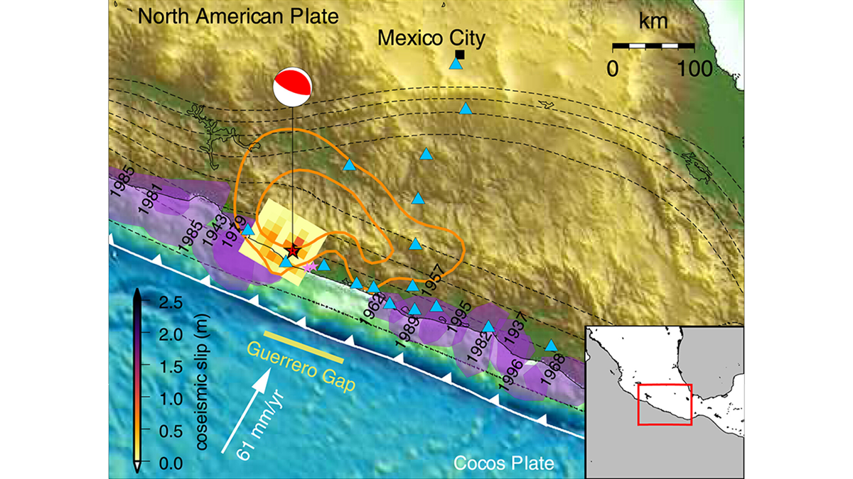
Forecasting Earthquake Ruptures from Slow Slip Evolution
A new generation of physics-based models that integrate temporal slip evolution over decades to seconds opens new possibilities for understanding how large subduction zone earthquakes occur.

Posted inENGAGE, News
No Canadian Volcanoes Meet Monitoring Standards
A new analysis reveals serious monitoring gaps at even the highest-threat volcanoes.

Posted inNews
Scientists Gain a New Tool to Listen for Nuclear Explosions
Mathematics and computer modeling help scientists tell natural earthquakes from nuclear tests.

Posted inEditors' Highlights
How Earthquakes Grow from a Tiny Fracture to a Catastrophic Event
State-of-art numerical simulations illustrate how a small-scale shear instability can become a giant earthquake in a manner that is consistent with seismological observation.
Posted inScience Updates
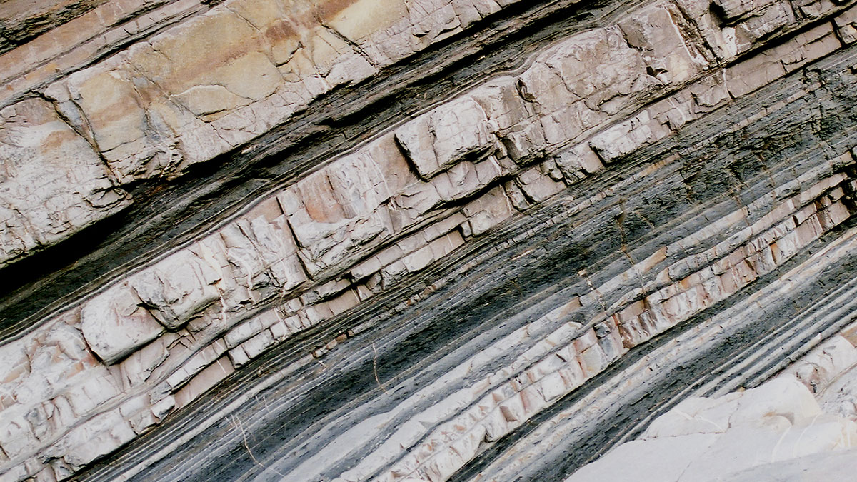
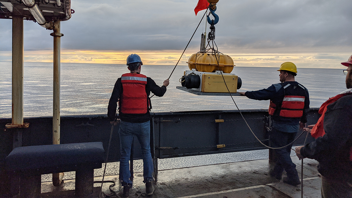
Submarine Avalanche Deposits Hold Clues to Past Earthquakes
Scientists are making progress on illuminating how undersea sedimentary deposits called turbidites form and on reconstructing the complex histories they record. But it’s not an easy task.
Posted inEditors' Highlights
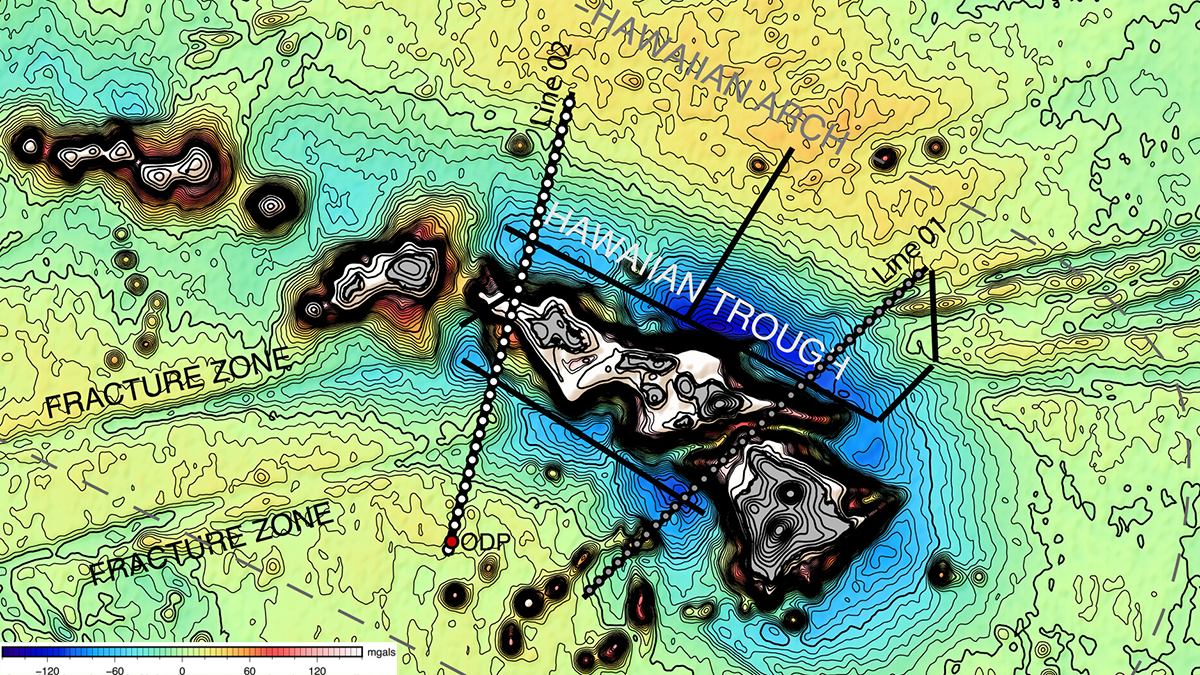
A Strong Pacific Plate Bends Under the Hawaiian Volcanic Chain
Two seismic studies reveal the volcanic loads and resulting flexure of the Pacific plate at the Hawaiian Ridge and, surprisingly, show no magmatic underplating.

Posted inNews
The United States Has an Updated Map of Earthquake Hazards
The new National Seismic Hazard Model shows where damaging earthquakes are likely to occur, informing public safety and infrastructure policies.
Posted inEditors' Vox
The Not-So-Silent Depths
A new book reveals that ocean depths are far from silent voids, but are actually alive with noise.

Posted inResearch Spotlights
Scientists Model What’s Moving Beneath Earth’s Surface
A 3D printed model of a fault served as the setting for a hydrofracturing experiment exploring the mechanisms behind slow earthquakes.