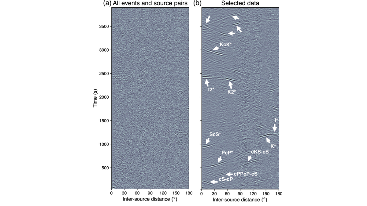
Inter-source correlograms yield coherent signals upon careful consideration of source mechanisms and source-receiver geometry, affording new means of characterizing planetary interiors.
seismology

Posted inEditors' Highlights
Low-Frequency Quakes Have Modest Effect on Slow Earthquake Cycle
Slow slip phenomena on subdaily scales, captured by seismic and GNSS data, show that low-frequency earthquakes are incidental to larger magnitude slow earthquakes, in which aseismic slip dominates.
Posted inNews
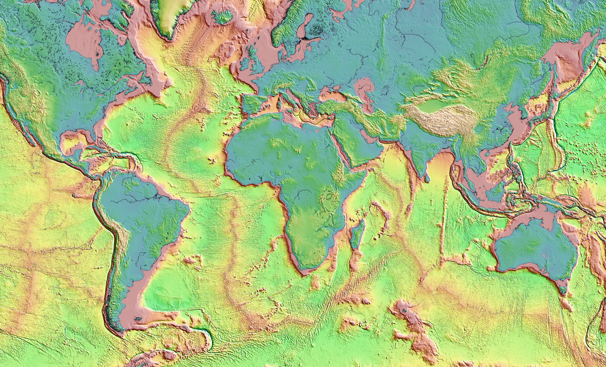
A New, Underground Atlas of Subduction Zones
Submap merges graphic design with geodynamics, providing a fast, free, and user-friendly resource to map subduction zones.

Posted inFeatures
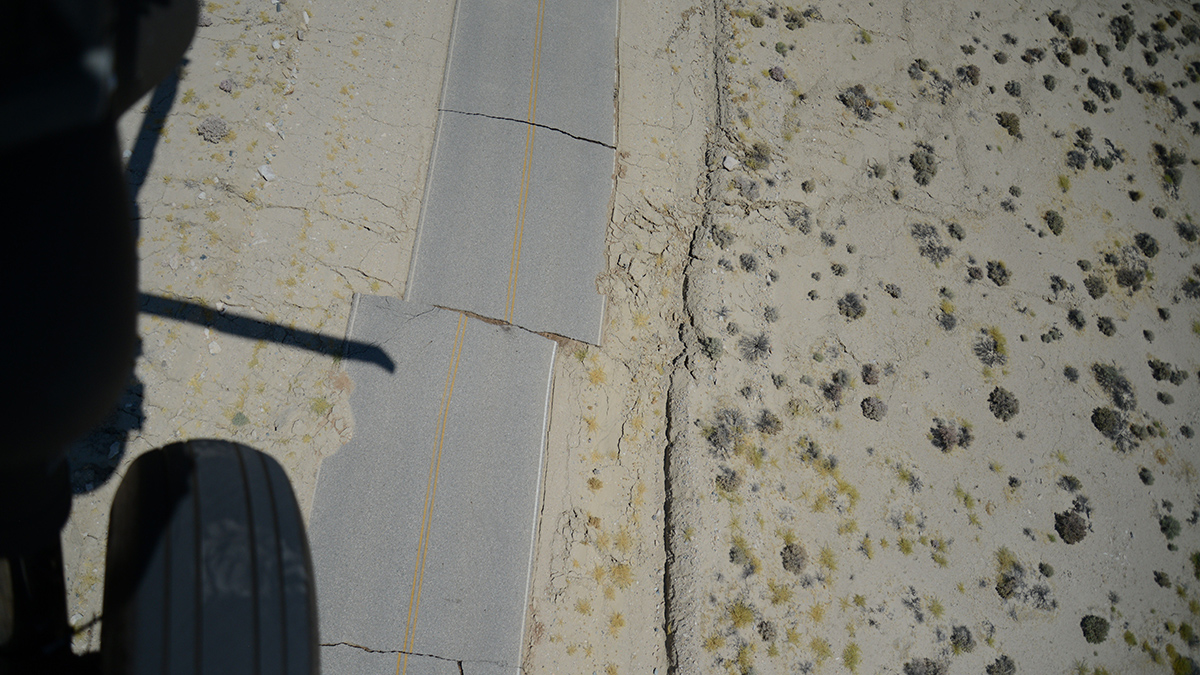
The 2023 Türkiye-Syria Earthquakes Shifted Stress in the Crust
In February, a devastating magnitude 7.8 earthquake struck the eastern Mediterranean, triggering a second major jolt and a cascade of aftershocks.
Posted inNews
Global Earthquake Analysis Seeks Elusive Foreshock Signal
Spotting foreshocks for what they are could help seismologists forecast large earthquakes.
Posted inNews
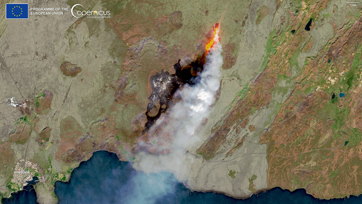
La tercera es la vencida para el Fagradalsfjall de Islandia
La región volcánica que hizo erupción en 2021 y 2022 después de más de 7 siglos de estar dormida, lo está haciendo de nuevo.
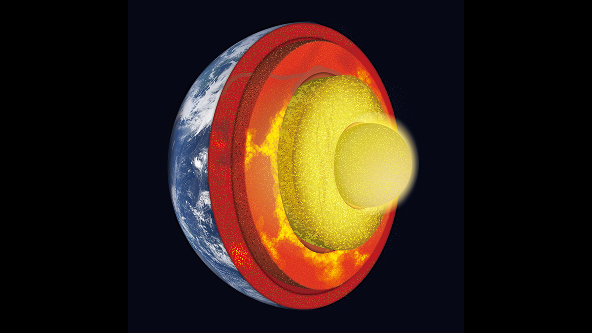
Posted inEditors' Vox
Digging Deep into Interactions Between the Core and Mantle
A new book presents major advances in our understanding of core-mantle interaction and co-evolution, and showcases technological developments improving our insights into deep Earth processes.

Posted inNews
Third Time’s the Charm for Iceland’s Fagradalsfjall
The volcanic region, which erupted in both 2021 and 2022 after more than 7 centuries of dormancy, is at it again.

Posted inEditors' Highlights
A New Workflow to Image the 3D Structure of Active Faults
A new approach to illuminate 3D fault structures using earthquake hypocenters may improve our understanding of earthquake propagation and arrest across step overs.

Posted inNews
Mounds of Ancient Ocean Floor May Be Hiding Deep in Earth
A mysterious seismic feature at the bottom of Earth’s mantle is more widespread than previously thought.