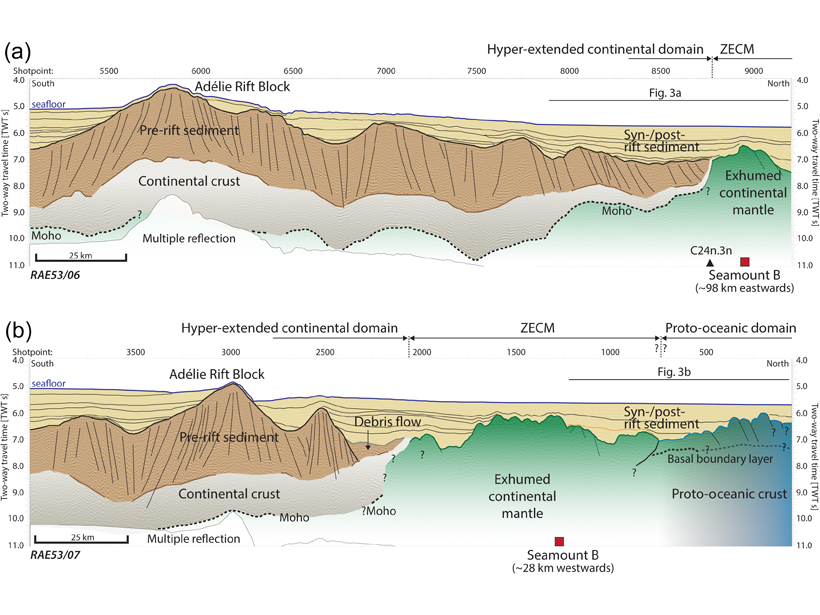
Seismic reflection images combined with petrological data provide new constraints on the nature of the basement in the enigmatic Australia-Antarctic oceanic-continent transition zone.
seismology
Posted inNews
The Seismic Hush of the Coronavirus
Scientists are listening for faint natural signals during the quiet of coronavirus lockdowns.

Posted inNews
Everything’s Coming Up Roses for Pasadena Seismologists
Using fiber-optic cables, a new seismic network charts vibrations associated with the Rose Parade’s massive floats and marching bands.

Posted inNews
Monitoring African Elephants with Raspberry Shake & Boom
A team of researchers has used low-cost devices to record footsteps and vocalizations from African elephants in the field.
Posted inEditors' Highlights
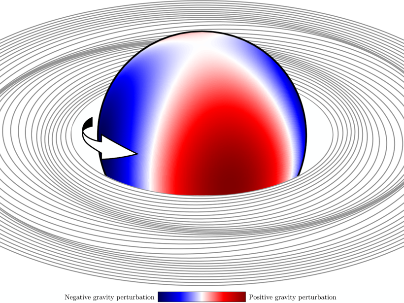
Using Saturn’s Rings as a Seismometer
The Cassini spacecraft observed spiral density waves in the rings of Saturn which can be used to probe its interior structure and rotation.

Posted inEditors' Vox
Imaging Seismic Sources
Waveform‐based location methods are being used to better characterize and understand seismic sources from the laboratory to the global scale.

Posted inENGAGE, News
Bringing Earthquake Education to Schools in Nepal
The Seismology at School in Nepal program aims to prepare rural communities for the next big earthquake.
Posted inResearch Spotlights
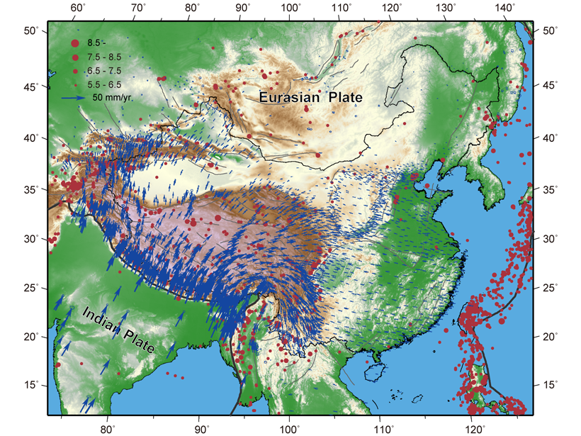
Space-Based Data Expand Understanding of Crustal Deformation
Researchers used the largest GPS data set yet to examine deformation of the crust across continental China and its implications for tectonic activity.
Posted inScience Updates
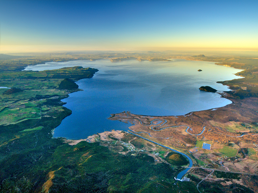
Implications of a Supervolcano’s Seismicity
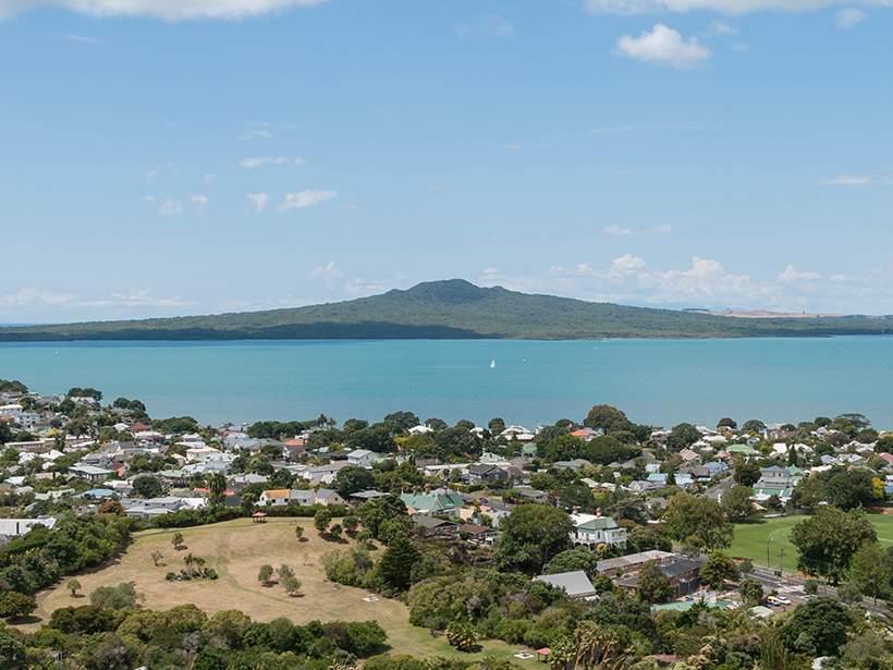
Last year’s rumblings beneath New Zealand’s Taupō supervolcano, the site of Earth’s most recent supereruption, lend new urgency to research and outreach efforts in the region.
Posted inNews
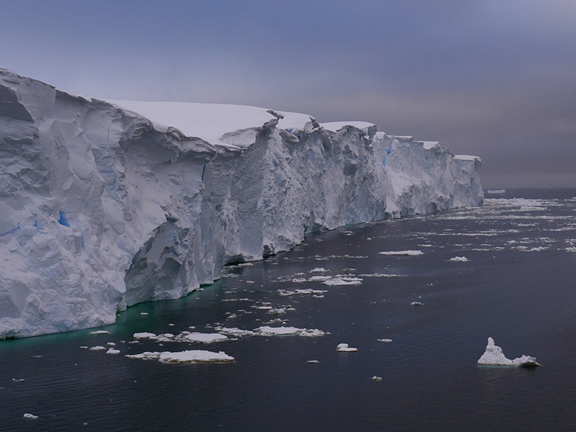
Controlled Explosions Pave the Way for Thwaites Glacier Research
Scientists detonate explosives in West Texas to prepare for fieldwork in West Antarctica.