The first seismic data obtained directly from the Mid-Atlantic Ridge suggest that upwelling may contribute to seafloor spreading.
seismology
Posted inEditors' Highlights
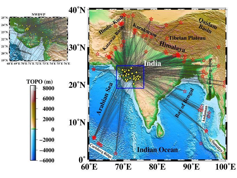
Hunting the Source of Deccan Traps Volcanism Using Seismic Waves
Seismic velocity patterns beneath the Deccan Traps region in western India reveal its volcanic history.
Posted inEditors' Highlights
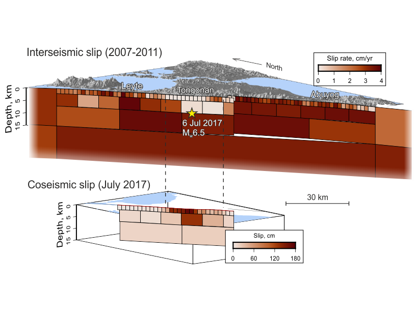
A New Picture of Seismogenesis on the Philippine Fault
Long-time series of satellite observation reveal that the creeping segment of the Philippine Fault is also capable of producing strong earthquakes, and show where these earthquakes might occur.

Posted inNews
Students Monitor Campus Noise in Seismic Silence
Researchers are engaging their students with low-cost seismology research to monitor local noise on campus.

Posted inNews
Geologists to Shed Light on the Mantle with 3D Model
The model, which will incorporate 227 million surface wave measurements, could help with everything from earthquake characterization to neutrino geosciences.

Posted inScience Updates
A Pandemic Pivot in Earth Science Outreach and Education
For some educators, restrictions imposed by COVID-19 created space for innovation and affirmed the value of online tools and learning environments for increasing access to and engagement with science.
Posted inNews
Laike Mariam Asfaw (1945–2020)
An ambassador for African geosciences and for Ethiopia, this celebrated geophysicist will be remembered for his contributions in research as well as his steadfast support of colleagues.

Posted inResearch Spotlights
Southern California’s Crustal Motion Tells of Earthquake Hazards
Precise measurements of the Earth’s vertical surface motion help to elucidate the hazards of faults in an earthquake-prone region.
Posted inAGU News
Ross Receives 2019 Keiiti Aki Early Career Award
Zachary E. Ross received the 2019 Keiiti Aki Early Career Award at AGU’s Fall Meeting 2019, held 9–13 December in San Francisco, Calif. The award recognizes “scientific accomplishments in the field of seismology.”
Posted inNews
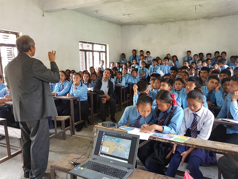
Trayendo la Educación Sobre Terremotos a las Escuelas de Nepal
El programa de Sismología en la Escuela en Nepal, tiene como objetivo preparar a las comunidades rurales para el próximo gran terremoto.