
The SPRUCE ecosystem in northern Minnesota offered a setting to research exactly how a snowy environment responds to rising temperatures.
snow
Posted inNews
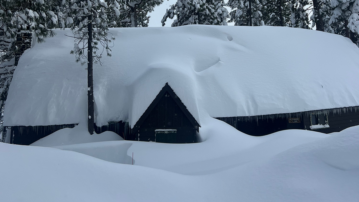
California Mountains Face Weather Whiplash
Last month’s massive snowstorm in the Sierra Nevada followed a dry start to winter. Such extremes in precipitation may become the norm.
Posted inNews
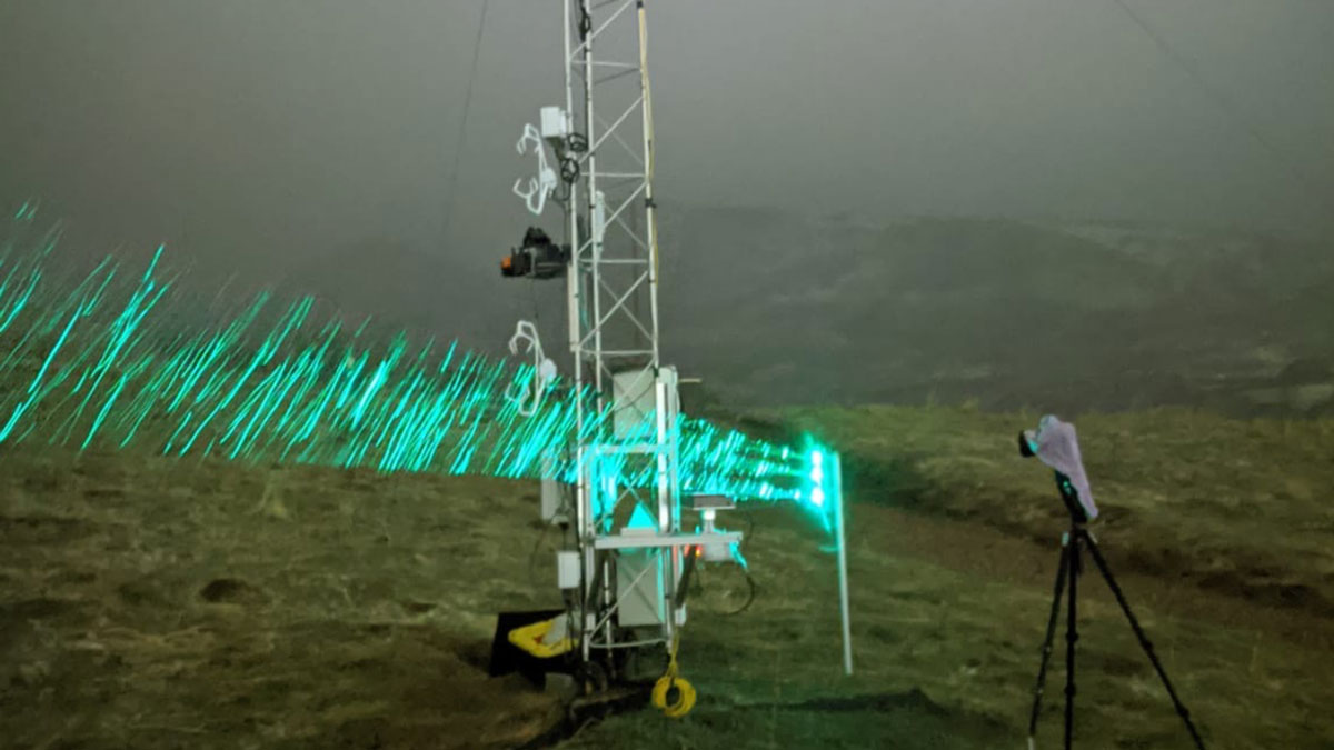
Moving at the Speed of Snow
Snowflakes take many routes from cloud to ground. Large, soft flakes swirl and tumble gently from above. Sharp, painful bits of ice get spit from the sky in a sideways burst. Mushy, wet snow falls in clumps. The ways in which snow travels through the air seem nothing short of complicated. But a new study […]

Posted inNews
Spring Heat Waves Pack a Punch for Snowpacks in the Pacific Northwest
New research shows how the snowpack loss due to moderate springtime heat waves outweighed that of a record-shattering summer heat dome.
Posted inResearch Spotlights
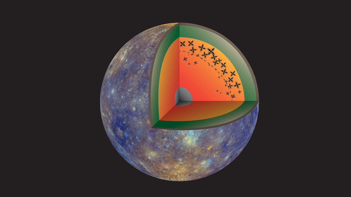
Iron Snow Ebb and Flow May Cause Magnetic Fields to Come and Go
Lab experiments find that iron crystals in planetary cores may form in bursts, causing periodic dynamos.

Posted inNews
Dust Is Melting Snow—And Current Models Can’t Keep Up
Mountain snowpack melts quicker when coated in dust. This cyclical problem is forcing water forecasts to evolve.

Posted inEditors' Highlights
Northern Ecosystems are Shaped by Snow
Changing climate in the Arctic leads to a shorter snow season but deeper snow in the depths of winter. Under the insulating snow, biological processes are accelerated leading to higher nutrient availability and carbon losses.
Posted inEditors' Highlights
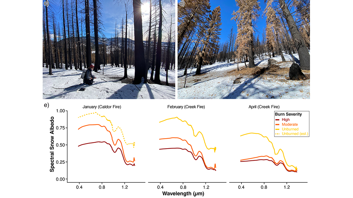
Summer Fire Means Winter Melt
Changing wildfire activity in California may impact seasonal hydrology by causing intense snowmelt during winter in areas where fires extend into higher elevation zones.
Posted inEditors' Highlights
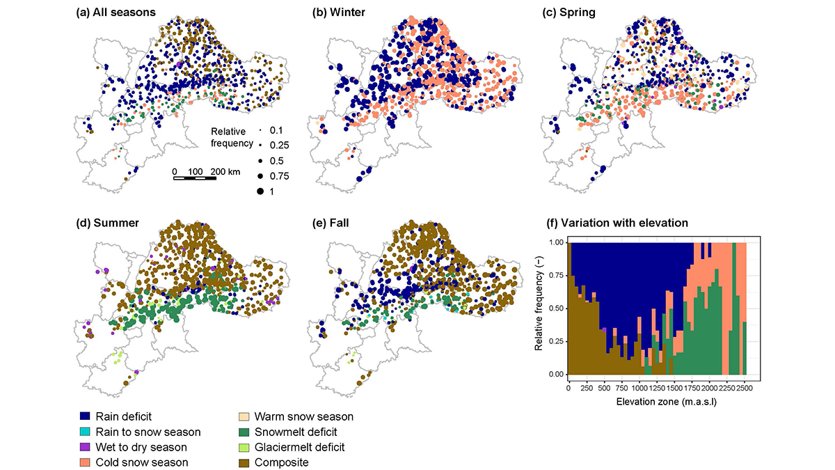
Streamflow Drought Intensification in the European Alps
A five-decade analysis of drought generation processes in the Alps shows their changing seasonality in high-elevation basins with increasingly frequent droughts caused by a lack of snowmelt water.
Posted inEditors' Highlights
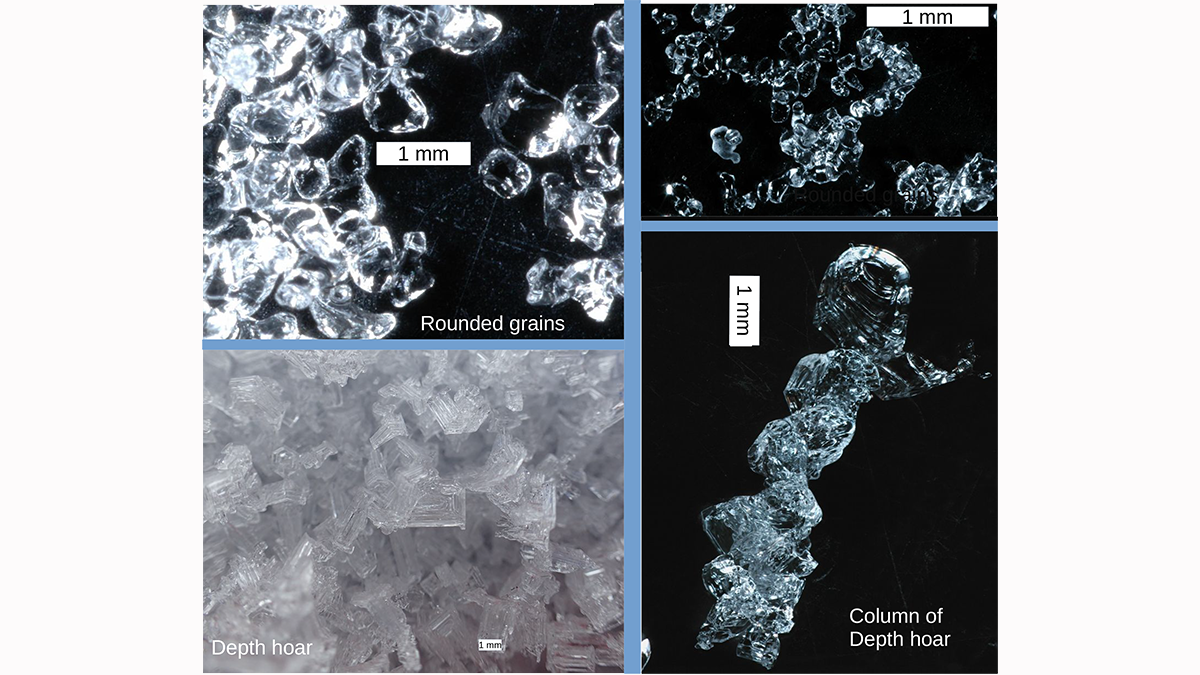
Measuring the Microstructure of Snow from Space
There is more to snow than flakes. Microwave measurements are shown to be capable of illuminating the microstructure of snow in ways that will improve our ability to monitor snow fields from space.