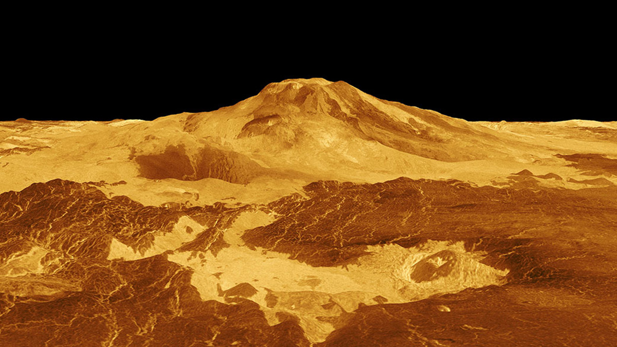
With a new look at old imagery, scientists may have found evidence of volcanic activity on Venus.
apps & software
Posted inNews
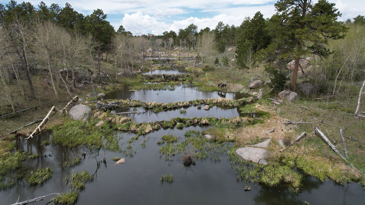
Scientists EEAGER-ly Track Beavers Across Western United States
Efficiently tracking nature’s engineers—beavers—at the scale of entire watersheds over time is now possible, thanks to a new artificial intelligence–trained model called EEAGER.

Posted inFeatures
Are We Entering the Golden Age of Climate Modeling?
Thanks to the advent of exascale computing, local climate forecasts may soon be a reality. And they’re not just for scientists anymore.
Posted inResearch Spotlights
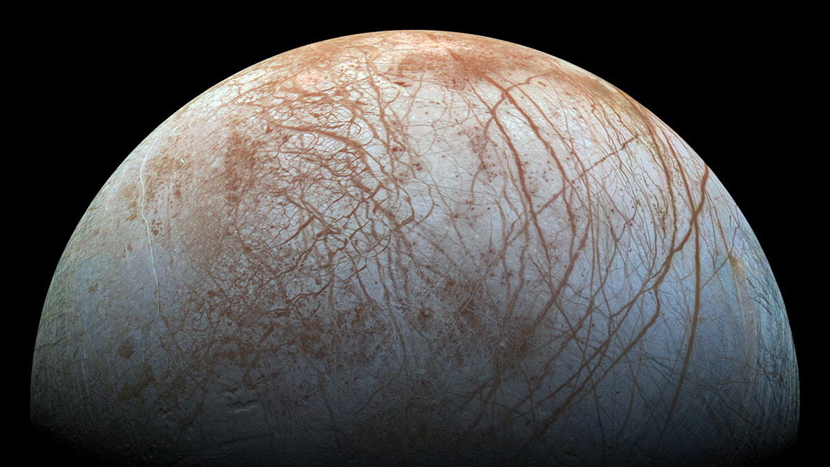
Zipping Up Data to Zap Them Back from an Icy Moon
NASA wants to send instruments to distant moons like Europa and Enceladus to search for life. But getting vital data back to Earth over limited bandwidth will take some impressive compression software.

Posted inNews
Las redes sociales complementan a la ciencia durante los desastres naturales
La información compartida en las plataformas de redes sociales podría ayudar a los científicos a recopilar datos en tiempo real y ayudar a las agencias en los esfuerzos de ayuda.
Posted inNews
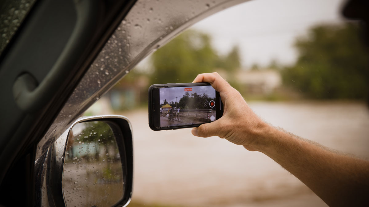
Social Media Supplements Science During Natural Disasters
Information shared on social media platforms could help scientists gather real-time data and assist agencies in relief efforts.

Posted inEditors' Vox
Notebooks Now! Elevating Computational Notebooks
AGU is launching a community-driven effort, funded by the Alfred P. Sloan Foundation, to support computational notebooks as primary research objects in scholarly publications.
Posted inEditors' Highlights
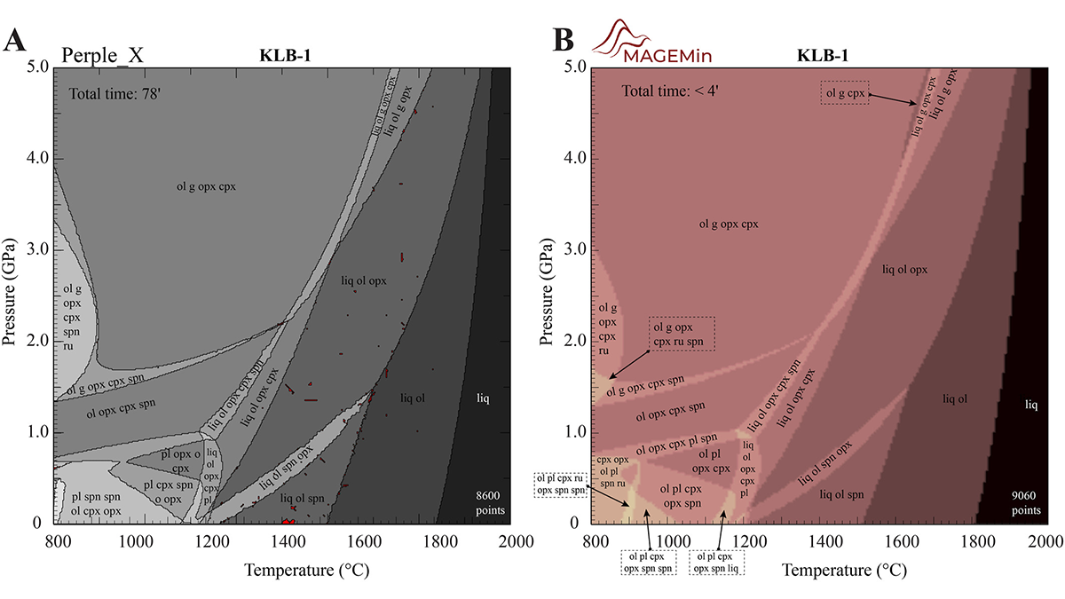
A New, Fast Computational Tool for Magmatic Phase Equilibria
Thermodynamic calculations in multiphase, multicomponent magmatic systems can be slow and buggy. A new parallel architecture solves the free energy minimization problem much faster than alternatives.

Posted inResearch Spotlights
A Simple Model Predicts Household Lead Exposure Risk
Using both sample data and crowdsourced science, a new model effectively identified houses at risk for higher concentrations of lead.
Posted inNews
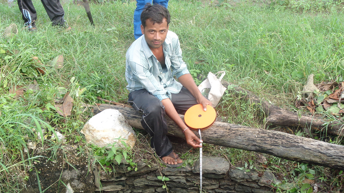
Satellite and on-the-Ground Data Help Monitor Groundwater in India
Village volunteers use remote sensing and manual measurement to help farmers use groundwater more efficiently.