• About
  • Sections
  • Topics
    • Climate
    • Earth Science
    • Oceans
    • Space & Planets
    • Health & Ecosystems
    • Culture & Policy
    • Education & Careers
    • Opinions
  • Projects
    • Postcards From the Field
    • ENGAGE
    • Editors’ Highlights
    • Editors’ Vox
    • Eos en Español
    • Eos 简体中文版
    • Print Archive: 2015–2025
  • Science Policy Tracker
  • Blogs
    • Research & Developments
    • The Landslide Blog
  • Newsletter
  • Submit to Eos
  • AGU.org
  • Career Center
  • Join AGU
  • Give to AGU
  • About
  • Sections
  • Topics
    • Climate
    • Earth Science
    • Oceans
    • Space & Planets
    • Health & Ecosystems
    • Culture & Policy
    • Education & Careers
    • Opinions
  • Projects
    • Postcards From the Field
    • ENGAGE
    • Editors’ Highlights
    • Editors’ Vox
    • Eos en Español
    • Eos 简体中文版
    • Print Archive: 2015–2025
  • Science Policy Tracker
  • Blogs
    • Research & Developments
    • The Landslide Blog
  • Newsletter
  • Submit to Eos
Skip to content
  • AGU.org
  • Career Center
  • Join AGU
  • Give to AGU
Eos

Eos

Science News by AGU

Support Eos
Sign Up for Newsletter
  • About
  • Sections
  • Topics
    • Climate
    • Earth Science
    • Oceans
    • Space & Planets
    • Health & Ecosystems
    • Culture & Policy
    • Education & Careers
    • Opinions
  • Projects
    • Postcards From the Field
    • ENGAGE
    • Editors’ Highlights
    • Editors’ Vox
    • Eos en Español
    • Eos 简体中文版
    • Print Archive: 2015–2025
  • Science Policy Tracker
  • Blogs
    • Research & Developments
    • The Landslide Blog
  • Newsletter
  • Submit to Eos

apps & software

Posted inScience Updates

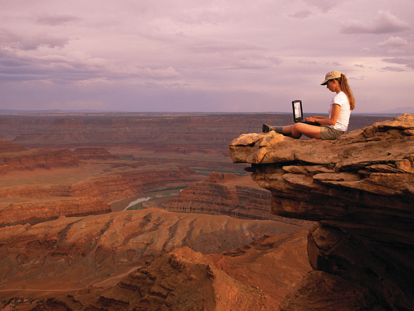
Field Data Management: Integrating Cyberscience and Geoscience

by M. Mookerjee, D. Vieira, M. A. Chan, Y. Gil, T. L. Pavlis, F. S. Spear and B. Tikoff 13 October 201516 February 2023

The smartphone and tablet revolution has changed how geologists work in the field, but now the community must come up with standards to tame the flood of data.

Posted inScience Updates

Puzzles Invite You to Explore Earth with Interactive Imagery

by M. M. Dordevic, D. G. De Paor, S. J. Whitmeyer, C. Bentley, G. R. Whittecar and C. Constants 21 July 20154 November 2022

The EarthQuiz challenge can take you to virtual field locations with just the click of a button. Where in the world is this, and can you guess the significance of the geological features shown?

Posted inScience Updates

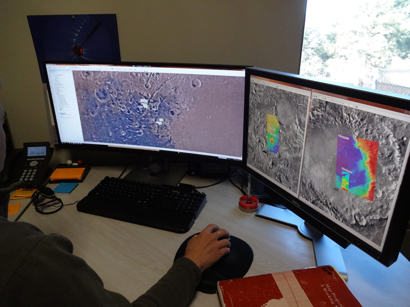
A Suite of Software Analyzes Data on the Sphere

by C. Harig, K. W. Lewis, A. Plattner and F. J. Simons 10 March 201514 January 2022

The software improves data analysis over small portions of a spherical planetary surface. Among other applications, it has helped track Greenland's ice loss over time.

Posted inNews

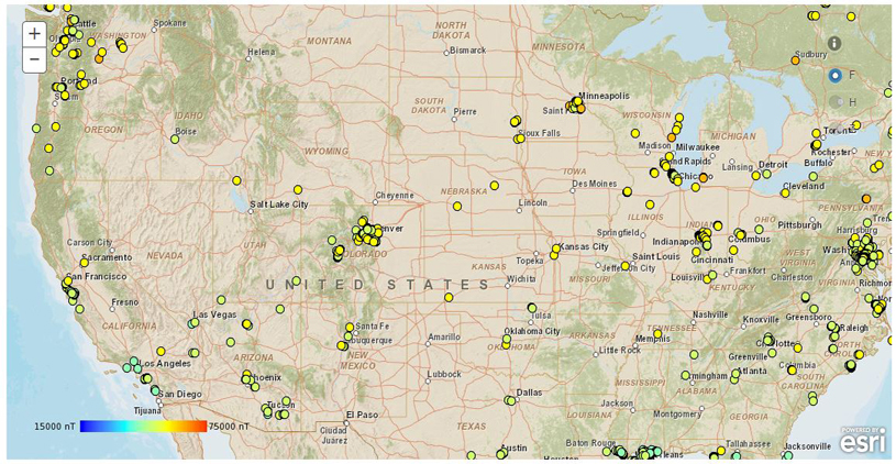
Smartphone App Seeks to Make Navigation Safer

by L. O’Hanlon 6 January 20155 May 2022

The app sends local magnetic field strength along with your phone’s position and orientation to scientists, who use the data to fine-tune magnetic field models.

Posted inScience Updates

Streamlining Field Data Collection with Mobile Apps

by R. J. Camp and J. M. Wheaton 9 December 201413 October 2021

With the availability and affordability of new customized apps on smartphones and tablets, data collected in the field are becoming easier to input, store, and share.

Posted inScience Updates

Visualization and Analysis Tools for Ultrascale Climate Data

by D. N. Williams 21 October 201411 January 2023

The Ultrascale Visualization Climate Data Analysis Tools (UV-CDAT) software project enables climate researchers to solve current and emerging data analysis and visualization challenges.

Posted inOpinions

Resources for Computational Geophysics Courses

by H. Keers, S. Rondenay and Y. Harlap 16 September 201412 January 2022

Lessons from experience with teaching a computational geophysics course.

Posted inOpinions

Computer Programing for Geosciences: Teach Your Students How to Make Tools

by R. Grapenthin 13 December 201110 May 2022

Learning programming skills can help students excel in their geoscience courses.

Posts pagination

Newer posts 1 … 6 7 8
A view of a bridge, with the New Orleans skyline visible in the distance between the bridge and the water. A purple tint, a teal curved line representing a river, and the text “#AGU25 coverage from Eos” overlie the photo.

Features from AGU Publications

Research Spotlights

New River Chemistry Insights May Boost Coastal Ocean Modeling

9 January 20269 January 2026
Editors' Highlights

Central China Water Towers Provide Stable Water Resources Under Change

9 January 20269 January 2026
Editors' Vox

Hydrothermal Circulation and Its Impact on the Earth System

3 December 20253 December 2025
Eos logo at left; AGU logo at right

About Eos
ENGAGE
Awards
Contact

Advertise
Submit
Career Center
Sitemap

© 2026 American Geophysical Union. All rights reserved Powered by Newspack