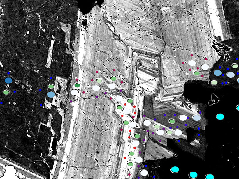
• About
  • Special Reports
  • Topics
    • Climate
    • Earth Science
    • Oceans
    • Space & Planets
    • Health & Ecosystems
    • Culture & Policy
    • Education & Careers
    • Opinions
  • Projects
    • Postcards From the Field
    • ENGAGE
    • Editors’ Highlights
    • Editors’ Vox
    • Eos en Español
    • Eos 简体中文版
    • Print Archive: 2015–2025
  • Policy Tracker
  • Blogs
    • Research & Developments
    • The Landslide Blog
  • Newsletter
  • Submit to Eos
  • AGU.org
  • Career Center
  • Join AGU
  • Give to AGU
  • About
  • Special Reports
  • Topics
    • Climate
    • Earth Science
    • Oceans
    • Space & Planets
    • Health & Ecosystems
    • Culture & Policy
    • Education & Careers
    • Opinions
  • Projects
    • Postcards From the Field
    • ENGAGE
    • Editors’ Highlights
    • Editors’ Vox
    • Eos en Español
    • Eos 简体中文版
    • Print Archive: 2015–2025
  • Policy Tracker
  • Blogs
    • Research & Developments
    • The Landslide Blog
  • Newsletter
  • Submit to Eos
Skip to content
  • AGU.org
  • Career Center
  • Join AGU
  • Give to AGU
Eos

Eos

Science News by AGU

Support Eos
Sign Up for Newsletter
  • About
  • Special Reports
  • Topics
    • Climate
    • Earth Science
    • Oceans
    • Space & Planets
    • Health & Ecosystems
    • Culture & Policy
    • Education & Careers
    • Opinions
  • Projects
    • Postcards From the Field
    • ENGAGE
    • Editors’ Highlights
    • Editors’ Vox
    • Eos en Español
    • Eos 简体中文版
    • Print Archive: 2015–2025
  • Policy Tracker
  • Blogs
    • Research & Developments
    • The Landslide Blog
  • Newsletter
  • Submit to Eos

apps & software

Citizen scientists can use smartphone apps to collect hydrological information from the streams they encounter.
Posted inScience Updates

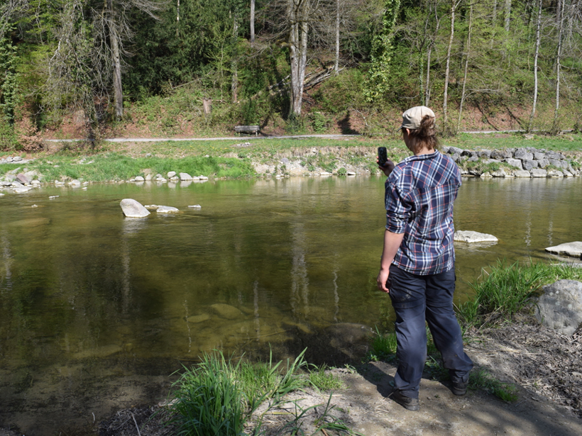
Testing the Waters: Mobile Apps for Crowdsourced Streamflow Data

by S. Kampf, B. Strobl, J. Hammond, A. Anenberg, S. Etter, C. Martin, K. Puntenney-Desmond, J. Seibert and Ilja van Meerveld 12 April 20189 February 2023

Citizen scientists keep a watchful eye on the world’s streams, catching intermittent streams in action and filling data gaps to construct a more complete hydrologic picture.

Posted inResearch Spotlights

Managing Radio Traffic Jams with the Cloud

by E. Underwood 7 February 201818 October 2022

Sensor networks and data mining allow for fully automated, real-time monitoring of radio waves.

Posted inEditors' Highlights

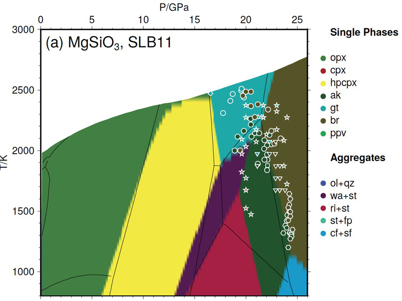
New Thermodynamic Model for Computing Mantle Mineralogy

by M. Walter 16 January 20184 August 2023

A newly developed open-access software package called MMA-EoS can calculate whole mantle mineralogy in multicomponent systems by Gibbs energy minimization.

A new educational resource helps students explore the interactions between power generation systems and water resources.
Posted inScience Updates

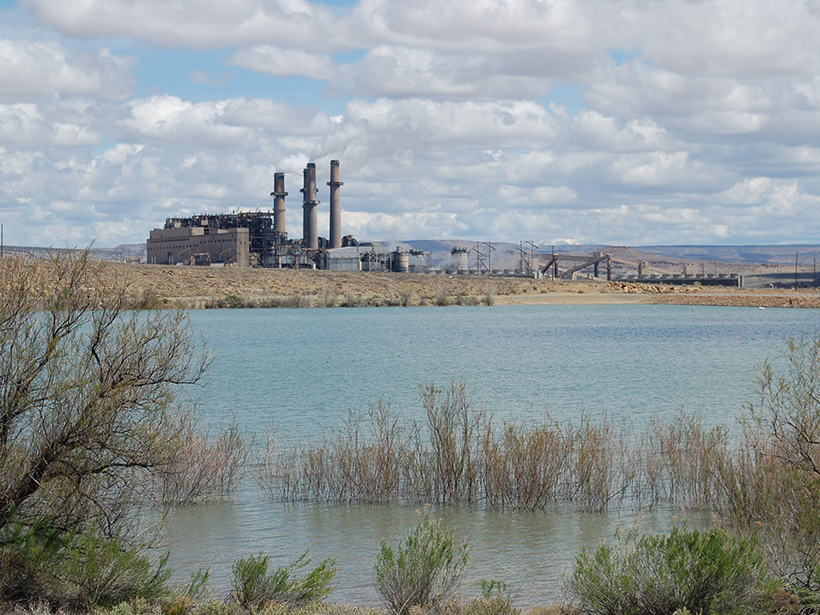
New Online Tool Teaches Students About the Energy-Water Nexus

by E. Habib, H. Eldardiry and V. C. Tidwell 31 October 201716 February 2023

Students use real data sets to explore how population changes, power generation, and water-saving strategies affect surface and groundwater use.

New software may be an important new tool for better ice sheet modeling
Posted inResearch Spotlights

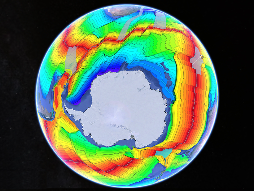
Open-Source Tool Aims to Boost Confidence in Ice Sheet Models

Sarah Stanley, Science Writer by Sarah Stanley 5 October 201724 May 2022

The software could help strengthen ice sheet models to provide a better basis for policy decisions.

GeoDeepDive helps geoscientists efficiently discover and leverage the hard-earned data locked in the scientific literature.
Posted inScience Updates

A New Tool for Deep-Down Data Mining

by S. E. Peters, I. Ross, J. Czaplewski, A. Glassel, J. Husson, V. Syverson, A. Zaffos and M. Livny 22 September 20175 May 2022

GeoDeepDive combines library science, computer science, and geoscience to dive into repositories of published text, tables, and figures and return valuable information.

Posted inEditors' Vox

Annotation Tool Facilitates Peer Review

by Brooks Hanson, J. Panning, R. Townsend and Paige Wooden 14 September 201728 September 2023

AGU journals will incorporate open source software to facilitate dialog among reviewers, editors and authors during peer review.

Google Earth image displays data overlays showing ages of the ocean floor, together with tectonic plate boundaries.
Posted inScience Updates

A Grand Tour of the Ocean Basins

by D. G. De Paor 1 September 20174 November 2022

A new teaching resource facilitates plate tectonic studies using a Google Earth virtual guided tour of ocean basins around the world.

Giovanni time-averaged satellite map of the March aerosol optical thickness off the coast of western Africa from 2003 to 2016
Posted inScience Updates

Giovanni: The Bridge Between Data and Science

by Z. Liu and J. Acker 24 August 201716 February 2023

Using satellite remote sensing data sets can be a daunting task. Giovanni, a Web-based tool, facilitates access, visualization, and exploration for many of NASA’s Earth science data sets.

Researchers demonstrate how two popular software packages can be used together for better efficiency
Posted inResearch Spotlights

A Powerful New Tool for Research

by Terri Cook 17 July 201722 August 2022

A novel interface allows users of MATLAB and GMT, two software packages widely used by the geoscience community, to simultaneously harness the capabilities of both products.

Posts pagination

Newer posts 1 … 4 5 6 7 8 Older posts
Over a dark blue-green square appear the words Special Report: The State of the Science 1 Year On.

Features from AGU Publications

Research Spotlights

How Internal Waves Transport Energy Thousands of Miles Across the Ocean

26 March 202626 March 2026
Editors' Highlights

Harnessing Subseasonal-to-Seasonal Predictability from Annual Evolution

31 March 202626 March 2026
Editors' Vox

The Future of Earth’s Future

24 March 202624 March 2026
Eos logo at left; AGU logo at right

About Eos
ENGAGE
Awards
Contact

Advertise
Submit
Career Center
Sitemap

© 2026 American Geophysical Union. All rights reserved Powered by Newspack