
If we can overcome its pitfalls, AI holds promise for improving trust in climate science and activating a largely disengaged public, with meaningful consequences for health and well-being globally.
apps & software
Posted inNews
A New, Underground Atlas of Subduction Zones
Submap merges graphic design with geodynamics, providing a fast, free, and user-friendly resource to map subduction zones.

Posted inScience Updates
A Holistic Approach to Hydropower Data
A new online platform offers comprehensive data and tools about U.S. hydropower assets, enabling data-driven decisionmaking at the energy–water nexus.

Posted inFeatures
Cee Nell: Making Data Visual
Nell turns vast columns of data into beautiful and understandable graphics.

Posted inFeatures
The Art of Scientific Curation
Scientific content curation provides users across diverse disciplines and levels of experience with a valuable means of accessing relevant and reliable information amid the growing data landscape.

Posted inOpinions
We Need a Better Way to Share Earth Observations
A more accessible, open data-sharing infrastructure will engage a broader community of contributors, helping to develop satellite data products that benefit Earth science research and applications.

Posted inNews
Felt Reports Could Shake Up Earthquake Response
Firsthand accounts of earthquake impacts could aid in identifying people who require help as well as increasing safety in some areas.
Posted inNews
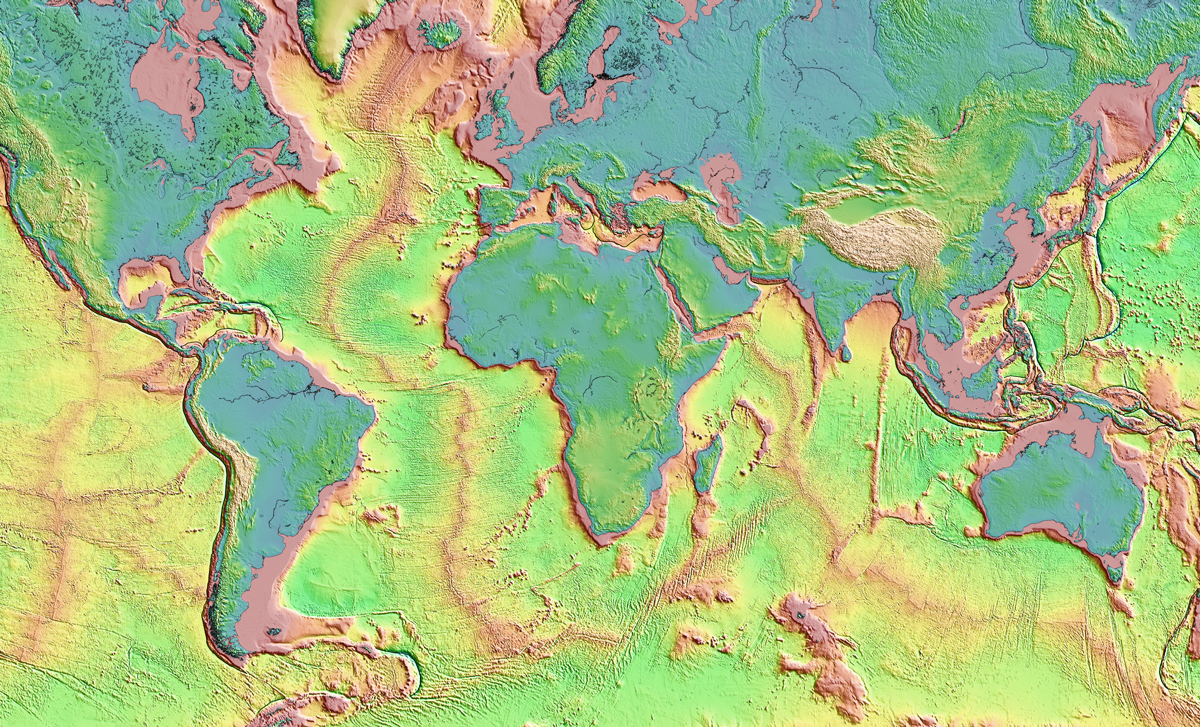
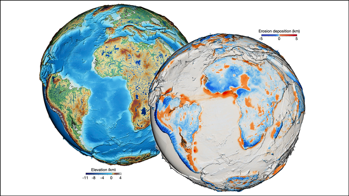
One Surface Model to Rule Them All?
For the first time, scientists have forged a nearly all-encompassing model of Earth’s surface evolution over the past 100 million years.

Posted inFeatures
Deluges of Data Are Changing Astronomical Science
Astronomers today are more likely than ever to access data from an archive rather than travel to a telescope—a shift that’s democratizing science.

Posted inAGU News
Your Databases Need a Reboot
Scientists are reassessing dated data in the time of the Cloud.