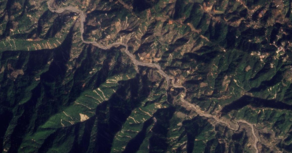
Between 4 and 6 August 2023, intense rainfall triggered at least 346 landslides in the area around Ho Bon commune in Mu Cang Chai district, Yen Bai province in Vietnam I have written frequently on this blog about clusters of rainfall-induced landslides. Another really interesting example has been highlighted in a paper (Toan et al. […]
Southeast Asia
Posted inThe Landslide Blog
Bukit Mantri: a mine waste facility failure in Malaysia
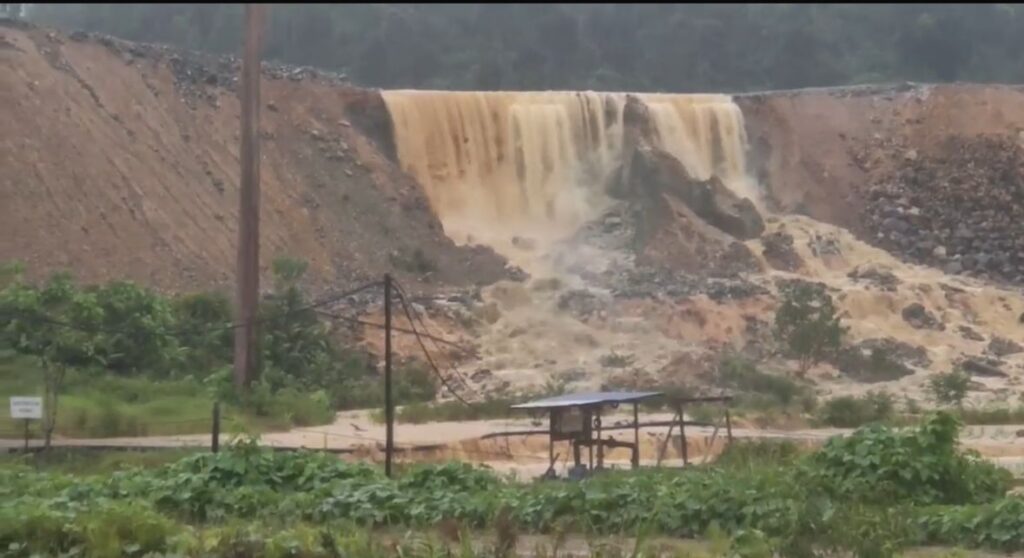
On 17 May 2025, a failure occurred in a mine waste facility at the Tawau gold mine in Malaysia. Images suggest that this might have been an overtopping event in a contaminated water storage pond. On 17 May 2025, there was a failure of a mine waste storage facility at Bukit Mantri in Malaysia. The […]
Posted inThe Landslide Blog
The 30 May 2025 landslide at Gunung Kuda in Cipanas Village, West Java, Indonesia
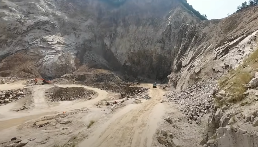
The Landslide Blog is written by Dave Petley, who is widely recognized as a world leader in the study and management of landslides. On 30 May 2025, a rock slope major failure occurred at a quarry at Gunung Kuda, which is located on the edge of Cipanas Village in Dukupuntang District, Cirebon Regency, West Java, […]
Posted inThe Landslide Blog
Continued uncertainty, but very real concerns, about mining related landslides in Marowali, Indonesia
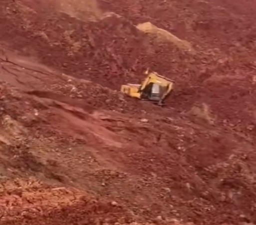
The Landslide Blog is written by Dave Petley, who is widely recognized as a world leader in the study and management of landslides. There are some reports today that another mining related landslide occurred in the Morowali area of Indonesia yesterday. There are few details in media reports, but videos have been posted that appear […]

Posted inEditors' Highlights
Peatland Plantations in Southeast Asia are Carbon Hotspots
A new study reports a rare set of data on greenhouse gas production and transport for a tropical peatland plantation showing exceptionally high concentrations of dissolved organic carbon.

Posted inEditors' Vox
Asian Megadeltas: Tackling Coastal Flooding Challenges
Integrating scientific insights into current actions is crucial for steering future research directions and underpinning informed management of coastal flooding in Asian deltas.
Posted inThe Landslide Blog
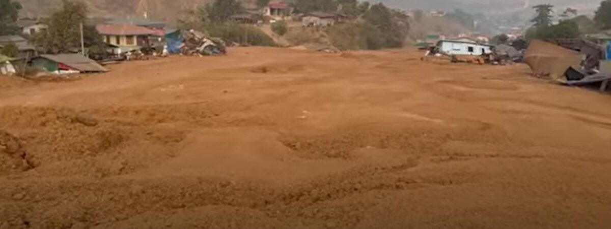
Another tailings landslide in Hpakant, Myanmar
The Landslide Blog is written by Dave Petley, who is widely recognized as a world leader in the study and management of landslides. Landslides in the jade mining area of Hpakant in Myanmar have been a regular theme of this blog over the years. This is a mining area on an epic scale, but it […]

Posted inThe Landslide Blog
The 23 August 2024 landslide at Nakkerd Hill, Phuket
The Landslide Blog is written by Dave Petley, who is widely recognized as a world leader in the study and management of landslides. On 23 August 2024, heavy rainfall triggered a landslide at Nakkerd Hill (also known as Nak Koet hill) in the Mueng distruct of Phuket, Thailand. The landslide was a channelised debris flow […]
Posted inThe Landslide Blog
A major landslide disaster has occurred in Myanmar, triggered by Typhoon Yagi
The Landslide Blog is written by Dave Petley, who is widely recognized as a world leader in the study and management of landslides. On 10 to 13 September 2024, the remnants of Typhoon Yagi swept across Thailand and Myanmar, bringing exceptional rainfall. Obtaining accurate information about the impacts of such events in Myanmar is extremely […]

Posted inThe Landslide Blog
Landslide problems on roads in Vietnam
The Landslide Blog is written by Dave Petley, who is widely recognized as a world leader in the study and management of landslides. On 13 July 2024, a terrible landslide occurred on a road in the mountainous province of Ha Giang in Vietnam. A minibus travelling along a road in Bac Me District at 4 […]