
As the ocean becomes increasingly inhospitable for corals, researchers in the Coral Triangle are turning to cryopreservation to freeze, thaw, and save the region’s hundreds of coral species.
Southeast Asia
Posted inThe Landslide Blog
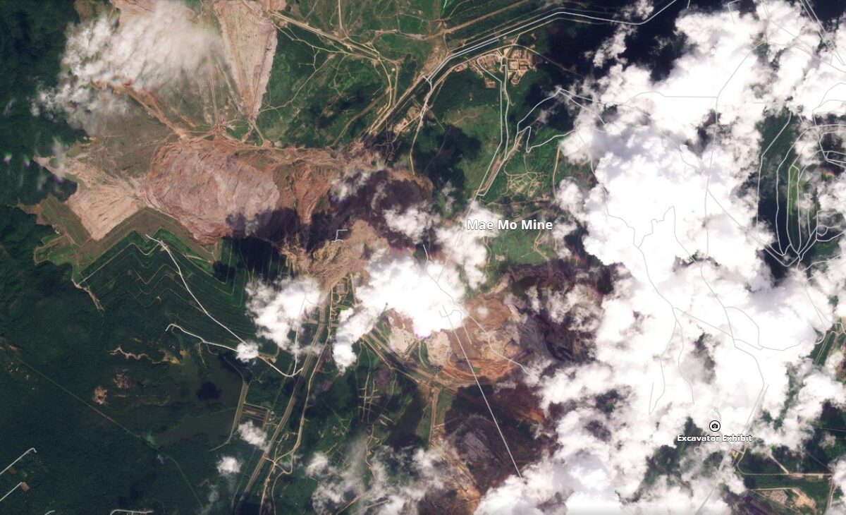
Full Planet imagery of the 4 November 2025 landslide at Mae Moh Mine in Thailand
Over the weekend, Planet captured near-perfect images of the Mae Moh Mine landslide in Thailand. Last week, I posted a set of Planet satellite images that captured most of the 4 November 2025 landslide at Mae Moh Mine in Thailand. However, there was considerable cloud in the imagery, which prevented a full understanding of the […]
Posted inThe Landslide Blog
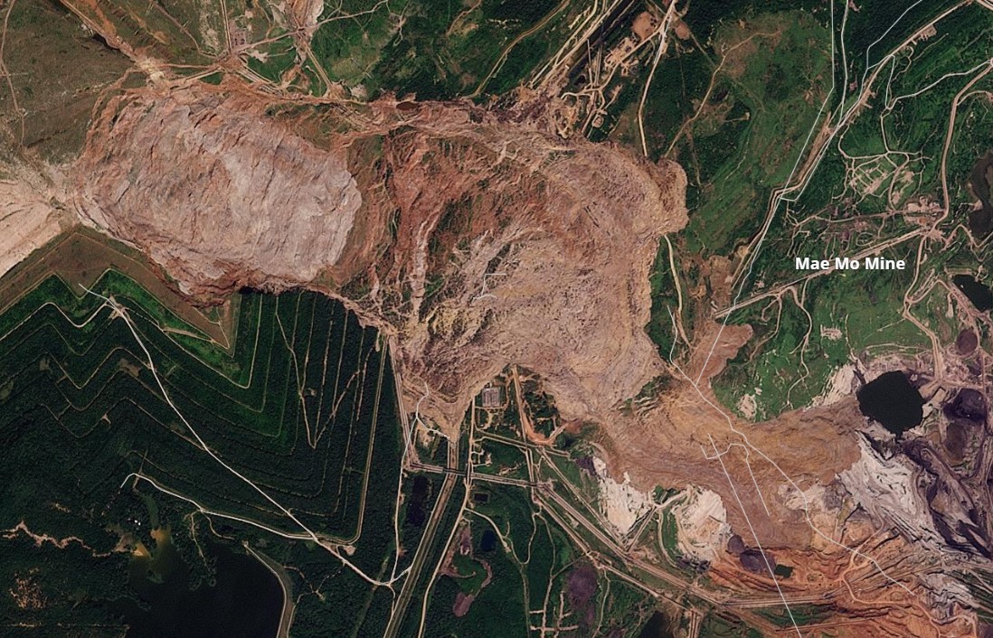
Planet imagery of the 4 November 2025 landslide at Mae Moh Mine in Thailand
Planet imagery shows the massive coal waste landslide at Mae Moh Mine. The failure was about 4.8 km long and 1.4 km wide As I noted in an earlier post on this blog, at about 4 am on 4 November 2025, a very large landslide occurred in a coal waste pile at the Mae Moh […]
Posted inThe Landslide Blog
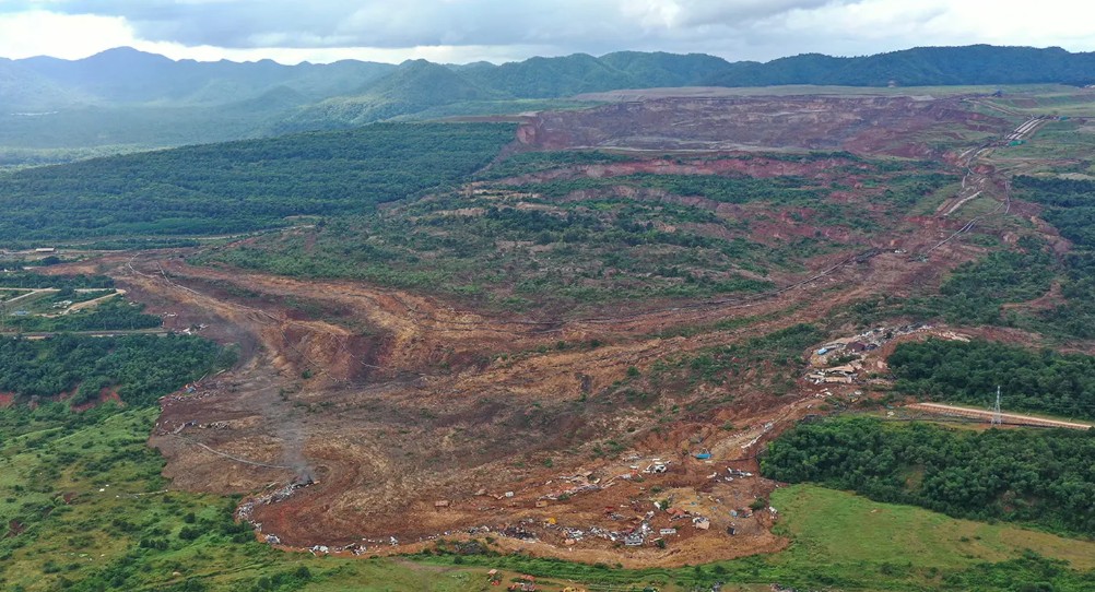
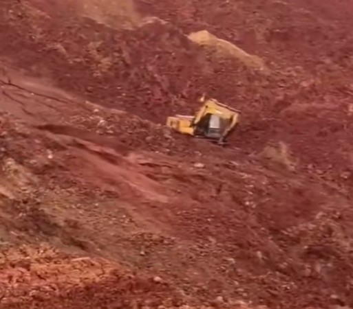
The 4 November 2025 landslide at Mae Moh Mine in Thailand
A landslide in coal waste covering about a square kilometre was triggered by heavy rainfall. At about 4 am on 4 November 2025, a very large landslide occurred in a coal waste pile at the Mae Moh Mine in Thailand. This is an extremely large coal mining site that is co-located with electricity generating plants. […]
Posted inThe Landslide Blog
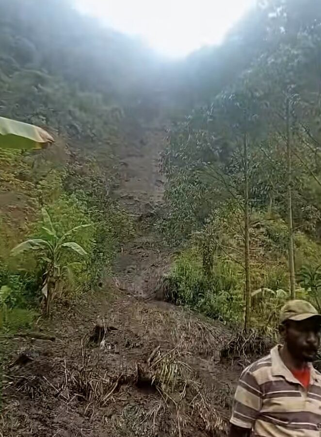
The 31 October 2025 landslide at Kukas in Enga Province, Papua New Guinea
An early morning landslide, triggered by heavy rainfall, killed at least 22 people in rural PNG. At about 2 am on 31 October 2025, a landslide struck a rural community at Kukas in Enga Province, Papua New Guinea. News reports suggest that it was triggered by heavy rainfall and that 22 bodies have been recovered […]
Posted inThe Landslide Blog
The 22 November 1815 Gejer Bali disaster
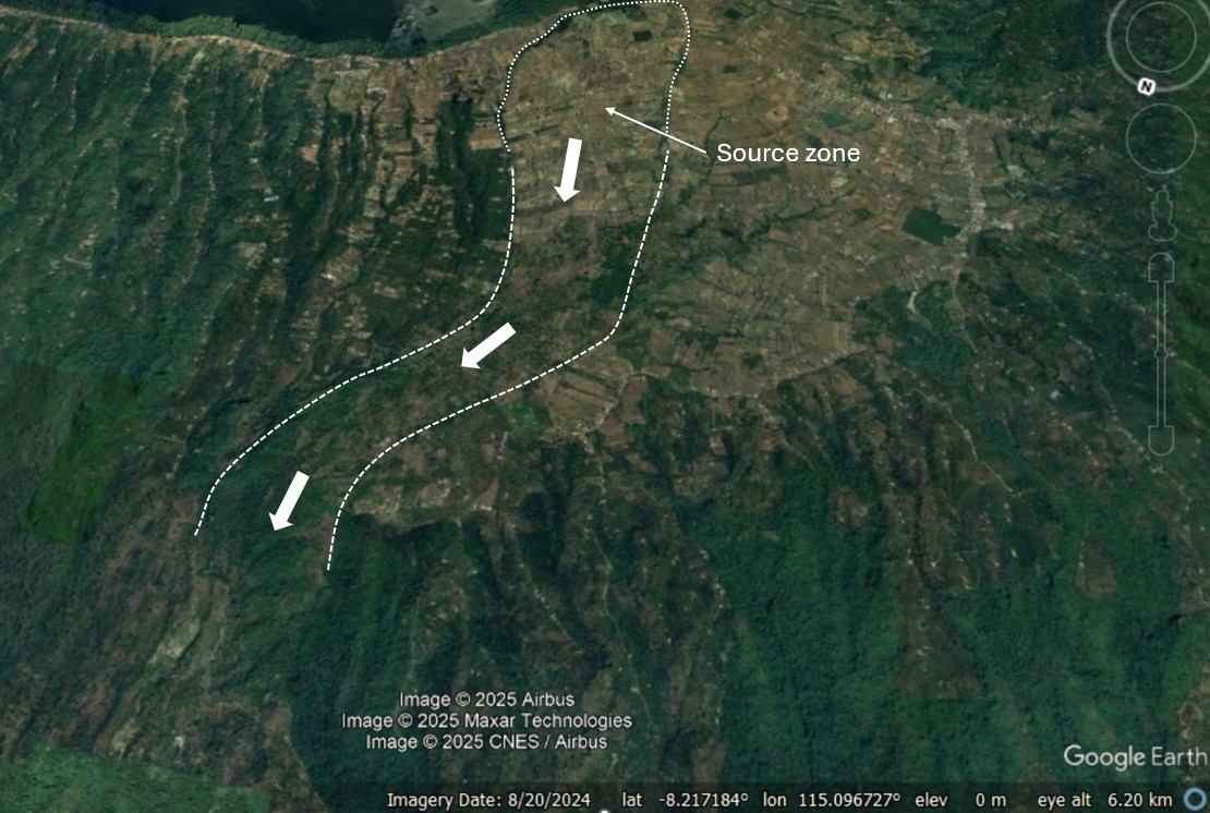
A new paper (Faral et al. 2025) provides details of a seismically-triggered landslide cascade and tsunami that killed up to 12,000 people. On 22 November 1815, a very significant landslide disaster occurred in Bali, in what is now Indonesia, killing between 10,000 and 12,000 people. A very interesting new paper (Faral et al. 2025) in […]
Posted inThe Landslide Blog
Multiple rainfall-triggered landslides in Ho Bon commune Vietnam in August 2023
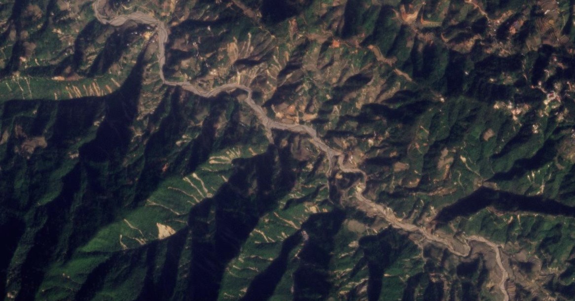
Between 4 and 6 August 2023, intense rainfall triggered at least 346 landslides in the area around Ho Bon commune in Mu Cang Chai district, Yen Bai province in Vietnam I have written frequently on this blog about clusters of rainfall-induced landslides. Another really interesting example has been highlighted in a paper (Toan et al. […]
Posted inThe Landslide Blog
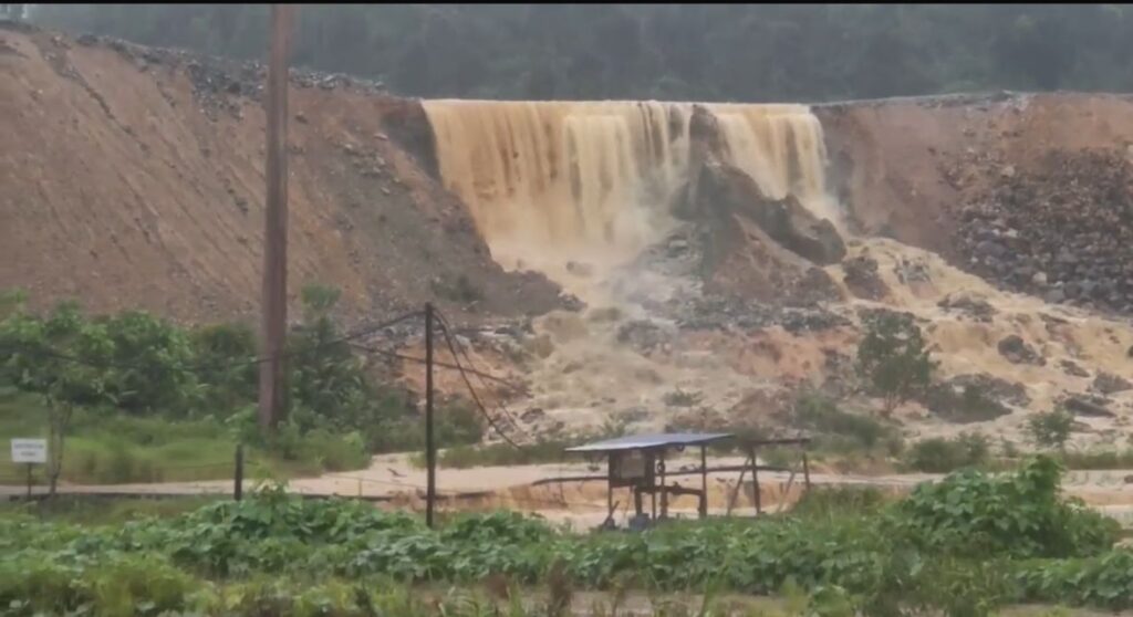
Bukit Mantri: a mine waste facility failure in Malaysia
On 17 May 2025, a failure occurred in a mine waste facility at the Tawau gold mine in Malaysia. Images suggest that this might have been an overtopping event in a contaminated water storage pond. On 17 May 2025, there was a failure of a mine waste storage facility at Bukit Mantri in Malaysia. The […]
Posted inThe Landslide Blog
The 30 May 2025 landslide at Gunung Kuda in Cipanas Village, West Java, Indonesia
The Landslide Blog is written by Dave Petley, who is widely recognized as a world leader in the study and management of landslides. On 30 May 2025, a rock slope major failure occurred at a quarry at Gunung Kuda, which is located on the edge of Cipanas Village in Dukupuntang District, Cirebon Regency, West Java, […]
Posted inThe Landslide Blog
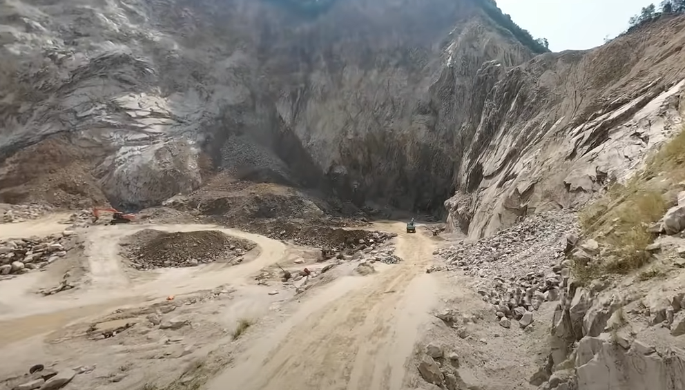
Continued uncertainty, but very real concerns, about mining related landslides in Marowali, Indonesia
The Landslide Blog is written by Dave Petley, who is widely recognized as a world leader in the study and management of landslides. There are some reports today that another mining related landslide occurred in the Morowali area of Indonesia yesterday. There are few details in media reports, but videos have been posted that appear […]