
Production of the weak, water-bearing mineral at the interface between the Cocos and North American Plates could contribute to the occurrence of poorly understood episodic tremor and slow slip.
subduction

Posted inNews
Mounds of Ancient Ocean Floor May Be Hiding Deep in Earth
A mysterious seismic feature at the bottom of Earth’s mantle is more widespread than previously thought.
Posted inEditors' Highlights
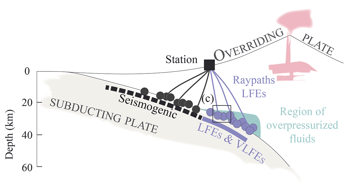
Are Low-Frequency Earthquakes Just Slow Slip?
Tests of seismic attenuation show fluid saturation and high pressure near a seismic source reduce high-frequency content, challenging the idea of slow slip as the cause of low-frequency earthquakes.

Posted inEditors' Highlights
Bio-Argo Floats Reveal Phytoplankton Increase at Ocean Fronts
Bio-Argo floats and satellite altimeter data reveal that upwelling caused by confluent flow on the warm side of ocean fronts increases phytoplankton carbon and chlorophyll.

Posted inEditors' Highlights
Topography Along the Apennines Reflects Subduction Dynamics
Topography and exhumation vary strongly along the Apennines, reflecting the geometry of the Moho and different geodynamic mechanisms.
Posted inEditors' Highlights
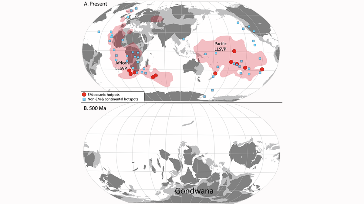
The Crust Travels to the Earth’s Core and Back in Record Time
Subduction of continental crust around the Gondwana supercontinent may explain the mantle Dupal anomaly of the southern hemisphere.

Posted inEditors' Highlights
Tracing Oxidizing Slab Fluids in Cold Volcanic Arcs
Elevated copper isotope ratios in arc magmas from fluid-rich cold subduction zones support the role of oxidizing fluids from the subducted lithospheric serpentinite in the oxidization of arc magmas.


Posted inEditors' Vox
Old Igneous Rocks Hold the Key to Crustal Thickness Evolution
The chemical composition of orogenic igneous rocks and their zircons is sensitive to crustal thickness and can be used to quantify the evolution of Moho depths beneath continents back in time.

Posted inResearch Spotlights
Months of Gravity Changes Preceded the Tōhoku Earthquake
Using GRACE satellite data, researchers discovered anomalous gravimetric signals that occurred before a seismic event that started deep within Earth.