
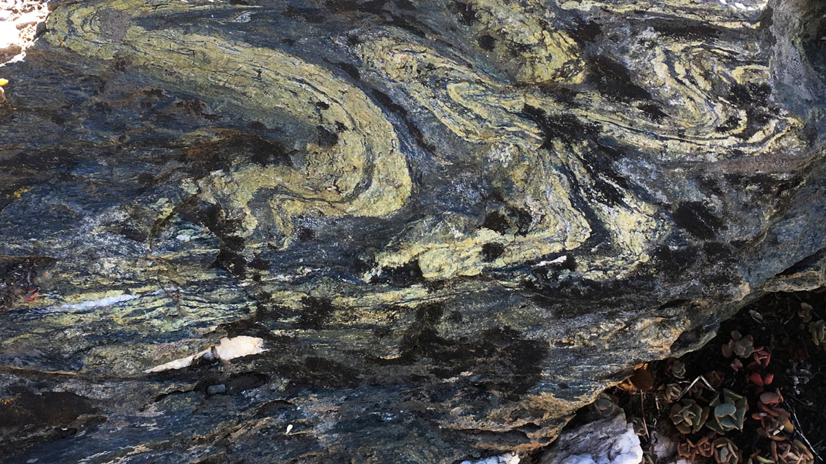
The emplacement of the Samail Ophiolite in Oman has been a source of disagreement among geologists. New state-of-the-art research offers a fresh perspective on its timing and geometry.
subduction
Posted inResearch Spotlights
Unearthing the Cause of Slow Seismic Waves in Subduction Zones
Researchers look to the fossil rock record to unearth the driving forces for variable seismic speed through subduction zones.

Posted inEditors' Highlights
Subduction Zone Earthquakes: Fast and Slow, Weak and Strong
What causes slow earthquakes in subduction zones? New insights from numerical models suggest that a mixture of strong and weak rocks might be the cause.

Posted inScience Updates
Swipe Left on the “Big One”: Better Dates for Cascadia Quakes
Improving our understanding of hazards posed by future large earthquakes on the Cascadia Subduction Zone requires advancements in the methods and sampling used to date and characterize past events.


Posted inEditors' Highlights
The Highs and the Lows of Megathrust Earthquakes
Why does low-frequency energy come from the shallow part of ruptures, and the high frequencies from deep?
Posted inEditors' Highlights
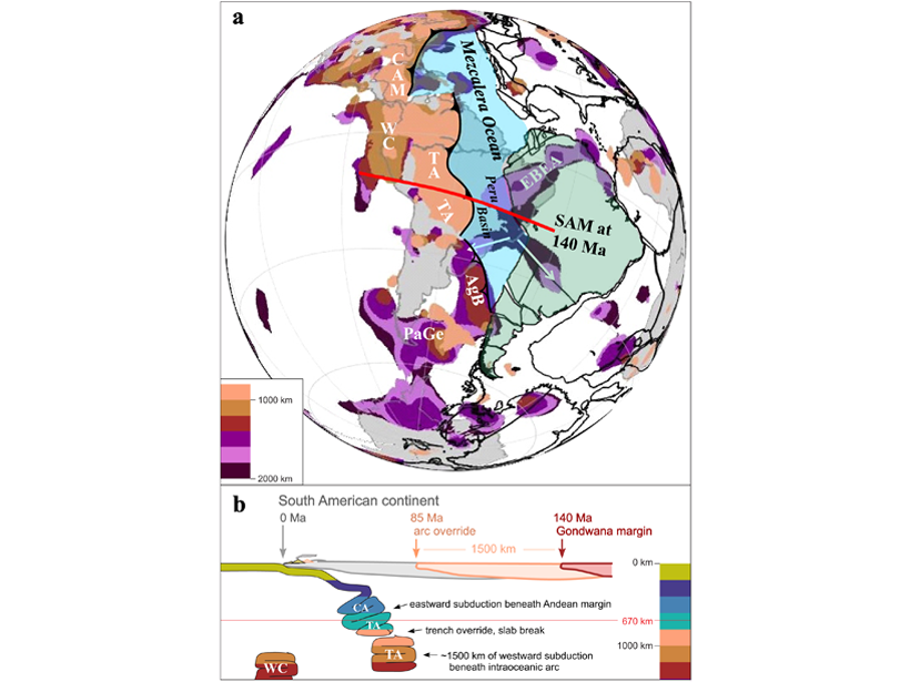
Previous Intra-oceanic Subduction Found Beneath South America?
Newly mapped fast velocity slabs in the lower mantle may be remnants of westward dipping intra-oceanic subduction, before flipping to the present eastward subduction beneath South America at 85 Ma.

Posted inResearch Spotlights
Subduction Initiation May Depend on a Tectonic Plate’s History
New seismic imaging study of the Puysegur Trench aims to solve one of the last major questions in plate tectonics.
Posted inEditors' Highlights
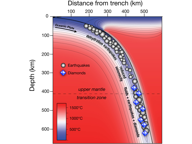
Diamonds Are at Fault
Deep-seated earthquakes in subduction zones are related to diamond formation.
Posted inEditors' Highlights
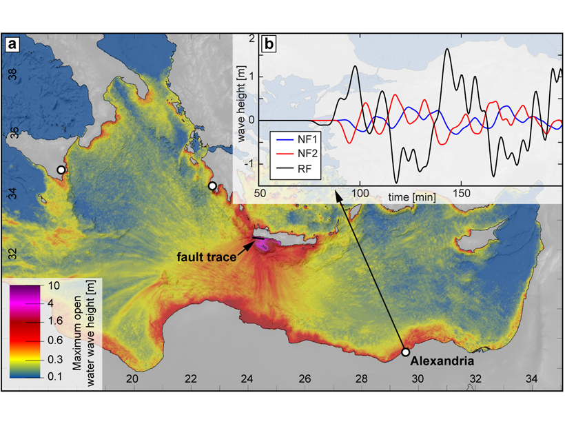
Was the AD 365 Mediterranean Earthquake Normal?
The great AD 365 earthquake at Crete has implied a locked Hellenic subduction zone that can produce more earthquakes to threaten Mediterranean coastlines. But what if wasn’t a subduction zone event?