
How do greenhouse gases and water circulate from minerals deep below Earth’s surface into the atmosphere and oceans—and then back again? Our understanding continues to evolve.
subduction

Posted inResearch Spotlights
An Innovative Approach for Investigating Subduction Slip Budgets
A new 3D model offers a state-of-the-art look at the full spectrum of slip behaviors in the Nankai subduction zone off Japan.
Posted inResearch Spotlights
Subduction May Recycle Less Water Than Thought
A new analysis of seismic data from the Middle America Trench suggests that previous calculations have vastly overestimated the total amount of water transported to the mantle worldwide.

Posted inScience Updates
Using Earthquake Forensics to Study Subduction from Space
Researchers combined satellite geodetic measurements of surface motion with a new geophysical data inversion method to probe the Chilean subduction zone in the wake of the 2010 Maule earthquake.
Posted inEditors' Highlights
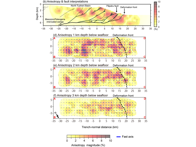
Fault Related Anisotropy in the Hikurangi Subduction Zone
A new study provides the first high-resolution three-dimensional anisotropic P-wave velocity model of the shallow part of the Northern Hikurangi subduction zone offshore New Zealand.

Posted inScience Updates
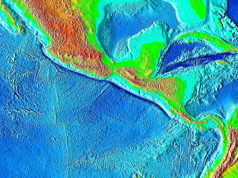
By Land or Sea: How Did Mammals Get to the Caribbean Islands?
A multidisciplinary team is jointly investigating mammal evolution and subduction dynamics to unravel how flightless land mammals migrated to the Greater Antilles and other Caribbean islands.
Posted inNews
What Controls Giant Subduction Earthquakes?
Subduction zones with a low dipping angle and thick sediments can produce giant earthquakes; this finding lets researchers estimate worst-case scenarios for coastlines around the world.
Posted inEditors' Highlights
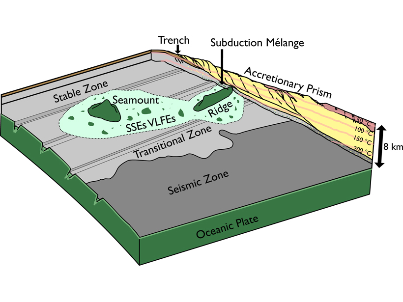
A Mechanism for Shallow, Slow Earthquakes in Subduction Zones
Slow earthquakes beneath the accretionary prism updip from the locked portion of a subduction zone can be caused by basaltic blocks embedded in a shale matrix.
Posted inEditors' Highlights
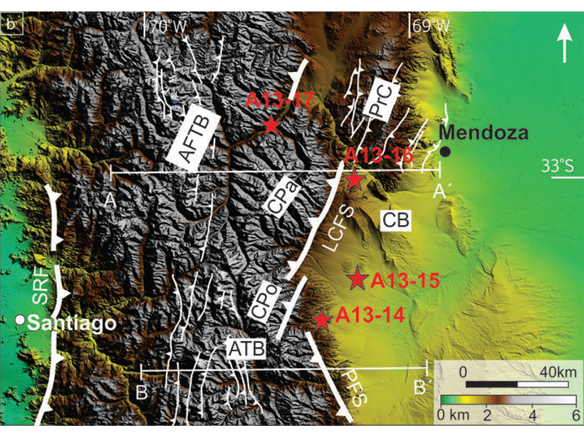
What Controlled the Growth of the Southern Central Andes?
Flat-slab subduction appears to have played a minor role in the growth of the Southern Central Andes, with evidence for eastward migrating deformation.

Posted inResearch Spotlights
Land Motion Offers Insights into Cascadia Earthquake Cycle
Comparing recent GPS data with a longer record of sea level along the western coast of North America allows researchers to home in on interseismic deformation above the Cascadia megathrust.