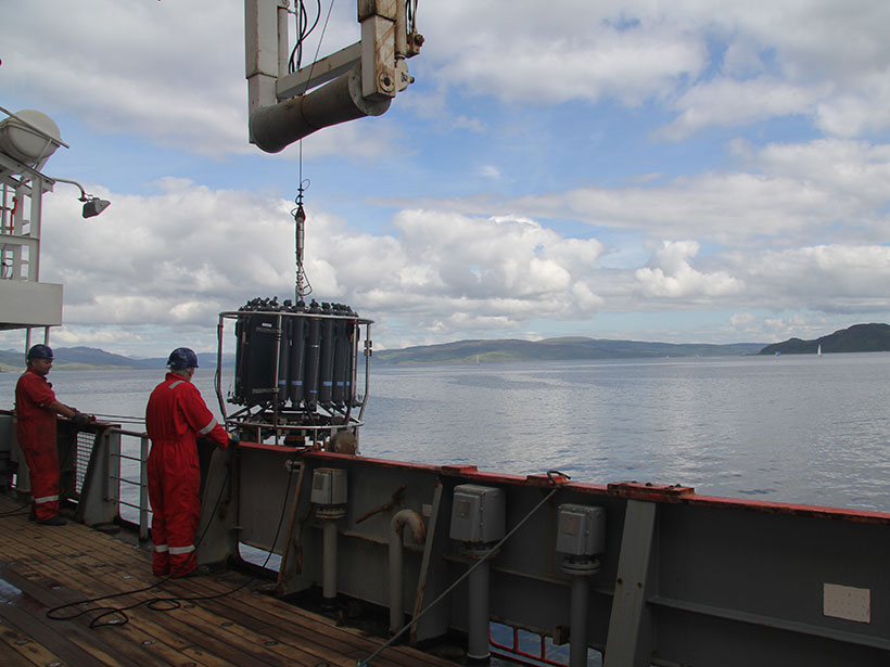
Continental shelves and estuaries are natural sources of nitrous oxide, but current global estimates of these emissions carry a lot of uncertainty, a problem that calls for regional studies.
wetlands

Posted inFeatures
Lost in the Everglades
Living in Geologic Time: An unintentional adventure in the River of Grass shows how Florida has changed dramatically over 15,000 years of human habitation.

Posted inNews
Coastal Wetlands Save $1.8 Million per Year for Each Square Kilometer
The protective value of a plot of wetlands varies widely based on the county it shields from storm-related property damage.

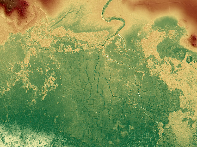
Posted inEditors' Highlights
Representing Estuaries and Braided Rivers as Channel Networks
The human eye is quite good at identifying channel networks among the rich patterns exhibited by estuaries and braided rivers, but computers have a harder time doing so. Could they do better?
Posted inNews
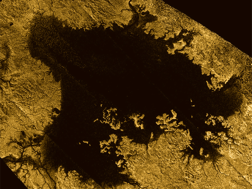
Scientists Search for Deltas on Saturn’s Largest Moon
Saturn’s moon Titan has rivers that empty into seas…but where are the deltas?

Posted inResearch Spotlights
Improving Estimates of Coastal Carbon Sequestration
A new two-model approach could reduce uncertainties in calculated rates of “blue carbon” accumulation within soils of seagrass, tidal marsh, and mangrove habitats.

Posted inNews
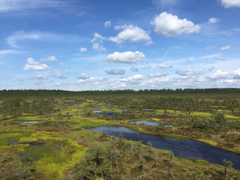
Peatlands Are Drying Out Across Europe
Peatlands are some of the world’s largest reservoirs of soil carbon, but new research finds that in Europe they are drying out, putting them at risk of turning from carbon sinks to carbon sources.
Posted inNews
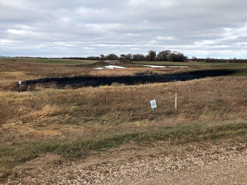
Keystone Pipeline Spills 9,120 Barrels of Oil in Dakota Wetlands
The leak took place along a preexisting section of the Keystone Pipeline. This is the pipeline’s fourth spill in 9 years.
Posted inNews
Resilient Peatlands Keep Carbon Bogged Down
Boreal peatlands contain some of the world’s largest reservoirs of soil carbon, and new research suggests some peatlands may hold on to that carbon even as the climate changes.
Posted inNews
Ancient Maya Farms Revealed by Laser Scanning
One agricultural network was 5 times larger than earlier estimates, and the fields may be an early source of human-caused greenhouse gas emissions.