Surface water bodies are critical freshwater resources for both human and ecological systems. They are also an essential part of the water cycle. Remote sensing technology allows us to detect their existence, assess their extent, and monitor their dynamics. A review article recently published in Reviews of Geophysics discusses recent progresses in this area. Here, one of the authors some questions about research has improved our understanding and where further efforts are still needed.
How do satellite-based instruments detect surface water?
Sensors onboard satellites use electromagnetic radiation as the information carrier to record, observe and perceive target objects on Earth. Electromagnetic radiation is a form of energy with the properties of a wave.

Depending on how the energy is used and detected, remote sensing can be divided into two categories.
Active remote sensing is when sensors emit signals and receive the reflection of ground objects.
Passive remote sensing is when sensors directly receive the reflection of sunlight from the Earth’s surface.
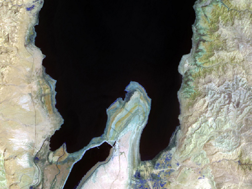
Surface water bodies usually appear very dark on remotely sensed images.
This is because they absorb most of the energy, especially those in infrared wavelength. Therefore, it is their characteristics of very low reflectance that makes water bodies detectable by satellite-based instruments.
What different types of surface water can be measured and monitored?
Theoretically, all types of open surface water bodies can be measured and monitored as long as they can be captured by the remote sensors. The four common types are lakes, reservoirs, rivers and wetlands.

Lakes and reservoirs play an essential role in regional water balance. Water volume variation of lakes and reservoirs can be estimated by measuring the water area change and water level dynamics from space.
Monitoring river water is important for water resources management and flood studies. It has been proven that river discharge could be estimated through remote sensing techniques, which would greatly facilitate hydrological studies.
Monitoring water in also wetlands is of great significance because inundation is a key factor for the survival of the flora and fauna there. However, water bodies underneath vegetation coverage are not easy to detect due to the obscuration of the vegetation. Further studies are expected in this field.
For surface water, how accurate are remotely-sensed measurements and what are their limitations?
There are two major factors that affect the accuracy of surface water detection. The first factor is the spatial resolution of remotely sensed data. This is the minimum unit or size on the ground that can be distinguished on the remote sensing image. Higher resolution data are generally more accurate for surface water detection but they usually have limitations, such as small coverage or low temporal resolution.
The second factor is water body extraction algorithms. These aim to widen the difference between water pixels and non-water pixels for more accurate detection. However, no matter how algorithms are improved, misclassification of water pixels would inevitably exist that affects the accuracy of surface water measurements.
Another serious limitation for optical sensors is cloud coverage because it blocks most of the sunlight reflection. Therefore, water bodies under cloud coverage cannot be detected correctly by optical sensors.
How have technologies and techniques improved over the last decade?
The last decade has been a golden period for remote sensing applications… Improvements have been made to both instruments and methodologies
The last decade has been a golden period for remote sensing applications, including those in surface water monitoring. Improvements have been made to both instruments and methodologies.
Many satellite missions carrying a variety of advanced sensors have been launched in recent years, and these have greatly enriched the data available to scientists.
These include satellites in the Joint Polar Satellite System (JPSS), Gaofen satellite series in the China High-resolution Earth Observation System (CHEOS), the Sentinel missions in the Copernicus programme, and Cubesat Constellations of Planet Labs.
Numerous algorithms have been used to extract data about surface water bodies from them. A series of automatic extraction methods have been developed for effectively identifying water bodies from image time series. Improvements regarding to the fusion of multi-source data, as well as the processing of large volume data for high resolution global water monitoring, have also been achieved.
What are some of the unresolved questions where additional research, data or modeling is needed?
Water volume cannot be measured directly from the space. The current solution is to integrate remotely sensed water extent with water level estimated from satellite altimetry. However, this integration is usually unsatisfied due to the inconsistency of two different data sources. The Surface Water and Ocean Topography (SWOT) mission, planned to be launched in 2021, intends to provide a major improvement in the availability of surface extent and storage change for surface water bodies such as lakes, reservoirs, wetlands, and rivers globally. With SWOT data, water volume, or river discharge can be easily estimated.
More and more remote sensing data are becoming available nowadays, but different data have their pros and cons. Data fusion models are going to be developed and applied to integrate multiple remote sensing data sources for enhanced water observations. For example, monitoring water dynamics at both high spatial and high temporal resolutions can be achieved through spatio-temporal fusion of different data. Extracting water bodies underneath vegetation coverage can be implemented through blending optical data with radar data or terrain information. There are very exciting times ahead in our field of science!
—Chang Huang, Northwest University, Xi’an, China; email: [email protected]
Citation:
Huang, C. (2018), Seeing surface water from space, Eos, 99, https://doi.org/10.1029/2018EO103123. Published on 01 August 2018.
Text © 2018. The authors. CC BY-NC-ND 3.0
Except where otherwise noted, images are subject to copyright. Any reuse without express permission from the copyright owner is prohibited.