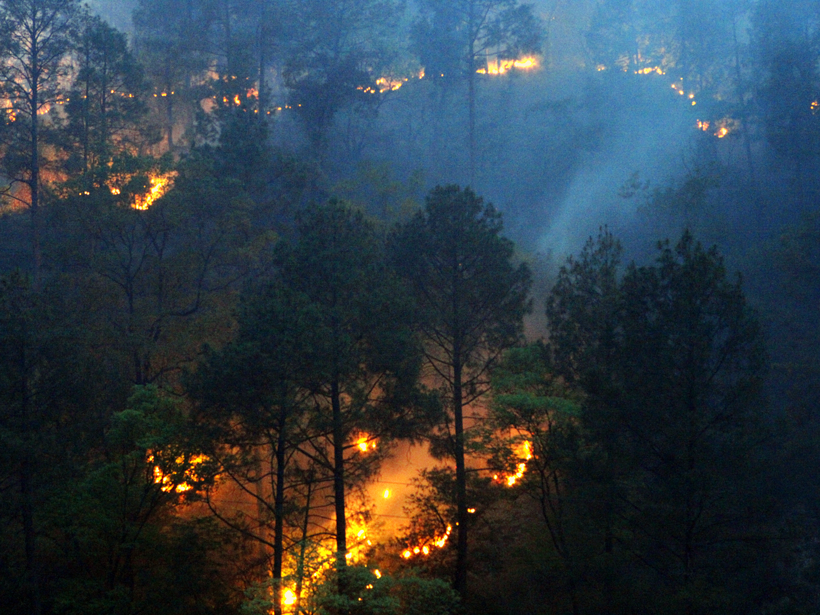
The overlap between peak fire season and pandemic response has made for a serendipitous experiment in forest fires in two Indian states. Humans, not lightning, seem to be the likeliest culprit.
wildfires
Posted inEditors' Highlights
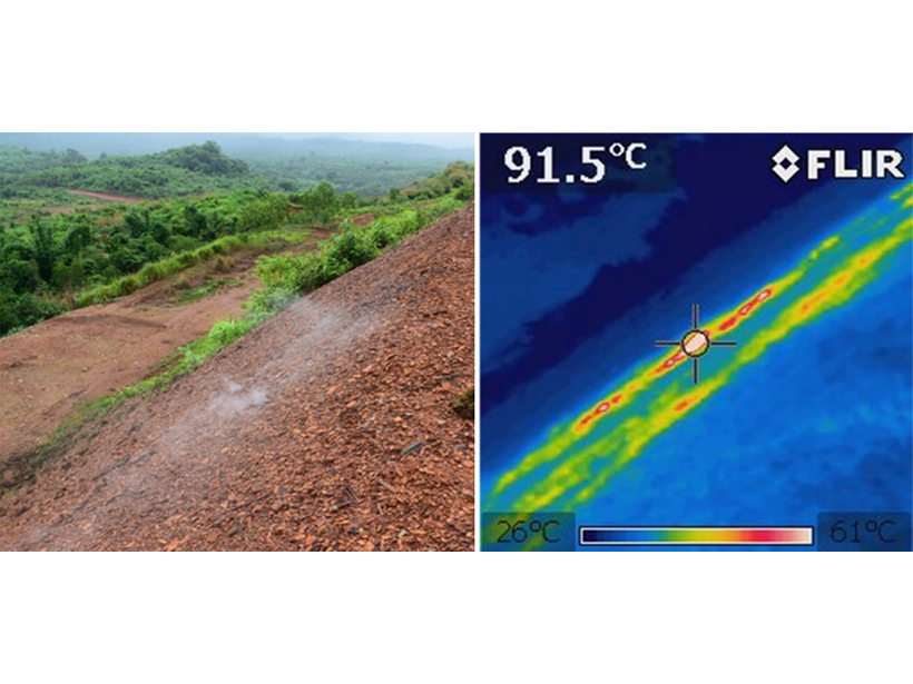
Citizen Science Reduces Risks from Combusting Coal-Mine Wastes
A community-based citizen science study on spontaneously combusting coal-mine waste heaps in Myanmar underpins the development of risk management plans to protect individuals and communities.

Posted inResearch Spotlights
Great Plains Plants Bounce Back After Large Wildfires
An analysis of nearly 1,400 wildfires suggests that some postfire techniques used to help restore vegetation may be unnecessary.

Posted inNews
The Rise of Zombie Fires
Wildfires can smolder underground through Arctic winters, reigniting at the surface when conditions are right.
Posted inEditors' Vox
New Special Collection: Fire in the Earth System
Papers are invited for a new cross-journal special collection presenting advances in understanding the physical and biogeochemical processes associated with landscape fires and their impacts.

Posted inNews
Could Wildfire Ash Feed the Ocean’s Tiniest Life-Forms?
Ash falling on the ocean after a wildfire could fuel plankton growth.
Posted inResearch Spotlights
Santa Ana Winds and Wildfires Influence Air Pollution
Inhaling particulate matter is hard on human health. New research shows that Southern California’s Santa Ana winds can clear or exacerbate fine-particulate pollution depending on wildfire conditions.

Posted inResearch Spotlights
Wildfire Smoke Boosts Photosynthetic Efficiency
Wildfires can destroy large tracts of vegetation. But their smoke plumes may help crops and other plants use sunlight more efficiently.
Posted inNews
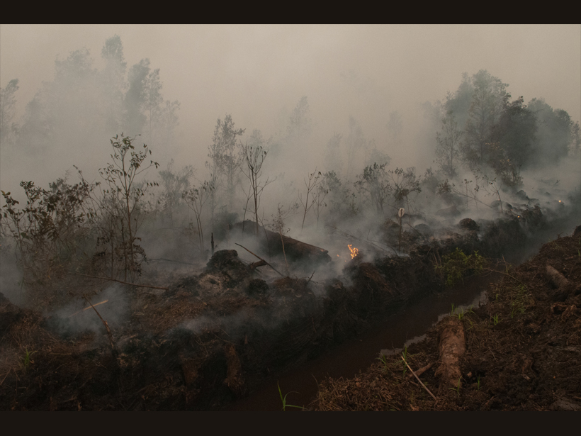
Starting (and Stopping) a Fire to Study It
Fire experiments on peatlands in Southeast Asia have identified previously unknown emissions patterns and could point to ways to detect these smoldering fires before they become too big to fight.
Posted inNews
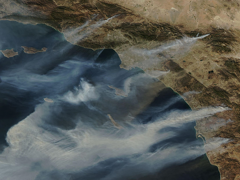
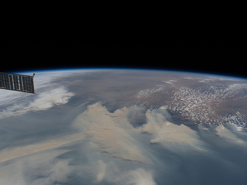
Where Australia’s Smoke Goes to Die
Wildfires from Down Under contribute to airborne pollution and carbon emissions—and some particulates can stay in the stratosphere for a year.