Smoke from burning landscapes is increasingly filling the air. Eos has dedicated its February 2020 issue to the increasingly important study of wildfire emissions.
wildfires
Posted inFeatures
Firing Up Climate Models
Scientists are working to incorporate wildfire data into climate models, resolving hindrances related to scale, speed, and the complex feedbacks between the climate and wildfire emissions.
Posted inScience Updates
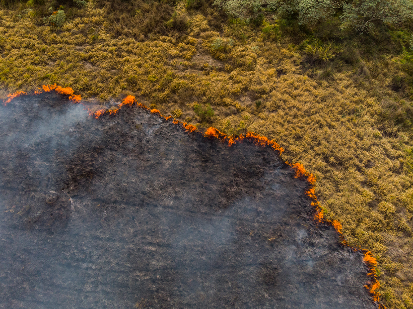
A Global Perspective on Wildfires
Satellites provide global-scale data that are invaluable in efforts to understand, monitor, and respond to wildfires and emissions, which are increasingly affecting climate and putting humans at risk.

Posted inFeatures
What Is Left in the Air After a Wildfire Depends on Exactly What Burned
Forecasting air quality after a wildfire is improving, thanks to more-refined models that measure the biomass going into the blaze and the emissions coming out.

Posted inNews
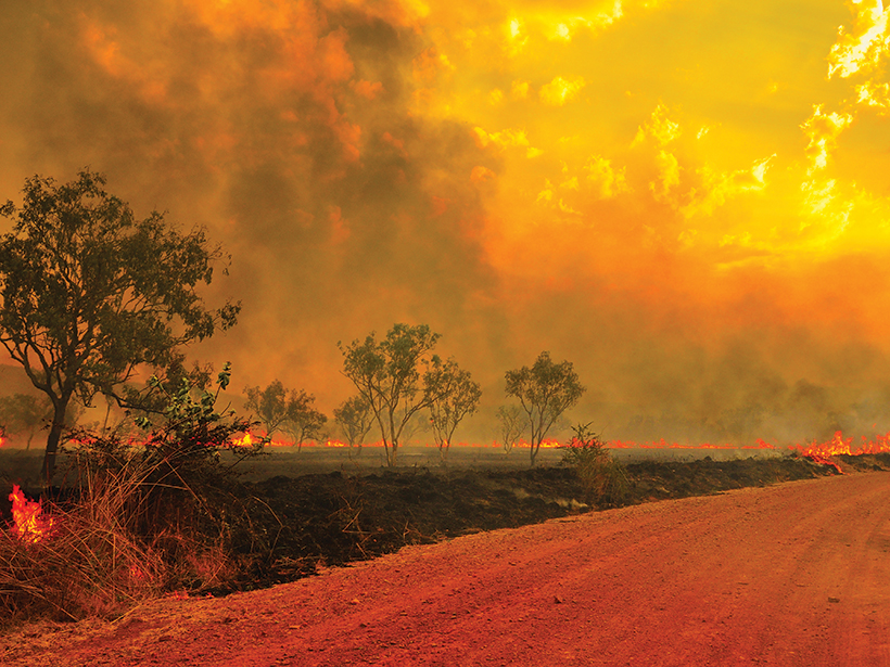
Five Environmental Consequences of Australia’s Fires
Australia’s road to recovery may be long: Here’s a developing list of how the fires are affecting glaciers, wildlife, water supplies, and global carbon emissions.

Posted inOpinions
Australia, Your Country Is Burning—Dangerous Climate Change Is Here With You Now
I am a climate scientist on holiday in the Blue Mountains, watching climate change in action.

Posted inNews
What Do You Get When You Cross a Thunderstorm with a Wildfire?
Lightning, fire vortices, and black hail are some of the frightening features of fire-fueled storms, which may become more common in the future.
Posted inScience Updates
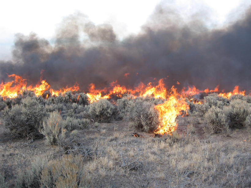
Rating Fire Danger from the Ground Up
Soil moisture information could improve assessments of wildfire probabilities and fuel conditions, resulting in better fire danger ratings.
Posted inNews
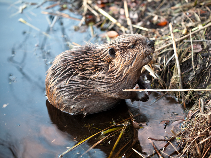
Are Beavers Nature’s “Little Firefighters”?
It’s about dam time: Beavers are acknowledged for their firefighting skills in five recent blazes.
Posted inEditors' Highlights
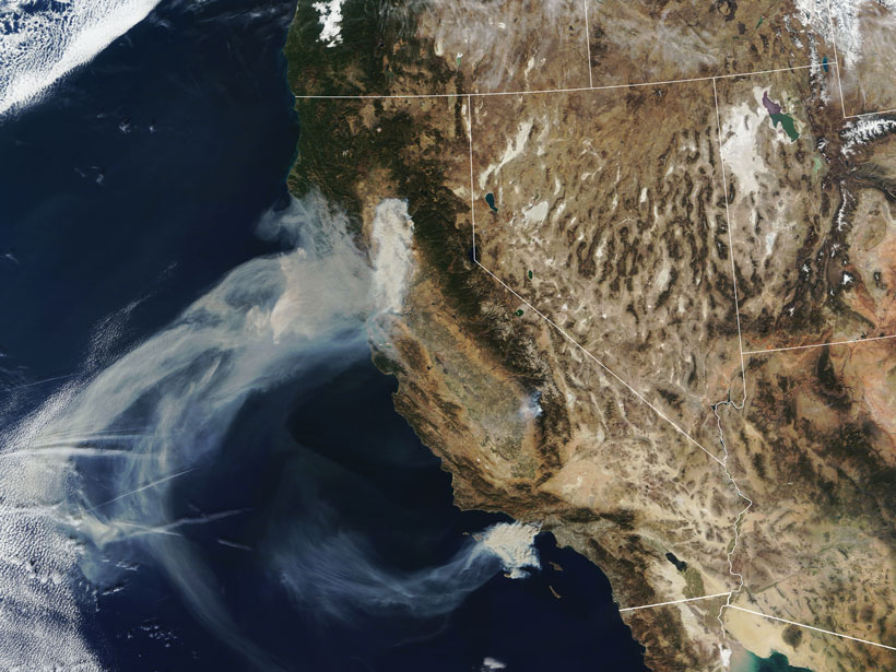
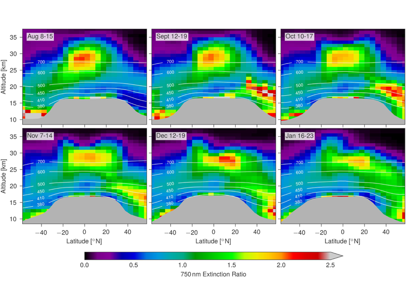
Satellite Measurements of Stratospheric Forest Fire Smoke
Intense boreal forest fires in August 2017 caused smoke plumes that reached record levels in the stratosphere; satellite measurements show that the effects rivaled a moderate volcanic eruption.