• About
  • Special Reports
  • Topics
    • Climate
    • Earth Science
    • Oceans
    • Space & Planets
    • Health & Ecosystems
    • Culture & Policy
    • Education & Careers
    • Opinions
  • Projects
    • Postcards From the Field
    • ENGAGE
    • Editors’ Highlights
    • Editors’ Vox
    • Eos en Español
    • Eos 简体中文版
    • Print Archive: 2015–2025
  • Policy Tracker
  • Blogs
    • Research & Developments
    • The Landslide Blog
  • Newsletter
  • Submit to Eos
  • AGU.org
  • Career Center
  • Join AGU
  • Give to AGU
  • About
  • Special Reports
  • Topics
    • Climate
    • Earth Science
    • Oceans
    • Space & Planets
    • Health & Ecosystems
    • Culture & Policy
    • Education & Careers
    • Opinions
  • Projects
    • Postcards From the Field
    • ENGAGE
    • Editors’ Highlights
    • Editors’ Vox
    • Eos en Español
    • Eos 简体中文版
    • Print Archive: 2015–2025
  • Policy Tracker
  • Blogs
    • Research & Developments
    • The Landslide Blog
  • Newsletter
  • Submit to Eos
Skip to content
  • AGU.org
  • Career Center
  • Join AGU
  • Give to AGU
Eos

Eos

Science News by AGU

Support Eos
Sign Up for Newsletter
  • About
  • Special Reports
  • Topics
    • Climate
    • Earth Science
    • Oceans
    • Space & Planets
    • Health & Ecosystems
    • Culture & Policy
    • Education & Careers
    • Opinions
  • Projects
    • Postcards From the Field
    • ENGAGE
    • Editors’ Highlights
    • Editors’ Vox
    • Eos en Español
    • Eos 简体中文版
    • Print Archive: 2015–2025
  • Policy Tracker
  • Blogs
    • Research & Developments
    • The Landslide Blog
  • Newsletter
  • Submit to Eos

wildfires

2 maps of the western United States
Posted inEditors' Highlights

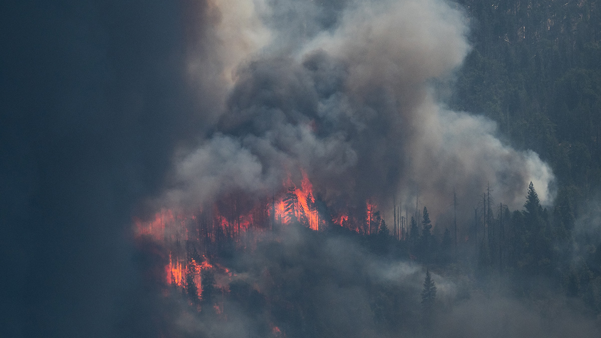
Wet Conditions Delay Wildfire Detection

by Guiling Wang 29 August 202328 August 2023

When accompanied by a considerable amount of rainfall, ignition of wildfire by lightning over forested land may not be detected until days later.

Photo of lightning striking trees.
Posted inEditors' Vox

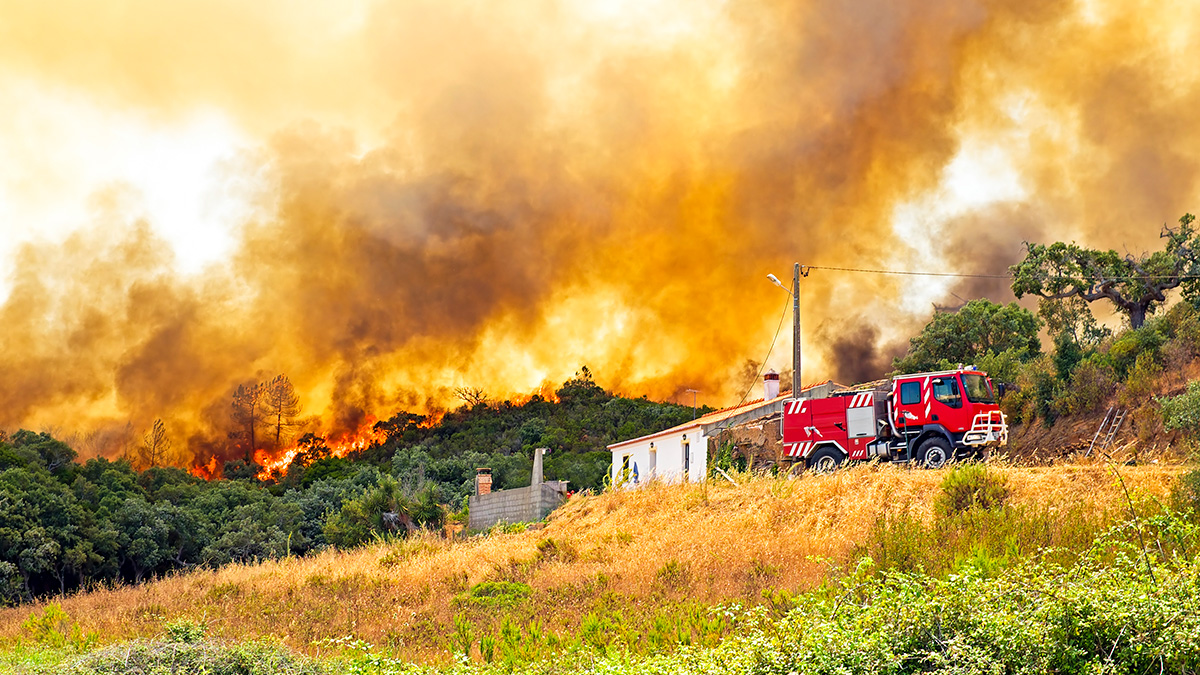
Lightning-Caused Wildfires are 80 Percent More Likely Under Dry Vegetation

by Krishna Rao, Noah S. Diffenbaugh, Alexandra G. Konings, A. Park Williams, Marta Yebra and Colleen Bryant 2 August 20232 August 2023

Mimicking a randomized control trial of wildfires, scientists use satellites to uncover the key role of vegetation dryness in wildfire risk, aiding wildfire management and preparedness in California.

Red liquid falls through the sky in a line behind a flying plane and partially covers trees in a dense forest
Posted inNews

Where Does Fire Retardant Fall in a Forest? Ask a Satellite

by Jenessa Duncombe 16 June 202316 June 2023

Knowing where fire retardant lands once it’s dropped from a plane is hard to pin down. A new remote sensing approach offers clues.

A large plume of dark smoke rises from a forest. Orange flames are visible among the trees.
Posted inNews

As Wildfires Grow, So Could Methane Emissions

by Derek Smith 13 June 202313 June 2023

Wildfires that wreaked havoc on California in 2020 filled the atmosphere with a potent greenhouse gas.

Posted inEditors' Vox

Using Cave Formations to Investigate Ancient Wildfires

by Micheline Campbell, Liza McDonough, Pauline C. Treble and Andy Baker 2 May 20231 May 2023

From sediment cores to speleothems, environmental archives are helping us to understand the history of wildfires.

Photo of an active flame front in a forest
Posted inNews

Climate Change, Megafires Crush Forest Regeneration

by Nancy Averett 28 April 202328 April 2023

High-intensity fires in western states kill mature trees and their seeds while warmer, drier conditions stress seedlings. But forest managers can still intervene to change this trajectory.

A dark image of a wildfire under hazy skies.
Posted inNews

Wildfire Smoke Destroys Ozone

by Elise Cutts 12 April 20233 June 2024

Smoke aerosols from large wildfires are the perfect reaction surface for chlorine chemicals, speeding their transformation from ozone-friendly forms to reactive ones.

Satellite image of tan whisps of clouds over green land. There is brown land to the right and blue ocean to the left.
Posted inNews

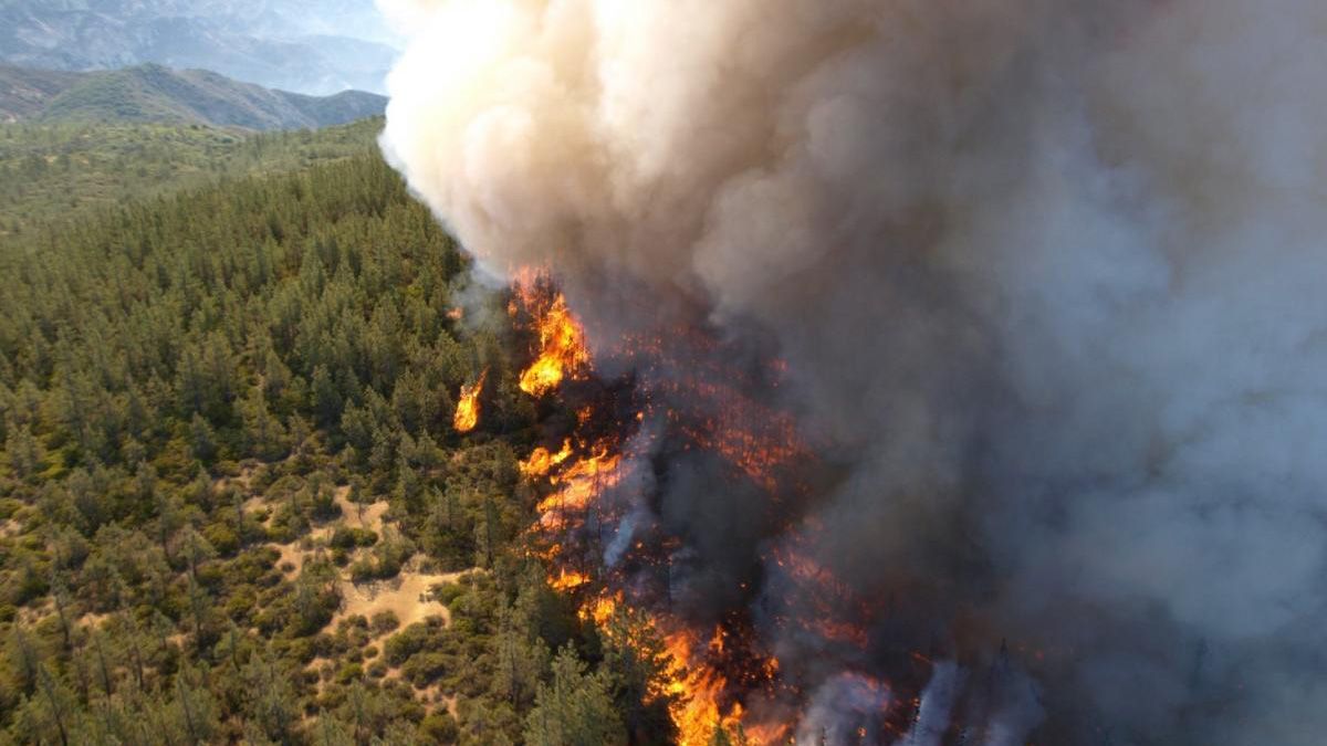
Extreme Wildfires Make Their Own Weather

by Elise Cutts 8 March 202313 March 2023

Extreme fires in the western United States and Southeast Asia influenced the local weather in ways that make fires and smoke pollution worse.

Field photos of burned forest and graphs showing reflectance properties.
Posted inEditors' Highlights

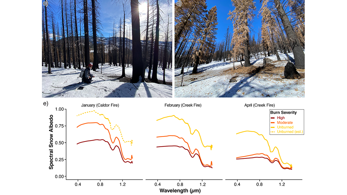
Summer Fire Means Winter Melt

by Valeriy Ivanov 2 February 20232 February 2023

Changing wildfire activity in California may impact seasonal hydrology by causing intense snowmelt during winter in areas where fires extend into higher elevation zones.

View of Seattle through a layer of wildfire smoke
Posted inNews

Potentially Good News for Solar Energy During Wildfires

Jenessa Duncombe, Staff Writer by Jenessa Duncombe 18 January 202318 January 2023

A preliminary analysis suggests that the impact of smoke blocking the Sun during 2020’s megafires was minimal for the nation’s solar panels.

Posts pagination

Newer posts 1 … 7 8 9 10 11 … 21 Older posts
Over a dark blue-green square appear the words Special Report: The State of the Science 1 Year On.

Features from AGU Publications

Research Spotlights

As Wildfires Increase in the West, So Does Suppression Spending

10 June 202610 June 2026
Editors' Highlights

Multi-Scale Fault Roughness Encapsulated in a Friction Law

11 June 202611 June 2026
Editors' Vox

Small-Scale Indian Ocean Dynamics Underpin Marine Ecology and Climate

4 June 20263 June 2026
Eos logo at left; AGU logo at right

About Eos
ENGAGE
Awards
Contact

Advertise
Submit
Career Center
Sitemap

© 2026 American Geophysical Union. All rights reserved Powered by Newspack