
Researchers incorporated local atmospheric parameters and terrain data to more accurately estimate the probability of fire in a specific area.
wildfires

Posted inNews
Wildfire Smoke Affects the Function of Lake Ecosystems
Smoke-covered lakes see shifts in biological and energy processes that influence food webs, carbon storage, and more.

Posted inENGAGE, News
Is It Climate Change? Americans Mostly Say Yes
Most Americans think climate change plays some role in creating extreme weather, though their perceptions didn’t always align with scientists’.

Posted inEditors' Highlights
A Powerful New Model for U.S. Climate–Air Quality Interactions
NOAA’s Geophysical Fluid Dynamics Laboratory has developed a new variable-resolution global chemistry-climate model for research at the nexus of U.S. climate and air quality extremes.
Posted inNews
Does Soil Sound Different After It’s Burned?
Yes, but not quite the way researchers expected it to.
Posted inENGAGE, Features
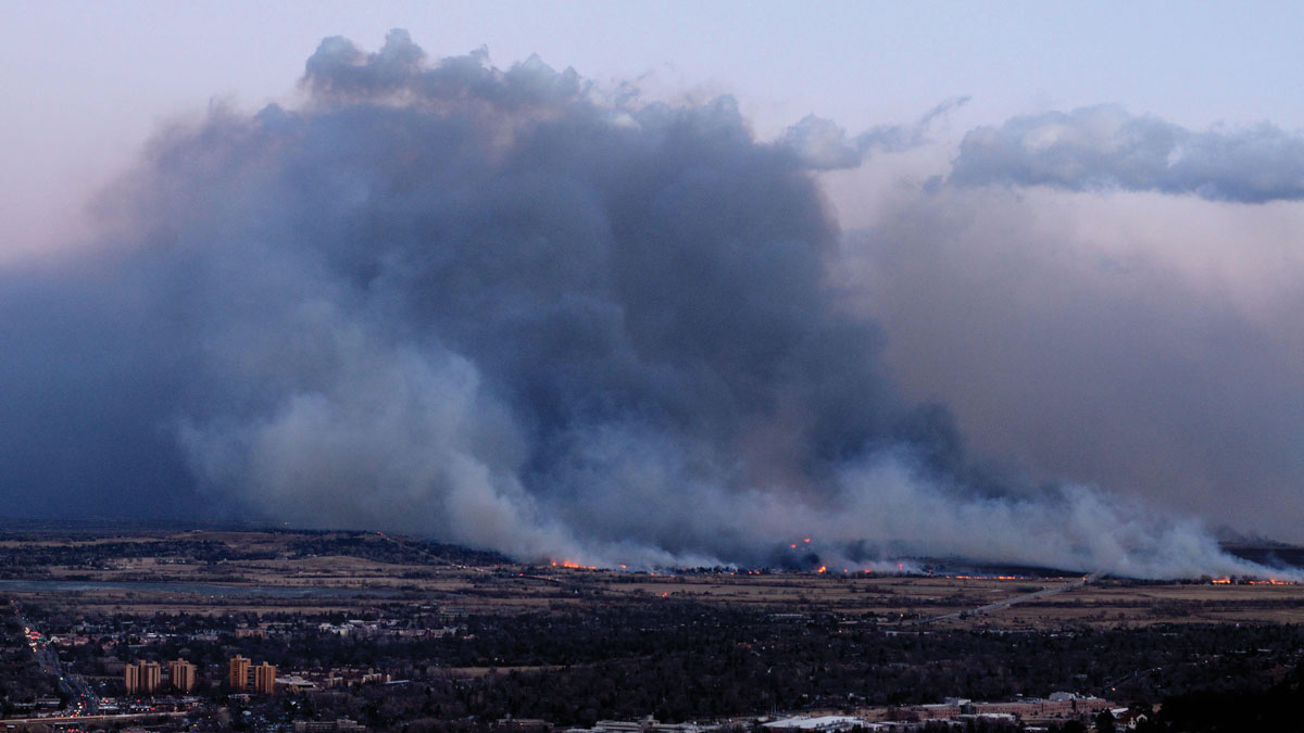
When Fieldwork Comes Home
The impacts of the 2021 Marshall Fire rippled through a community of Colorado geoscientists, spurring them to action.

Posted inEditors' Vox
Foundations in Hazards and Disasters for Undergraduate Students
A new textbook for undergraduates explores different types of natural hazards and disasters through foundational scientific knowledge, engaging case studies, and mitigation strategies.
Posted inNews
Forecasters Expect Slow Start to U.S. Wildfire Season
A wet spring in the United States will dampen early fires, but some regions will see elevated risk this summer.

Posted inENGAGE, News
The Crocodile Dundee Site Helping Rewrite the History of Australian Bushfires
A lake made famous by Hollywood has yielded powerful new evidence that humans have conducted controlled burns on the Red Continent for tens of thousands of years.

Posted inScience Updates
The Open Ocean, Aerosols, and Every Other Breath You Take
Phytoplankton and other marine plants produce half of Earth’s atmospheric oxygen and have big effects on food webs and climate. To do so, they rely on nutrients from the sky that are hard to quantify.