The Landslide Blog is written by Dave Petley, who is widely recognized as a world leader in the study and management of landslides.

In a short statement on its website yesterday, Victoria Gold (“a mining company focused on the Yukon”) confirmed that “the heap leach pad (“HLP”) at the Eagle Gold Mine in Yukon experienced a failure”.
A picture has been circulated on social media that is thought to show this event:-
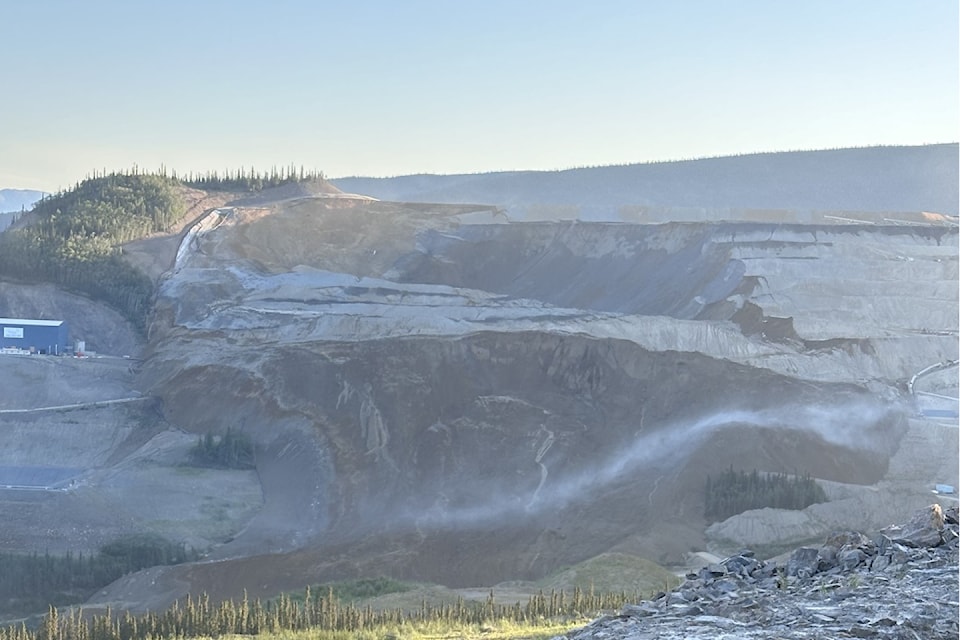
The statement confirms that operations at the site have been suspended but that no-one was injured. The report also indicates that “a portion of the failure has left containment”.
Yukon News is providing updates about the landslide, but information is somewhat sketchy.
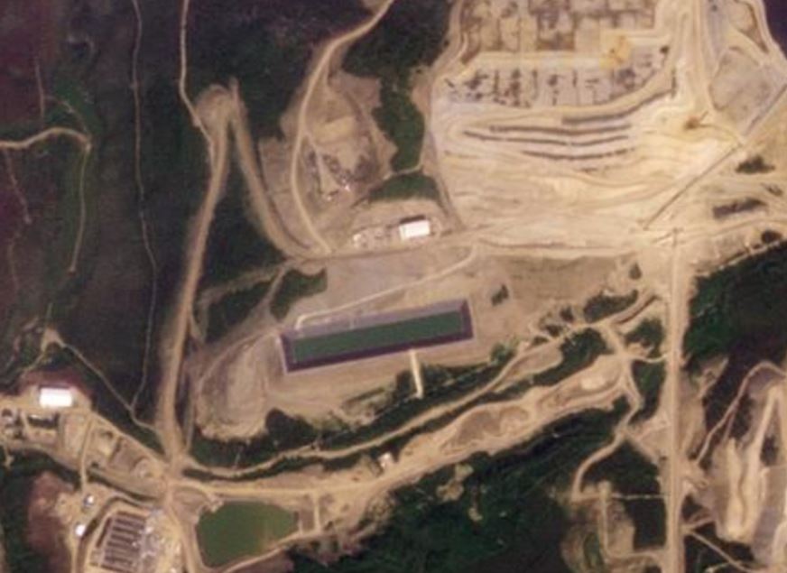
Eagle Gold Mine is located at [64.0320, -135.8482]. The crown of the landslide itself is at [64.04180, 135.83304]. It has been nicely caught in a Planet Labs image collected yesterday. This is a satellite image of the affected part of the mine, collected on 16 June 2024:-
And here is an image captured yesterday (24 June 2024), showing the same site. The marker indicates the location of the crown of the landslide, which has moved to the south and then to the west:-

I have annotated the major features of the landslide below:-
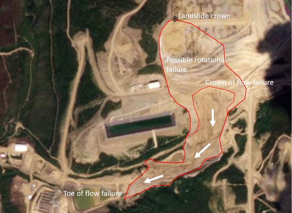
The approximate outline of the landslide is in red, with the rear scarp of the flow failure in dashed lines. The satellite image does appear to correspond to the social media photographs of the landslide.
Here is a slider that allows the two satellite images to be compared:-


The landslide appears to be a rotational slump in the upper reaches – note the displaced benches below the crown – that has turned into a flow further down the slope. Judging by the satellite image, the landslide is large – about 1,430 metres from crown to toe (along the landslide track) and a a maximum of about 370 metres wide.
This is the second major heap leach failure this year, following the major landslide on 13 February 2024 at Çöpler Mine in Turkey.
Victoria Gold has pledged to “provide further information as it becomes available”, so it will be interesting to see what emerges over the next few days. The cost of this major landslide is unlikely to be trivial.
Reference
Planet Team (2024). Planet Application Program Interface: In Space for Life on Earth. San Francisco, CA. https://www.planet.com/