
The Landslide Blog is written by Dave Petley, who is widely recognized as a world leader in the study and management of landslides.

On Friday, the first set of satellite images became available of the 13 February 2024 landslide at Çöpler Mine in Turkey. This was a very good radar image released by Capella Space and circulated via social media, including Twitter:-
This image generated some rather weird social media activity, with one poster claiming that this was not a landslide, which was strange.
This is the image in its full form, courtesy of Capella Space:-
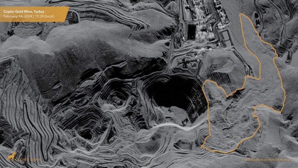
Note that the boundaries of the landslide are highlighted in the image above.
On Twitter, Tolga Gorum correctly identified that the image shows that the landslide moved in two directions, with the majority moving into the valley, but a portion moving into the main pit:-
I think this is correct, but my interpretation is that a greater portion entered the pit than is shown here. In particular, I think that the source area of the failure towards the west probably extended further to the north, with the debris cascading down the benches in the pit wall.
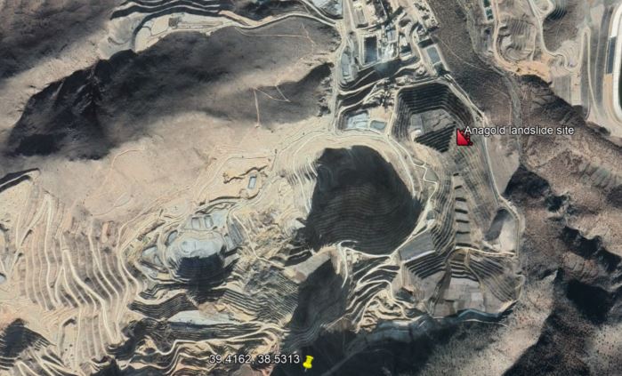
This is a Google Earth image of about the area of the failure, collected in November 2021:-
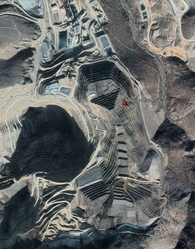
The shadows play a trick on your mind here, and it is easy to interpret the topography in reverse. But the large stack of the leach heap that failed can be seen.
Below is a very rough and ready comparison between the Google Earth image and the radar image – these need to be properly orthorectified to be useful, but it gives the general sense of the landslide.

The search for the remains of the missing staff continue. It is estimated that 35 million cubic metres of waste will need to be moved, equating to 400,000 truck loads (I assume that this is predicated on using the very large mining dump trucks, as the number is too low for normal trucks). Note that the volume of the landslide is rather larger than previous estimates.
In other news, the permits to operate the mine have now been terminated – it will be interesting to see how this plays out in the coming months. Additionally, Cengiz Demirci, the in-country senior vice president of operations at SSR Mining (which is Anagold’s parent company) was arrested on Sunday morning. Six other employees of the mine have also been arrested. The accusation appears to be that they ignored signs of movement in the leach heap prior to the failure.
The trigger of the failure remains unclear, if indeed there was one. There are suggestions that blasting may have been a factor, but this would not be normal in a leach heap.
The ultimate cost of this landslide is likely to be many multiples of the money saved on mining operations through inadequate construction and/or operation of the leach heap.