The Landslide Blog is written by Dave Petley, who is widely recognized as a world leader in the study and management of landslides.

On 29 April 2024, a major debris flow swept through Mai Mahiu in Kenya. At least 60 people were killed, although many more bodies remain missing. It is thought that the final toll will be in the region of 132 people.
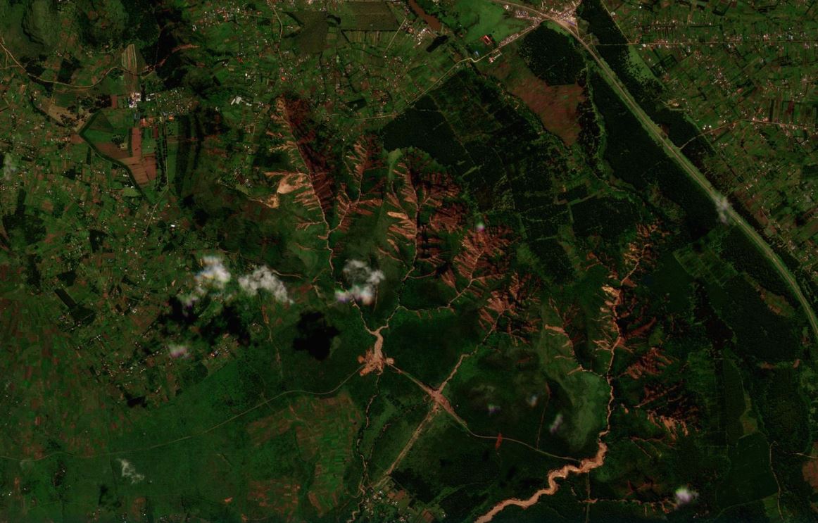
There has been much confusion about the sequence of events, with reports of a dam failure and of landslides. As usual, we have had to wait for a cloud-free day to know for certain, when satellite images become available. That day arrived on 12 May, and Planet Labs was able to acquire an excellent image of the area.
We knew already that the source zone was the Kijabe Hills, a forested, deeply incised area located at [-0.933, 36.616]. The post-event satellite image is stunning:-

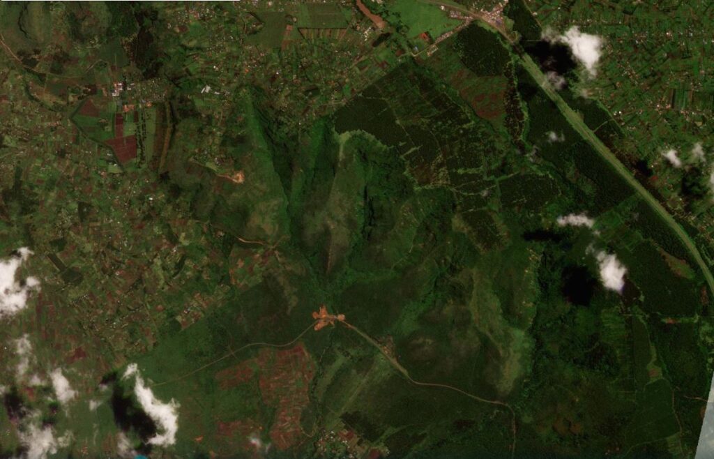
The imagery shows an extraordinary concentration of shallow landslides on the slopes above the channels in the Kijabe Hills. For reference, this was the same area on 7 April 2024:-
And here is a slider to compare the two images:-


The channelised debris flow that swept through Mai Mahiu was devastating. This part of the Planet Labs image shows the full course of the landslide:-
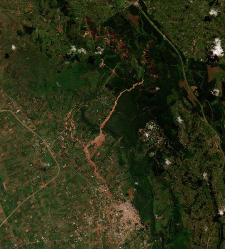
As the image shows, the landslide swept through a populated area. This section of the image captures the dreadful impact of this landslide:-

The concentration of landslides in the source area of this event suggests that the rainfall must have been extremely intense locally. As climate change accelerates, and peak rainfall intensity continues to rise, these events are becoming increasingly common. To be in the path of one of these channelised debris flows is the true definition of horror.
Finally, it is interesting to note that several catchments in the Kijabe Hills generated intense landsliding, but only one (the one located at the east of the area) formed a massive debris flow. This may well support the suggestion that the flow from this catchment was impeded by the railway bridge, which collpased to release the flow catastrophically.
Reference
Planet Team (2024). Planet Application Program Interface: In Space for Life on Earth. San Francisco, CA. https://www.planet.com/