The Landslide Blog is written by Dave Petley, who is widely recognized as a world leader in the study and management of landslides.

On 29 April 2024, a devastating debris flow swept through Mai Mahui in Kenya. The latest reports indicate that 48 people were killed and 84 people are missing. The disaster was triggered by heavy rainfall, but there has been considerable misreporting of the cause, with many outlets describing the event as a dam burst.
The valley that was the source of the accident is located above the town of Kijabe at [-0.9186, 36.5949]. This is a Google Earth image from 2020 of the site that I believe was the source of the flow:-
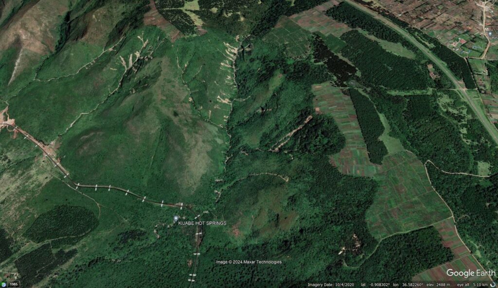
Note the deeply incised valley with depleted forest cover and the multiple landslides, primarily shallow flows, in this and the adjacent valley. These landslides occurred some time between March 2019 and October 2020. Note also that the valley is crossed by a railway line, near to Kijabe Hot Springs.
There is a good NTV Kenya report about the disaster on Youtube:-
The journalist has travelled up into the source area in Mai Mahiu and has interviewed an academic from a local university about the cause of the disaster. The footage from the report is stark. For example, this is the path of the flood wave through Mai Mahiu:-

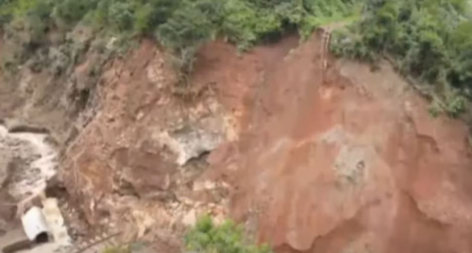
So, it appears that this is a classic case of a multiple landslide, channelised debris flow. The reports indicate that there was a series of landslides in the valley above Kijabe, which combined to form a terrible debris flow. It could be that a part of the flow was trapped behind the railway bridge, which failed, releasing the flow in a more concentrated form. The footage includes an image of this location:-
We need satellite imagery to confirm this hypothesis. Unfortunately, at present there is too much cloud to allow the site to be viewed.
This is a terrible example of a cascading hazard triggered by extreme rainfall. Unfortunately, as rainfall intensity continues to increase globally, driven by climate change, this pattern is increasingly common.