The Landslide Blog is written by Dave Petley, who is widely recognized as a world leader in the study and management of landslides.

In the last few days on November 2025, Cyclone Senyar brought torrential rainfall to parts of Indonesia, and in particular to Sumatra. At the time or writing, at least 1,022 people are known to have been killed and 206 more are missing.
One area that has been particularly badly impacted is Malalak, which is located in Agam Regency in West Sumatra – at [-0.39384, 100.27425]. This is a Google Earth image of the town, collected in February 2025:-
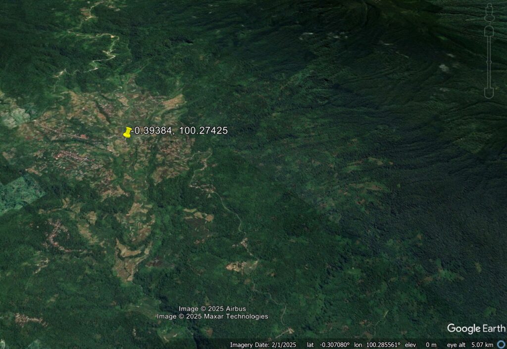
Note the presence of the volcanoes close to the town, and the deeply incised river channels. This is a location at risk from channelised debris flows.
Unfortunately, this is a cloudy place, so obtaining good imagery is hard. But on 1 December 2025, Planet Labs captured an image using their PlanetScope sensors that give a sense of what has happened. This is the image:-
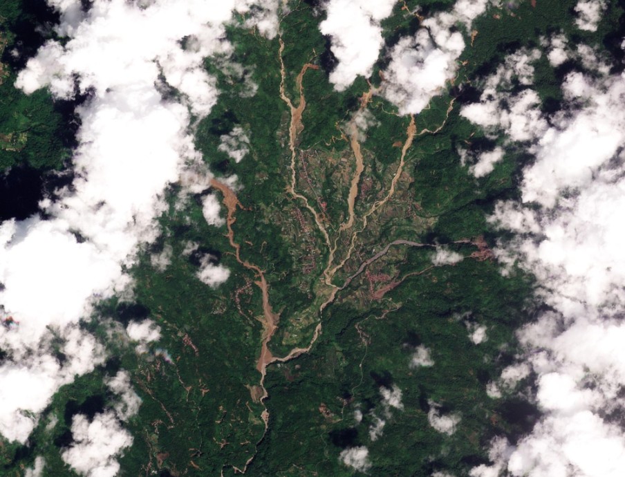
The sources of the landslides in the images remain hidden. However, it is evident is five substantial channelised debris flows that have affected the area, many of which have multiple upstream sources. There are some smaller events too. There is a high level of destruction as many of these landslides have flowed through the urban areas.
Reuters has a gallery of images of the aftermath of the landslides at Malalak, and there is some footage of the aftermath of the events too:-
Hopefully, imagery will become available that gives a sense of the source of these failures. In my mind, to be in a town with multiple channelised debris flows from different directions is hellish. This scenario appears to have occurred in several locations in Indonesia at the end of November.
Acknowledgement
Thanks as always to Planet Labs (2025) for their amazing imagery.