
June to September is known as “the monsoon” in the Southwest. For these few months, rains quench Earth’s thirst, bringing cactus blooms, insect hatches, and the sweet smell of creosote bushes. But sometimes the monsoon doesn’t come.
Over the past 20 years, the average temperature has risen across the Southwest, from California to Colorado, and drought is shifting from a transient condition to a way of life. Torrential rains that hit Flagstaff, Ariz., earlier this month were a blip amid a 26-year long-term drought that’s left the Lake Mead reservoir on the Nevada-Arizona border at its lowest level since the 1930s. In efforts to conserve water, Las Vegas recently banned “nonfunctional” grass, and the Hopi Nation ordered livestock reductions.
Earth is entering a period that some scientists have called the “no-analog future” because climate change has left them unable to use past experience to predict future weather trends, like rain and water availability. But this month, a new monitoring project called the Surface Atmosphere Integrated Field Laboratory, or SAIL, started collecting data that scientists hope will fill holes in hydrology models and guide water policy in this uncertain future.
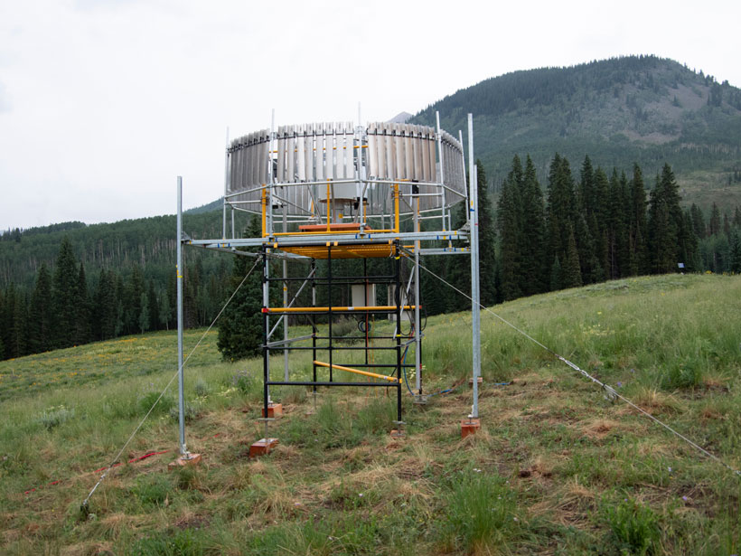
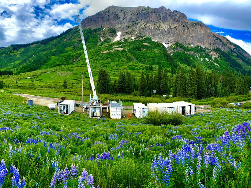
Over the next 2 years, SAIL will use dozens of instruments—including radar, lidar, cameras, balloons, and other equipment—nestled near the Rocky Mountain town of Crested Butte, Colo., to measure clouds, aerosols, wind, temperature, precipitation, and a wide array of other weather features with greater consistency and frequency than any previous project. Putting all this information together, SAIL scientists hope to learn how much water enters upper Colorado River watersheds through rain and snow as well as what happens to that water as it makes its way downstream to communities like Window Rock, Phoenix, and Las Vegas. This information can improve models of how water moves through mountainous regions worldwide—information that will help communities that depend on mountain runoff.
Opening the Black Box
“They’re taking what was this big black box between the atmosphere and the streamflow, and they’re opening that up.”
Scientists have known for years that the amount of water flowing down from mountains is declining as temperatures rise, but Indiana University hydrologist Adam Ward likens the reasons for this decline to a black box. A self-described “SAIL enthusiast” who’s not directly involved in the project, Ward said he’s excited about SAIL because “they’re taking what was this big black box between the atmosphere and the streamflow, and they’re opening that up.”
Opening this black box will require what Lawrence Berkeley National Laboratory geologist and SAIL senior scientist Ken Williams calls “extreme collaboration.” Several government labs and nonprofit organizations are working with nearly a dozen academic institutions to make this multimillion dollar per year venture possible.
“Our work has really embraced what we call a community watershed concept,” Williams said, referring to the wide variety of expertise represented in SAIL. “It’s allowed our collective research team to gather data that ranges from the tops of trees, to soils, to underlying bedrock.” All this information is necessary to build complex hydrological models to predict water availability more accurately in the coming decades.
Aerosols in the Colorado Rockies
Jessie Creamean is an atmospheric scientist at Colorado State University who joined SAIL to research how dustlike particles called aerosols contribute to snow in the Colorado Rockies. Snow is particularly important to water availability in mountainous watersheds because snowpack that builds up during the winter melts slowly throughout the summer and provides downstream regions with a continuous supply of water.
Just as plants germinate from seeds, storms stem from aerosols.
Just as plants germinate from seeds, storms stem from aerosols. These tiny particles bring water molecules together to turn clouds into precipitation. As a graduate student working in the Sierra Nevada Mountains in California, Creamean found that aerosols from as far away as North Africa could affect snowfall. Now, she’s excited to characterize the role that aerosols play in the Rockies, not only because of their scientific merit but also because of the role snow plays in her life. “I’m an avid backcountry skier,” she said. “And so a healthy snowpack really affects my happiness in the winter, quite frankly.”
Alejandro Flores is a Boise State University hydrologist and SAIL researcher who’s taking research like Creamean’s and turning it into models to predict precipitation. Although processes that occur in the atmosphere are important for snow, the interface between the land and the atmosphere matters just as much, Flores said. He’s excited about SAIL’s radar system, which, when combined with other instruments, will give scientists a minute-by-minute view of how snow accumulates on the ground and how water enters the soil. Although previous projects have collected similar data, none have collected such frequent readings over as long a period of time as SAIL.
“It’s a new way of doing science, to get the modelers and the observational teams coordinating from day one.”
“This topic is one that is very important to me, not only professionally but also personally,” said Flores, who grew up in Colorado. “I know and understand the pressures that are being put on water in the West by things like climate change.”
Ward said the consistency of the project’s data will make it useful for his own research on mountain streamflow. Earth scientists are often stuck tying together observations made by many different groups in many different ways, and the lack of internal consistency makes it difficult to draw conclusions. But with SAIL, scientists will have a complete set of consistent data describing the inner workings of a watershed.
“It’s a new way of doing science, to get the modelers and the observational teams coordinating from day one,” Ward said.
—Saima Sidik (@saimamaysidik), Science Writer
This news article is included in our ENGAGE resource for educators seeking science news for their classroom lessons. Browse all ENGAGE articles, and share with your fellow educators how you integrated the article into an activity in the comments section below.
Citation:
Sidik, S. (2021), Collaboration in the Rockies aims to model mountain watersheds worldwide, Eos, 102, https://doi.org/10.1029/2021EO163405. Published on 21 September 2021.
Text © 2021. The authors. CC BY-NC-ND 3.0
Except where otherwise noted, images are subject to copyright. Any reuse without express permission from the copyright owner is prohibited.