Over the next few weeks, wind-battered, Lycra-clad Olympic skiers will perch atop South Korea’s Yongpyong Alpine Center awaiting their runs. As the starting bell reverberates through their aerodynamic helmets, the skiers will fling themselves forward, hurtling downhill with astonishing speed and grace. Little do they know that as they speed toward the finish line, they are traversing millions of years of geologic time.
Yongpyong and most other venues at the PyeongChang Olympics are located in the Taebaek Mountains, which stretch along the east coast of the Korean Peninsula for more than 480 kilometers. With an average elevation nearly 600 meters above sea level, the mountains boast a rich history of winter sports: Yongpyong has hosted numerous alpine skiing championships through the years. This year, the men’s and women’s giant slalom, slalom, and alpine team events are playing out on its slopes.
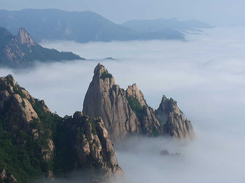
The geology of Yongpyong and the Taebaek Mountains tells a story of repeated mountain-building events and tectonic motion that molded the terrain into the winter wonderland it is today.
The center, located roughly 6 kilometers southwest of the PyeongChang Olympic Stadium, also happens to sit on a notable geologic boundary.
As competitors descend the mountain, they “rapidly pass a time gap on the ski slope, like in a time machine,” said Moonsup Cho, a geologist and invited professor at Kyushu University in Japan. The boundary at the bottom of the slope abruptly divides 250-million-year-old rocks from an adjacent layer that clocks in at just 170 million years old. Cho and two colleagues published a geologic review of the Korean Peninsula and the Olympic Winter Games venues that appeared in International Geology Review on 15 January.
The geology of Yongpyong and the Taebaek Mountains tells a story of repeated mountain-building events and tectonic motion that molded the terrain into the winter wonderland it is today. A close look at the Yongpyong ski course does not detail the entire history of the peninsula, whose age exceeds 2 billion years, but it does reveal how ancient geologic events created the modern PyeongChang landscape so well suited to showcasing human agility and daring on snow and ice.
The Starting Gate
As skiers heave themselves down the mountain and carve across the Camel Back and Devil Ridge portions of the course, they sweep over rocks that formed when the North China and South China blocks of continental crust plowed into each other 250 million years ago. The collision created one of the early mountain chains that dominated this region—a massive 2,000-kilometer-long wrinkle that stretched from central China across Korea and into Japan. This Triassic period range rivaled today’s Himalayas.
That early uplift left behind the sedimentary rocks of what’s called the Nogam Formation, Korean for “green rocks.”
Those mountain peaks were ground down long ago, but that early uplift left behind the sedimentary rocks of what’s called the Nogam Formation, Korean for “green rocks.” Where the rock is exposed, this pileup of sandstones, shales, and conglomerates gleams with a green tint produced by minerals such as chlorite. Chlorite minerals often form in environments altered by heat, pressure, or chemical activity. At Yongpyong, the chlorite may have formed when the rocks of the formation were thermally recrystallized, or “slightly cooked” as Cho describes it, by volcanic material that accompanied further tectonic pushing and grinding in the area. As a result, the rocks are harder and more resistant to weathering than surrounding rocks. These rocks are still around today, offering clues to the ancient collision that pushed them up into the view of sleek Olympic competitors.
The Finish Line

Just over a kilometer from the starting gate, the Nogam Formation abruptly ends near the base of a hill when it butts up against a collection of granites known as Daebo granite, one of the most common rock types on the Korean Peninsula.
Daebo granites formed in recent geological time, during a later buildup of mountains at this Olympic venue. About 170 million years ago during the Jurassic period, one of Earth’s great slabs of crust, the Pacific Plate, subducted, or moved under, the Asian continent. This action pushed magma up through the continental crust, which hardened into the Daebo granites found throughout the peninsula.
The Daebo rocks feature in many of Korea’s notable landscapes, including Seoraksan National Park—“a must-see spot for visitors,” according to Cho—approximately 60 kilometers north of Yongpyong. From the top of the alpine center on a clear day, Olympians can see Mount Seoraksan (1,708 meters), the tallest peak in the Taebaek range. Many of the granites in the Yongpyong area occupy valleys because the granites are softer and more susceptible to weathering than the hardened rocks of the Nogam Formation.
Back up the Chairlift
Nogam and Daebo remain from the distant-past episodes that made this place into a modern-day winter sports mecca. But the lofty terrain that dominates today developed only 28 to 20 million years ago, according to Cho and his colleagues, when the Taebaek Mountains uplifted during the tectonic activity that separated the Japanese islands from the Asian mainland.
“About 30 million years ago, the Japanese islands were part of the continent,” explained Kyoungwon Min, a coauthor of the review paper and an associate scientist in the Department of Geological Sciences at the University of Florida in Gainesville.
Although these formations and the titanic forces that created them are just a backdrop for the Olympic performances beginning today in PyeongChang, they will remain quietly at work during the games.
As the Pacific Plate moved under the continent, however, the subducting plate triggered volcanism along the eastern margin of the Eurasian Plate. The stretching force generated by such volcanism, combined with the backward movement of the oceanic trench between the two plates, pushed the newly detached Japanese islands toward the Pacific Ocean and shaped a basin that evolved into the East Sea (Sea of Japan). It was this spreading that pushed up the Taebaek peaks and exposed much of the Nogam Formation and Daebo granite seen around Yongpyong today, Min said.
Although these formations and the titanic forces that created them are just a backdrop for the Olympic performances beginning today in PyeongChang, they will remain quietly at work during the games. As Robert Stern, a professor of geosciences at the University of Texas at Dallas, put it, “The Winter Olympics, in general, and especially the outdoor events, represent an opportunity to discuss our planet and our science.”
—Aaron Sidder (email: [email protected]), Freelance Science Writer
Citation:
Sidder, A. (2018), Cycles of mountain building formed 2018 Winter Olympics terrain, Eos, 99, https://doi.org/10.1029/2018EO092751. Published on 09 February 2018.
Text © 2018. The authors. CC BY-NC-ND 3.0
Except where otherwise noted, images are subject to copyright. Any reuse without express permission from the copyright owner is prohibited.