
Cities along Lake Michigan, like Chicago, are dealing with increasingly problematic shoreline erosion that has already caused millions of dollars in damage. Technologies including aerial photographs and bathymetric lidar have helped experts track coastal changes. Yet high-resolution data sets along the lakes’ shores are lacking, and there is little understanding about how changes to the coastlines have lasting impacts. Gathering data and revealing changes can help with coastal monitoring and management.
With the help of drones and crowdsourced data, researchers are expanding studies to include ecological and physical changes to the lakes’ shorelines. Data from two projects will be presented on 17 December at AGU’s Fall Meeting 2021.
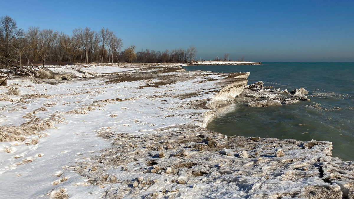
The first project focuses on collecting data on the Great Lakes during the winter so experts can better understand the physical features and chemical properties of sedimentary rock in the nearshore system. “The goal is to see what the cumulative impacts of ice-nearshore and ice-shoreline interactions are,” said C. Robin Mattheus, a coastal geologist with the Illinois State Geological Survey. Once formed, ice affects beaches and sandbars, which interact with waves and sediment. This interplay can change the shape of a shoreline in as little as a year.
Data collection was done with drones flown across beaches collecting photos. The images were then merged into one orthophoto, allowing the scale of the photographs to be uniform. Using the orthophotos, the team created topographic models illustrated in StoryMaps to document the dynamism of the shoreline. “This is at a very high resolution, counted at a centimeter scale,” said J. Elmo Rawling III, a geomorphologist at the Wisconsin Geological and Natural History Survey.
Cue the Volunteers!
“[This project is] unique in that it’s the first of its kind within the region to put drones in the hands of people to collect coastal imagery.”
The second project—Interdisciplinary Citizen-based Coastal Remote Sensing for Adaptive Management (IC-CREAM)—involved the local community. Through the project, community members were trained to monitor shoreline change and infrastructure damage. “[This project is] unique in that it’s the first of its kind within the region to put drones in the hands of people to collect coastal imagery,” said Erin Bunting, an assistant professor of geography, environment, and spatial sciences at Michigan State University. IC-CREAM’s crowdsourced data create “constant information with the high spatial resolution needed to better understand beach erosion, vegetation loss, and other physical changes happening along the lakes’ coasts,” said Bunting.
Dan Laskey, a volunteer involved with IC-CREAM who has been based in Manistee, Mich., for the past 40 years, said, “the development and movement of the shoreline is something that’s pretty important to us as we spend so much time here.” He started noticing changes to the lakes’ shorelines about 30 years ago when he and his wife were considering buying a cottage near Michigan’s Portage Lake.
The research team members have incorporated themselves into local communities by attending town council meetings and speaking to city and project managers about what these data mean and their impact. “Given the large expanse of the Great Lakes, it’s really hard to have a direct and constant connection within these communities, and that’s something we’re trying to establish with community science,” said Bunting.
—Iris Crawford (@IrisMCrawford), Science Writer