Take a tour of the solar system, and you’ll find myriad mysteries. How old are Saturn’s rings? What carved out Mercury’s hollows? What created Iapetus’s weird ridge?
This year at the American Geophysical Union’s annual Fall Meeting in New Orleans, La., several scientists dedicated a poster session to just a pinch of solar system puzzles—including strange landscapes on our own planet.
“We thought it would be interesting to create a risk-free session” where scientists can “come with a totally off-the-wall idea and everyone will want to chat about it,” said Angela Stickle, a planetary scientist at Johns Hopkins University’s Applied Physics Laboratory in Laurel, Md., and co-convener of the session.
Perhaps some new collaborations will come out of the discussion, Stickle added. Maybe an Earth scientist will see an image of a strange feature on Mars and think, “Wait, I’ve seen something like that on Earth!” and a new partnership will flourish.
Here are four of these mysterious terrains, along with possible explanations for them. For more of the solar system’s wacky, unexplained morphology, check out the poster session “If You See Something, Say Something: Exploring the Weird and Wonderful Features of the Solar System Posters” today from 8:00 a.m. to 12:20 p.m.
Brainy Mars?

One curious landscape spotted on Mars is a vast expanse known as the “brain terrain.” Scientists spotted the landscape in 2013 as they began to study Arcadia Planitia, a vast, smooth plain in Mars’s northern midlatitudes. Some scientists posit that the roughly 10-meter-wide dark troughs are places where ice has been lost to sublimation—the process by which solid ice skips the liquid stage and just evaporates—while the bright spots still contain ice, said Nathan Williams, a planetary scientist at NASA’s Jet Propulsion Laboratory in Pasadena, Calif., and a poster presenter.
If this explanation is true, more questions abound. “How old is the ice?” Williams wonders. “What implications does that have on the climate history of Mars?”
Most important of all, “in the future, could ice from the brain terrain be used as an in situ resource for drinking, fuel, and/or agriculture?” Williams asks.
Willy Wonka and the Taffy Factory

Meanwhile, half a planet away in the southern midlatitudes lies Mars’s taffy pull terrain, or simply “taffy terrain,” which looks like a swirling mass of the gooey candy trapped in time. Scientists found the terrain in the basin of a 2,300-kilometer-wide impact crater called Hellas Planitia and nowhere else.
“The taffy terrain bears some resemblance to submarine salt domes in the Gulf of Mexico, glacial deposits with mixed ash in Iceland, or chalk formation in Egypt’s white desert,” Laura Kerber, a planetary scientist at NASA’s Jet Propulsion Laboratory, wrote in her poster abstract.
However, scientists have “never seen anything like it, and it’s only on one place on Mars, so something weird is going on there,” said Tanya Harrison, a planetary scientist at Arizona State University who wasn’t involved in this particular poster.
The leading theory behind the taffy terrain’s origins involves landscapes containing different types of rock—some easy to erode, some harder to erode. As time passes, more easily eroded rock moves away, leaving behind the weird, flow-like pattern on the harder rocks, Harrison explained.
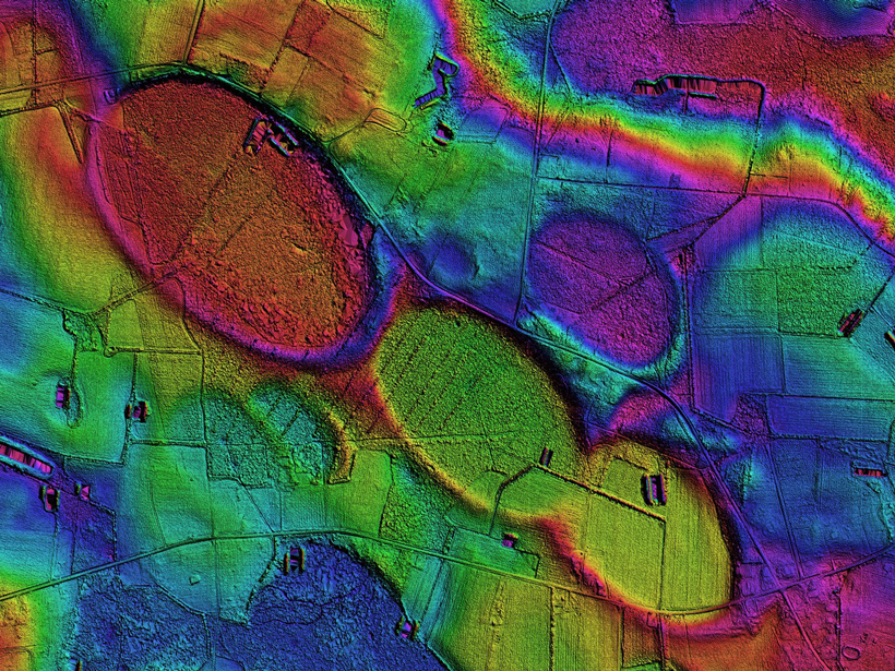
Carolina Bays

Our own blue planet isn’t lacking mysterious terrains. On the United States’ east coast, for example, stretching from New Jersey to Florida, hundreds of unexplained circular depressions pock the landscape. These depressions, which range in length from 180 meters to around 20 kilometers, are the Carolina bays—so named because a large cluster is found in the Carolinas. All of them are aligned northwest to southeast. And no one has a solid explanation for how they formed.
“Tens of thousands of these landforms [exist] around and amongst millions of people, and yet no serious geological undertakings have been made in the past 40 years to investigate them,” said Michael Davias, a researcher at Cintos Research, an independent group of citizen scientists, and presenter of a poster.
Theories of formation range from swarms of meteorites to wind, Davias said. Scientists seem to be divided into two camps: those who think some external force like impacts created the depressions and those who think the depressions formed from wind- or water-related erosion.
Bright Streaks

One face of Saturn’s icy moon Dione is crisscrossed with unexplainable bright streaks. The Cassini spacecraft first showed scientists these streaks on Dione, as well as on the larger moon Rhea. Scientists have yet to figure out their origins.
When a mystery like these bright streaks pops up, “it makes you rise to the challenge” to get to the bottom of it, said Emily Martin, a planetary scientist at the National Air and Space Museum in Washington, D. C., and presenter of a poster on the topic.
The leading theory behind the bright streaks involves tectonics, but not the kind of tectonics we’re familiar with on Earth, Martin pointed out. No other plate tectonics like Earth’s exists in the solar system (except maybe on Europa), so the cracks and faults on Dione and Rhea result from the pushing and pulling of gravity as the moons orbit Saturn.
However, Martin is currently exploring an alternative theory involving impacts: Maybe an impact’s scour created the bright streaks, or perhaps a cloud of orbiting debris rained down on the moons.
—JoAnna Wendel (@JoAnnaScience), Staff Writer
Citation:
Wendel, J. (2017), Four planetary landscapes that scientists can’t explain, Eos, 98, https://doi.org/10.1029/2017EO088617. Published on 11 December 2017.
Text © 2017. The authors. CC BY-NC-ND 3.0
Except where otherwise noted, images are subject to copyright. Any reuse without express permission from the copyright owner is prohibited.