Climate change is warming the Arctic and melting sea ice, yet Siberia has experienced significantly colder and harsher winters for the past few decades. A study published yesterday in Science Advances shows that interactions between melting regional sea ice and the stratosphere—an atmospheric layer spanning about 10–50 kilometers above Earth’s surface—play a key role in creating these frigid winter conditions.
This stratospheric pathway “significantly contributes to the occurrence of the surface cold events over the Eurasian midlatitude, especially in Siberia and East Asia,” Pengfei Zhang, lead scientist on the study, told Eos. Zhang is a postdoctoral researcher in climate science at Purdue University in Lafayette, Ind.
Scientists previously have observed that Siberia experiences colder winters when the Barents and Kara Seas, two sub-Arctic seas off the northern Eurasian coast, exhibit greater sea ice loss in the preceding autumn months. Zhang’s team modeled the cascading effects of that regional sea ice loss to see what factors may lead to a colder Siberia.
They found that modeling the circulation changes in the stratosphere was key in reproducing the observed Siberian chill. “The impact of sea ice loss in late autumn–early winter persists throughout the whole winter due to the long timescale of stratospheric processes,” Zhang explained.
Autumn Thaw, Winter Chill
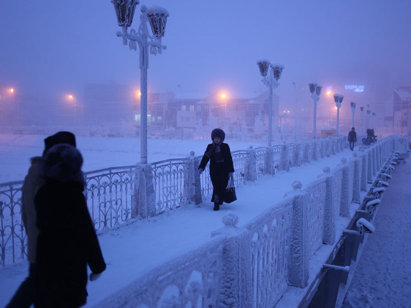
Years that have seen the lowest concentrations of sea ice because of warm Arctic temperatures were followed by Siberian cold anomalies lasting through the next 3 months.
The Barents and Kara Seas reach their minimum in sea ice concentration by November each year. Years that have seen the lowest concentrations of sea ice because of warm Arctic temperatures were followed by Siberian cold anomalies lasting through the next 3 months. Average winter temperatures in the region typically hover around –18°C, but sometimes temperatures drop to –25°C for spans of a week or more. One northern Siberian town even saw temperatures plummet to –66°C this past January.
The explanation for this “warm Arctic, cold Siberia” pattern remained elusive. Scientists debated whether the harsh winter conditions were caused by natural variability in the troposphere—the atmospheric layer closest to the surface—or whether higher atmospheric layers, as some models have suggested, also played a role. Differences between atmospheric circulation models as well as incomplete treatments of the stratosphere within those models complicated the debate, Zhang explained.
In this research, Zhang and his team used an advanced atmospheric general circulation model to link sea ice loss in the Barents and Kara Seas with Siberian surface climate and weather extremes. The models, which include state-of-the-art stratosphere calculations, used observed sea ice concentration to predict sea and air surface temperatures, surface wind velocities, and cold air outbreaks, as well as circulation patterns in the troposphere and stratosphere.
Decreased sea ice concentrations weaken and shift the stratospheric polar vortex, which then causes a colder Siberia.
Then they tried to find a distinct trigger. “We switched on and off the stratosphere–troposphere coupling in the model to explicitly isolate the solid pathways underlying the Arctic–Eurasia linkage,” Zhang explained.
When the models considered only air circulation near the surface, the researchers found that their simulations yielded a warmer Siberia than what was observed. To get the region as frigid and windy as it has been during recent winters, they found that they needed to include stratospheric circulation as well as mixing between the troposphere and the stratosphere.
In short, they found that decreased sea ice concentrations weaken and shift the stratospheric polar vortex, a low-pressure phenomenon that helps drive regional climate patterns. This weakened polar vortex then causes a colder Siberia.
Toward Better Forecasts
By accurately accounting for the stratosphere, the team was able to reproduce observed climate conditions in Siberia using only regional sea ice loss rather than ice loss across the entire Arctic.
Can the technique be used to predict, say, the winter climate events over Eurasia? Perhaps, Zhang said, but accuracy depends on whether climate and weather models “can simulate a realistic stratosphere.”
The team is currently exploring whether the stratosphere plays a similar role in linking regional sea ice loss to extreme weather events in the northern reaches of North America.
—Kimberly M. S. Cartier (@AstroKimCartier), Staff Writer
Citation:
Cartier, K. M. S. (2018), Why are Siberian temperatures plummeting while the Arctic warms?, Eos, 99, https://doi.org/10.1029/2018EO103403. Published on 26 July 2018.
Text © 2018. The authors. CC BY-NC-ND 3.0
Except where otherwise noted, images are subject to copyright. Any reuse without express permission from the copyright owner is prohibited.