• About
  • Sections
  • Topics
    • Climate
    • Earth Science
    • Oceans
    • Space & Planets
    • Health & Ecosystems
    • Culture & Policy
    • Education & Careers
    • Opinions
  • Projects
    • ENGAGE
    • Editors’ Highlights
    • Editors’ Vox
    • Eos en Español
    • Eos 简体中文版
    • Print Archive
  • Science Policy Tracker
  • Blogs
    • Research & Developments
    • The Landslide Blog
  • Newsletter
  • Submit to Eos
  • AGU.org
  • Career Center
  • Join AGU
  • Give to AGU
  • About
  • Sections
  • Topics
    • Climate
    • Earth Science
    • Oceans
    • Space & Planets
    • Health & Ecosystems
    • Culture & Policy
    • Education & Careers
    • Opinions
  • Projects
    • ENGAGE
    • Editors’ Highlights
    • Editors’ Vox
    • Eos en Español
    • Eos 简体中文版
    • Print Archive
  • Science Policy Tracker
  • Blogs
    • Research & Developments
    • The Landslide Blog
  • Newsletter
  • Submit to Eos
Skip to content
  • AGU.org
  • Career Center
  • Join AGU
  • Give to AGU
Eos

Eos

Science News by AGU

Support Eos
Sign Up for Newsletter
  • About
  • Sections
  • Topics
    • Climate
    • Earth Science
    • Oceans
    • Space & Planets
    • Health & Ecosystems
    • Culture & Policy
    • Education & Careers
    • Opinions
  • Projects
    • ENGAGE
    • Editors’ Highlights
    • Editors’ Vox
    • Eos en Español
    • Eos 简体中文版
    • Print Archive
  • Science Policy Tracker
  • Blogs
    • Research & Developments
    • The Landslide Blog
  • Newsletter
  • Submit to Eos

J. Benveniste

Ocean waves pound the shore of a coastal town in Italy.
Posted inScience Updates

New Achievements in Coastal Altimetry

by M. Restano, M. Passaro and J. Benveniste 14 September 201815 November 2021

11th Coastal Altimetry Workshop; Frascati, Italy, 12–15 June 2018

Sentinel-2A natural-color satellite image of the Sundarbans area in the Ganges-Brahmaputra Delta, captured on 18 March 2016.
Posted inOpinions

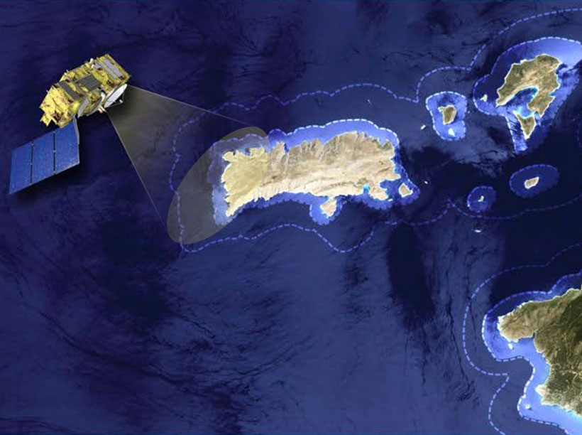
Monitoring Coastal Zone Changes from Space

by A. Cazenave, Gonéri Le Cozannet, J. Benveniste, P. L. Woodworth and N. Champollion 2 November 201724 February 2023

The resilience of coastal communities depends on an integrated, worldwide coastal monitoring effort. Satellite observations provide valuable data on global to local scales.

Farmers harvest seaweed on the Zanzibar coast of Tanzania.
Posted inScience Updates

Challenges and Opportunities for Coastal Altimetry

by S. Vignudelli, J. Benveniste and P. Cipollini 6 July 20175 January 2022

10th Coastal Altimetry Workshop; Florence, Italy, 21–24 February 2017

Posted inScience Updates

Coastal Altimetry Challenges Our Understanding of Short Scales in the Ocean

by P. Cipollini, S. Vignudelli and J. Benveniste 24 March 201522 March 2023

8th Coastal Altimetry Workshop; Konstanz, Germany, 23–24 October 2014

A view of a bridge, with the New Orleans skyline visible in the distance between the bridge and the water. A purple tint, a teal curved line representing a river, and the text “#AGU25 coverage from Eos” overlie the photo.

Features from AGU Publications

Research Spotlights

Watershed Sustainability Project Centers Place-Based Research

4 December 20254 December 2025
Editors' Highlights

Changes in Slab Dip Cause Rapid Changes in Plate Motion

4 December 20252 December 2025
Editors' Vox

Hydrothermal Circulation and Its Impact on the Earth System

3 December 20253 December 2025
Eos logo at left; AGU logo at right

About Eos
ENGAGE
Awards
Contact

Advertise
Submit
Career Center
Sitemap

© 2025 American Geophysical Union. All rights reserved Powered by Newspack