• About
  • Sections
  • Topics
    • Climate
    • Earth Science
    • Oceans
    • Space & Planets
    • Health & Ecosystems
    • Culture & Policy
    • Education & Careers
    • Opinions
  • Projects
    • ENGAGE
    • Editors’ Highlights
    • Editors’ Vox
    • Eos en Español
    • Eos 简体中文版
    • Print Archive
  • Blogs
    • Research & Developments
    • The Landslide Blog
  • Newsletter
  • Submit to Eos
  • AGU.org
  • Career Center
  • Join AGU
  • Give to AGU
  • About
  • Sections
  • Topics
    • Climate
    • Earth Science
    • Oceans
    • Space & Planets
    • Health & Ecosystems
    • Culture & Policy
    • Education & Careers
    • Opinions
  • Projects
    • ENGAGE
    • Editors’ Highlights
    • Editors’ Vox
    • Eos en Español
    • Eos 简体中文版
    • Print Archive
  • Blogs
    • Research & Developments
    • The Landslide Blog
  • Newsletter
  • Submit to Eos
Skip to content
  • AGU.org
  • Career Center
  • Join AGU
  • Give to AGU
Eos

Eos

Science News by AGU

Support Eos
Sign Up for Newsletter
  • About
  • Sections
  • Topics
    • Climate
    • Earth Science
    • Oceans
    • Space & Planets
    • Health & Ecosystems
    • Culture & Policy
    • Education & Careers
    • Opinions
  • Projects
    • ENGAGE
    • Editors’ Highlights
    • Editors’ Vox
    • Eos en Español
    • Eos 简体中文版
    • Print Archive
  • Blogs
    • Research & Developments
    • The Landslide Blog
  • Newsletter
  • Submit to Eos

CC BY-NC-ND 2019

Satellite image of a fire in Northern California
Posted inNews

New Eyes on Wildfires

Jon Kelvey, Science Writer by Jon Kelvey 30 April 20192 July 2025

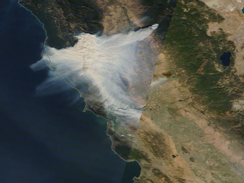
Onboard machine learning and compact thermal imaging could turn satellites into real-time fire management tools to help officials on the ground.

A visualization of black carbon around the globe.
Posted inResearch Spotlights

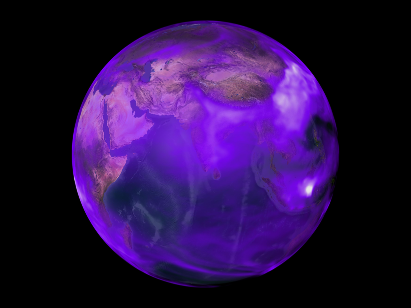
Previous Research Has Underestimated Black Carbon Emissions

by Terri Cook 30 April 201919 October 2021

New observational constraints suggest that U.S. emissions of this heat-absorbing aerosol were 80% higher during the late 20th century than prior estimates have indicated.

A stream flowing down a valley
Posted inResearch Spotlights

Modeling River Boulders to Improve Hydropower Sustainability

Aaron Sidder, freelance science writer by Aaron Sidder 30 April 20199 March 2023

Large stones in streams provide crucial habitat for fish. Modeling the boulders and streamflow offers fresh insights into how water engineering projects alter aquatic habitats.

A pathway leads to a community water treatment plant in rural southeastern Puerto Rico.
Posted inScience Updates

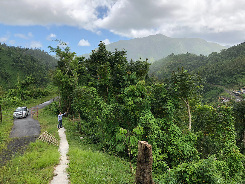
Sharing Data Helps Puerto Ricans Rebound After Hurricane Maria

by J. Hart, C. Bandaragoda and G. Ramirez-Toro 30 April 20198 October 2021

Recent hurricane seasons left many communities wondering if this is the new normal. Digital infrastructure designed for citizen data collection may help these communities increase resilience.

Posted inEditors' Highlights

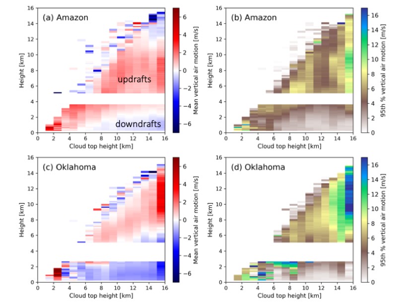
New Observations of Thunderstorm Updrafts and Downdrafts

by Minghua Zhang 30 April 20199 March 2023

Unique measurements of air motion within deep convective clouds offer new insights in our understanding of these storms and provide constraints for weather and climate prediction.

Ocean acidification map of the bottom ocean water layer
Posted inResearch Spotlights

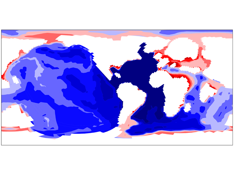
Explaining Ocean Acidification Patterns During Ancient Warming

Sarah Stanley, Science Writer by Sarah Stanley 29 April 201912 September 2022

Asymmetrical changes in ocean circulation and the marine carbon cycle could account for different degrees of ocean acidification between the Pacific and Atlantic.

Tracers of ecosystem respiration
Posted inResearch Spotlights

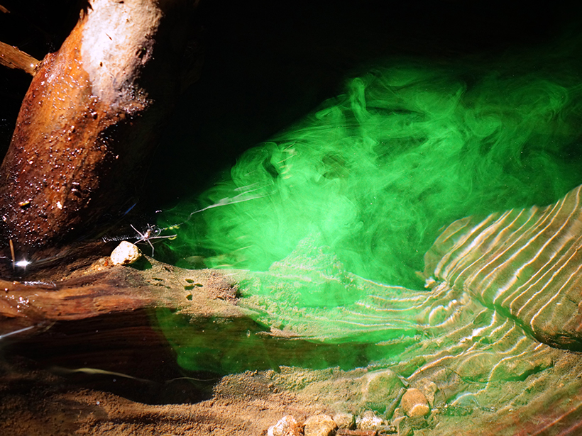
Understanding Stream Metabolism with Reactive Tracers

Aaron Sidder, freelance science writer by Aaron Sidder 29 April 20197 March 2022

When the blue dye resazurin encounters living microorganisms, it transforms into fluorescent pink resorufin and helps scientists understand ecosystem respiration, but it has its limitations.

An almond orchard with trees in bloom
Posted inNews

California Heat Waves Triggered by Pacific Thunderstorms

Mary Caperton Morton, Science Writer by Mary Caperton Morton 29 April 201930 March 2023

New link may offer 5-week lead time on predicting extreme heat in California’s fruit belt.

A computer simulation’s rendering of the interior of the Earth’s core showing magnetic field lines being stretched by turbulent convection.
Posted inNews

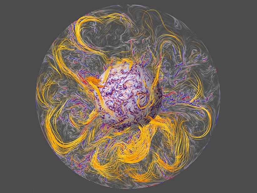
New Model Shines Spotlight on Geomagnetic Jerks

Mary Caperton Morton, Science Writer by Mary Caperton Morton 29 April 201920 December 2021

Scientists get one step closer to being able to predict jerks—notoriously capricious changes to Earth’s geomagnetic field detectable by satellites.

Beartooth Uplift in Montana
Posted inScience Updates

Linking Observations and Modeling of Flat-Slab Subduction

by J. E. Saylor, E. Finzel and M. Jadamec 26 April 201918 January 2022

The Center for Tectonics and Tomography: Workshop on Flat Slab Subduction; Houston, Texas, 18–20 January 2019

Posts pagination

Newer posts 1 … 38 39 40 41 42 … 66 Older posts
A view of a Washington, D.C., skyline from the Potomac River at night. The Lincoln Memorial (at left) and the Washington Monument (at right) are lit against a purple sky. Over the water of the Potomac appear the text “#AGU24 coverage from Eos.”

Features from AGU Publications

Research Spotlights

Coherent, Not Chaotic, Migration in the Brahmaputra-Jamuna River

2 July 20252 July 2025
Editors' Highlights

The Mid-20th Century Winter Cooling in the Eastern U.S. Explained

3 July 20253 July 2025
Editors' Vox

Water Tracks: The Veins of Thawing Landscapes

25 June 202525 June 2025
Eos logo at left; AGU logo at right

About Eos
ENGAGE
Awards
Contact

Advertise
Submit
Career Center
Sitemap

© 2025 American Geophysical Union. All rights reserved Powered by Newspack