Source: Geophysical Research Letters
Satellite estimates of precipitation are the only way to achieve the complete spatial coverage needed to understand how the water cycle may respond to warming, specifically, whether it speeds up or slows down. These estimates rely on indirect measures such the brightness temperature of cloud tops, which need to be calibrated with ground-based observations.
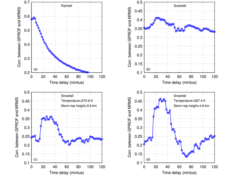
You et al. [2019] highlight the need to consider the time lag between satellite retrievals and ground-based estimates of precipitation, especially in the case of snowfall, when correcting the former with the latter. While the lag is small—of the order of a fraction of an hour—it is significant on climate time scales in reducing apparent discrepancies between the two types of measurements. This is therefore relevant to improved monitoring and understanding of the global water cycle.
Citation: You, Y., Meng, H., Dong, J., & Rudlosky, S. [2019]. Time‐lag correlation between passive microwave measurements and surface precipitation and its impact on precipitation retrieval evaluation. Geophysical Research Letters, 46, 8415–8423. https://doi.org/10.1029/2019GL083426
—Alessandra Giannini, Editor, Geophysical Research Letters
Text © 2019. The authors. CC BY-NC-ND 3.0
Except where otherwise noted, images are subject to copyright. Any reuse without express permission from the copyright owner is prohibited.