
北极海冰恢复不完全导致冬季急流向赤道偏移。由于海洋环流起到了额外的驱动作用,北大西洋急流的偏移尤其不确定。
Editors’ Highlights
Posted inEditors' Highlights
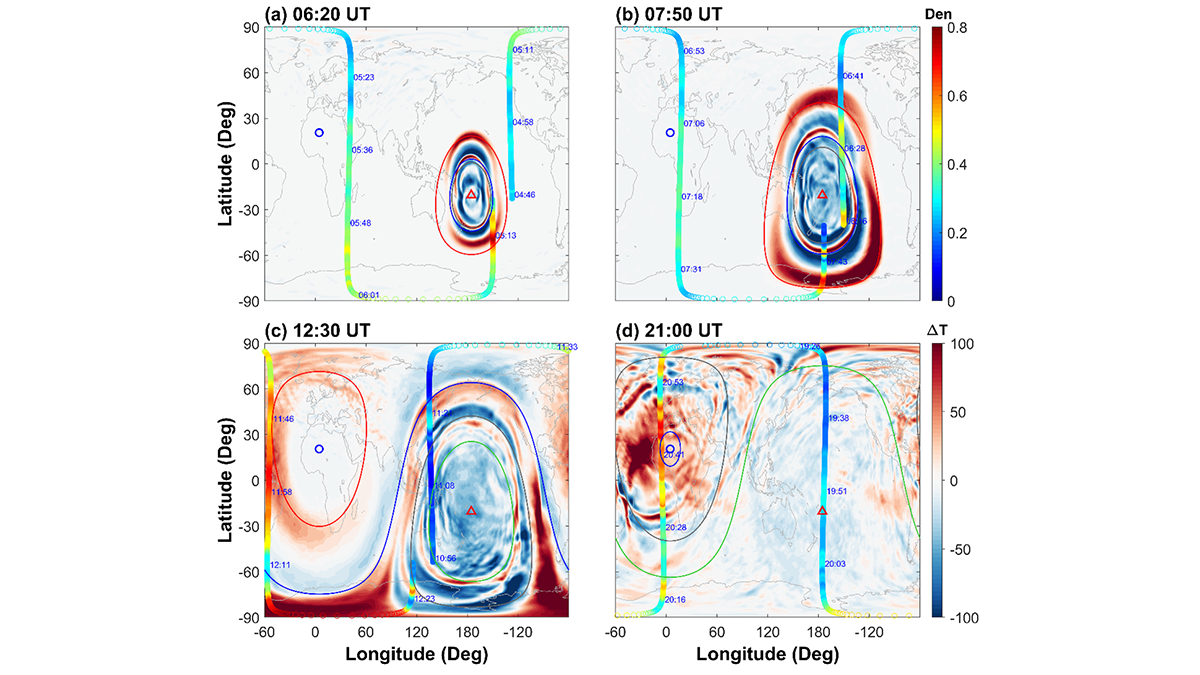
Tonga’s Volcanic Fury Ripples to the Netherworld
Secondary gravity waves emerge as the hidden architects of global-scale thermospheric upheaval following the Tonga eruption in 2022.

Posted inEditors' Highlights
Why the Southern Alps Turned Red During the Summer of 2019-2020
Snow on the Southern Alps turned from white to red in 2019-2020. New geochemical evidence points to the color change resulting from red Australian desert dust carried across the Tasman Sea.
Posted inEditors' Highlights
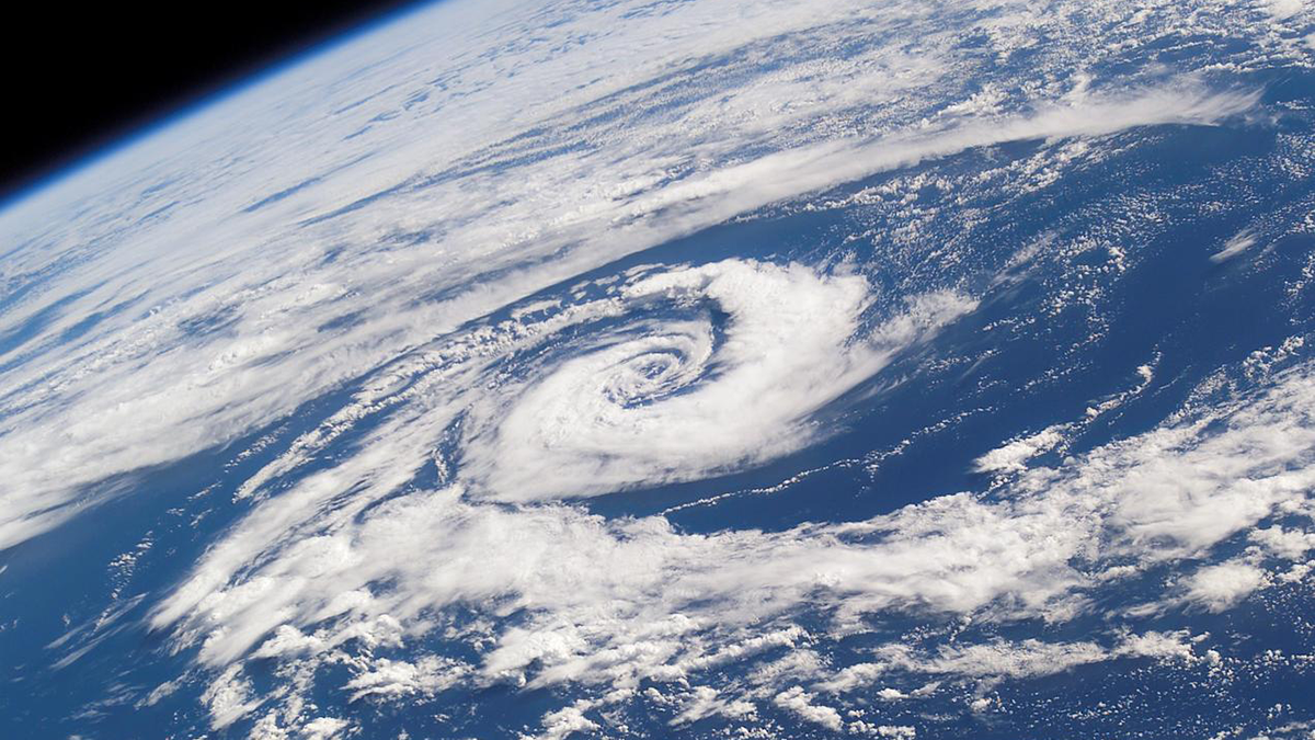
The All-In-One Cyclone Identification Framework
Researchers present a new framework for global detection and classification of all low-pressure systems.

Posted inEditors' Highlights
Upwelling Near Fronts Initiate Offshore Phytoplankton Blooms
A new study finds that phytoplankton blooms, often seen near the separation point of western boundary currents, are supported by nutrient supply upwelling and cross-shelf transport.
Posted inEditors' Highlights
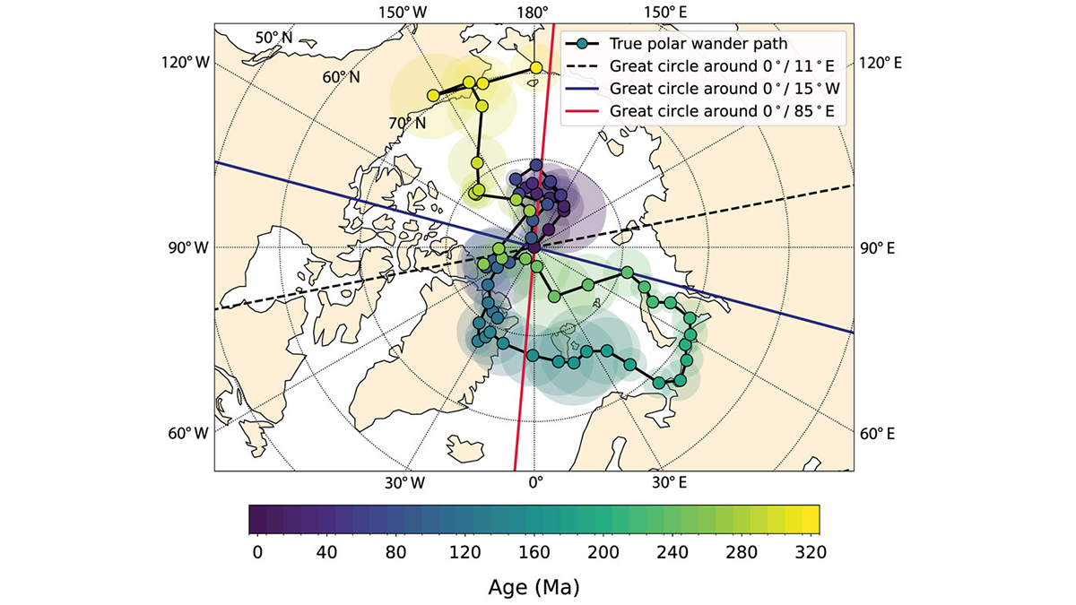
300 Million Years of Polar Wander: Slowly but Surely
A reanalysis of paleomagnetic poles provides tighter bounds on the style and rate of motions of our whole planet with respect to its rotation axis.
Posted inEditors' Highlights
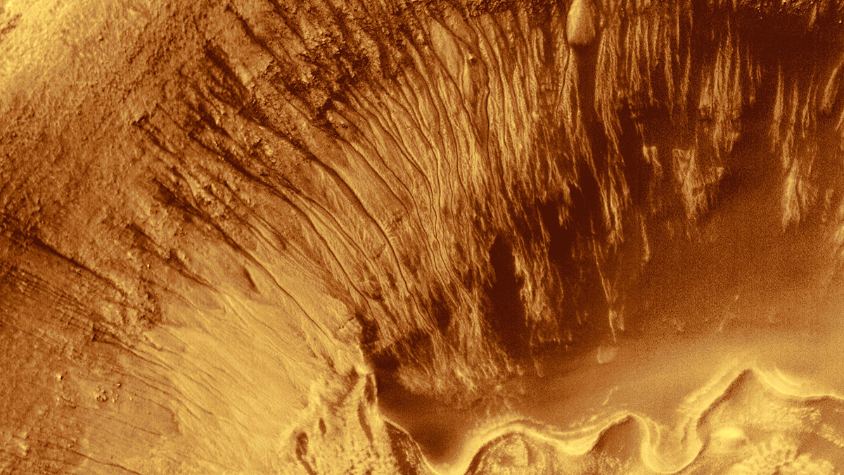
Geophysics Sheds Light on Early Martian Water and Habitability
A new study uses inversions of orbital gravity and magnetic field data to argue for the presence of ancient, long-lasting hydrothermal systems on Mars.
Posted inEditors' Highlights
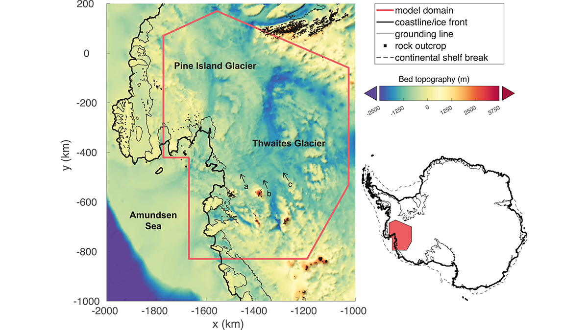
Nonlinear Dynamics May Lead to Faster Retreat of Antarctic Ice
The Antarctic ice sheet behaves like a non-Newtonian fluid and may be more nonlinear than previously thought. This impacts its future stability and requires revisions to predictions of sea level rise.
Posted inEditors' Highlights
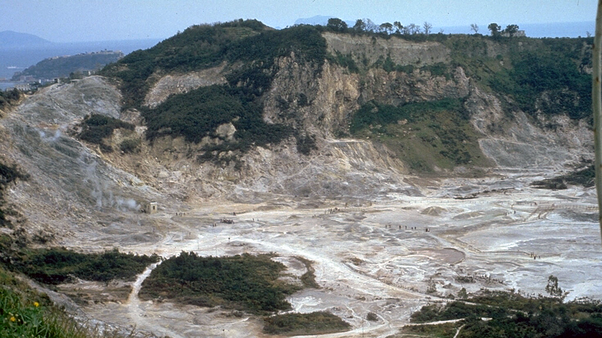
Deflected Dikes Perturb the Plumbing System
A multidisciplinary synthesis of the Campi Flegrei, Italy volcanic setting highlights the importance of sub-caldera layering for magma dynamics.
Posted inEditors' Highlights
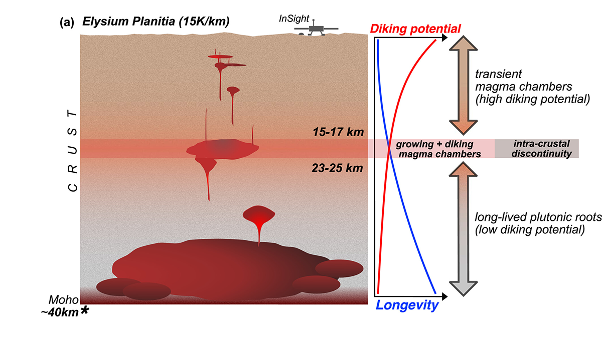
Martian Magmas Live Long and Prosper
The depths, longevity, and potential to generate silicic compositions of magma chambers are linked to crustal temperature, which varies across Mars and over its geological history.