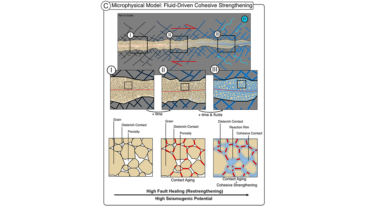
In fault gouge, fluids drive chemical healing by cementing grains, a mechanism for seismic slip in rocks frictionally expected to creep. This cohesion matters for fault stability.
Editors’ Highlights
Posted inEditors' Highlights
Seeing Earth’s Most Common Minerals from Space
A novel method marks an important step toward mapping quartz and feldspar globally.
Posted inEditors' Highlights
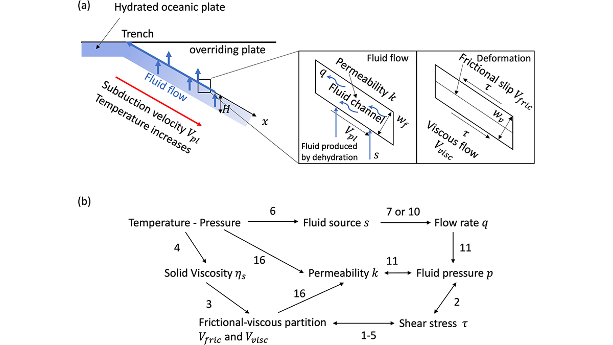
How Dehydration-Driven Fluid Pressure Shapes Megathrust Slip Modes
By modeling dehydration-driven fluid pressure, a new study links deep fluids to where megathrust earthquakes end and slow slip begins.
Posted inEditors' Highlights
Shoreline Migration, Sediment Accumulation, and Blue Carbon Storage
Autogenic processes of sediment storage and erosion regulate shoreline movement and therefore, where coastal wetlands develop, setting up subsurface areas of preserved organic matter, blue carbon.
Posted inEditors' Highlights
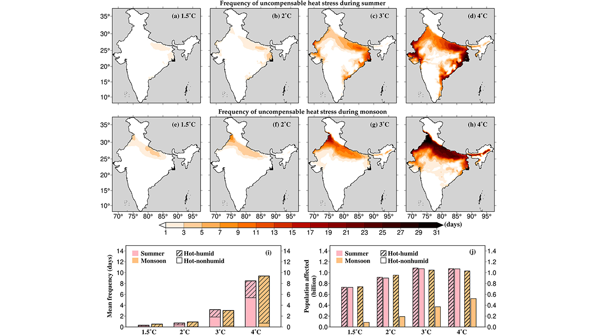
Unbearable Heat for Hundreds of Millions
The Global South, in particular, is suffering from the consequences of global heating. A new study quantifies heat stress in India by projecting it during the critical seasons.
Posted inEditors' Highlights
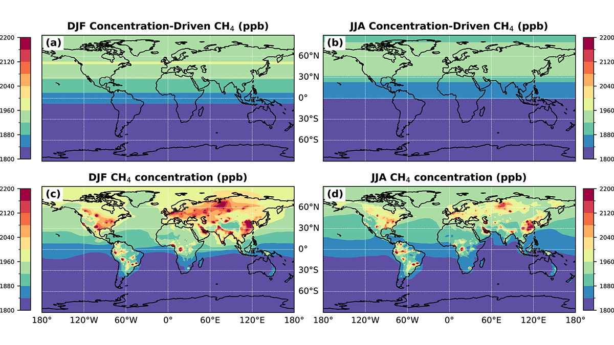
Where Methane is Emitted Matters for Global Burden
Methane emitted at higher latitude regions (Europe) tends to stay in the atmosphere longer, contributing to higher global concentrations than other regions (Asia, North America).
Posted inEditors' Highlights
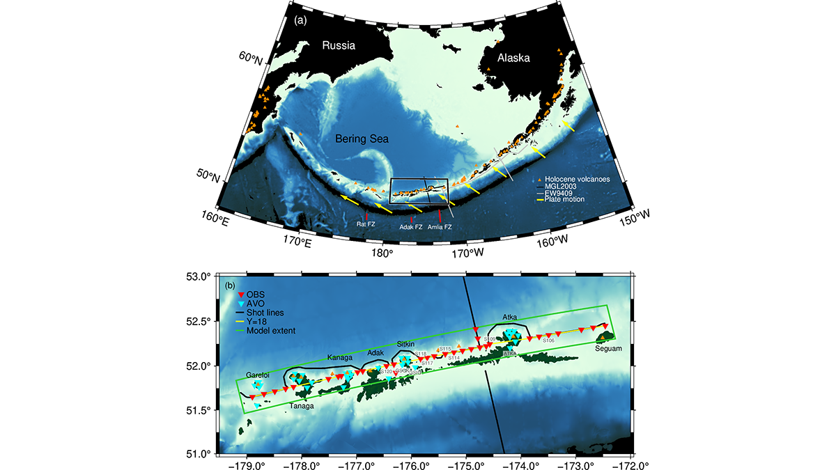
A Snapshot of Continental Crust in the Making
New seismic images from the Aleutian Arc show how active volcanic arcs may build new continental crust, highlighting the complex transition at multiple stages.
Posted inEditors' Highlights
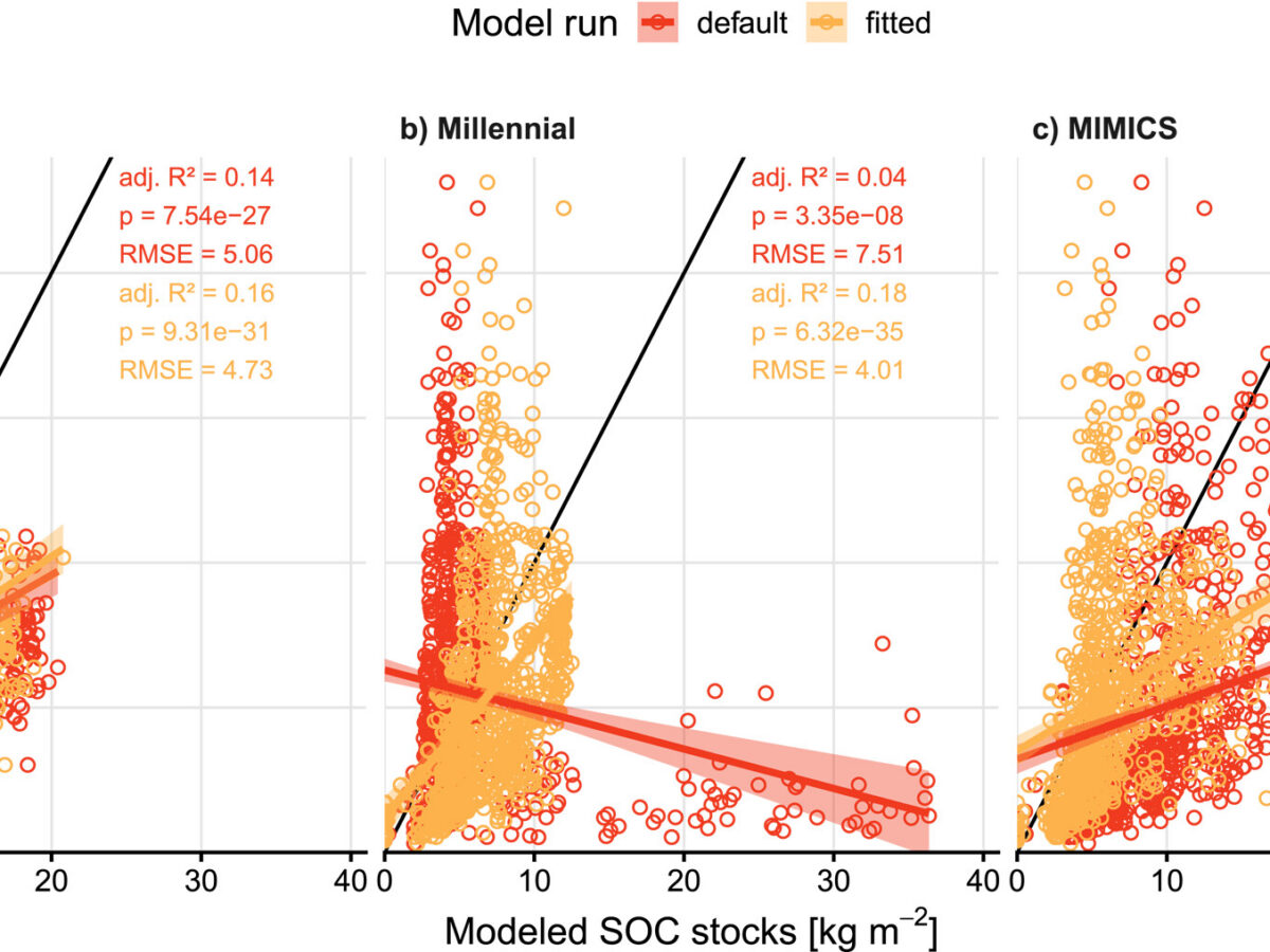
Soil Biogeochemistry Models Omit Key Processes Due to Geographic Bias
Popular soil biogeochemistry models inadequately represent regionally-important processes and lack transferability, resulting in poor predictions of soil organic carbon stocks in sub-Saharan Africa.
Posted inEditors' Highlights
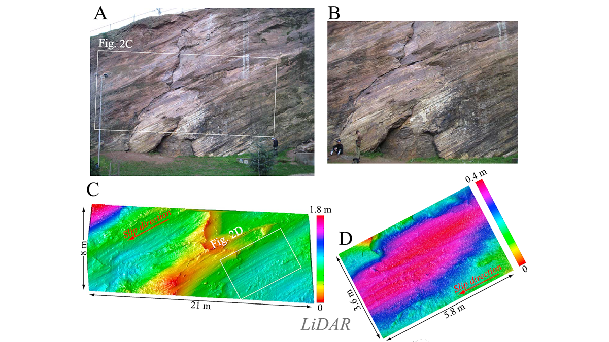
Multi-Scale Fault Roughness Encapsulated in a Friction Law
A new rate- and roughness-dependent friction law incorporates multi-scale fault processes to reproduce earthquake fracture energy scaling.
Posted inEditors' Highlights
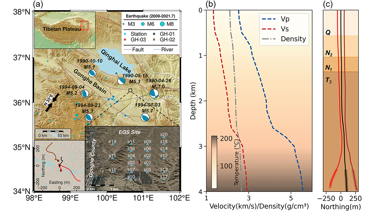
Pre-Existing Structure and Stress Shape Geothermal-Induced Seismicity
At China’s first Enhanced Geothermal System site, dense seismic observations, integrated with borehole data and stress modeling, reveal weak faults and scale-dependent control of stress and structure on induced seismicity.